
The Mourne Mountains cram Northern Ireland‘s best hillwalking into one tiny corner of County Down. A dozen-plus granite peaks over 600m sit shoulder to shoulder, the Mourne Wall snaking over the tops and Slieve Donard rising straight from the sea at Newcastle. This mourne mountains guide covers what’s actually worth your time.
It’s close, too. About an hour from Belfast and a shade over two hours from Dublin, which makes it one of the easiest wild places to reach on the whole island. Newcastle is the gateway town, and it’s the natural base for a trip.
A word before you lace up: these mountains make their own weather, and it turns fast. Go with layers, waterproofs, and low expectations about the forecast, and you’ll have a brilliant time. Show up in shorts expecting sunshine and you’ll be one more soaked walker trudging back to the car.
Below I’ll break down what the range is actually like, the five walks worth your time, the forests and reservoirs for anyone not chasing a summit, whether you need a guide, and where to stay so you’re not backtracking every morning.
More County Down and Mourne Country Guides
- The Royal County Down Golf Club: A Guide To The Course
- The Best Beaches in Northern Ireland
- All You Need To Know About Mountain Biking In Northern Ireland
Quick Answer:
This mourne mountains guide covers a compact range of granite peaks in County Down, about an hour from Belfast. Slieve Donard is the highest at 850m, a 4 to 5 hour return climb from Newcastle. Beyond the summits you’ll find Tollymore Forest Park, Silent Valley reservoir, and the 22-mile Mourne Wall.
The Mourne Mountains Guide: Know the Range First
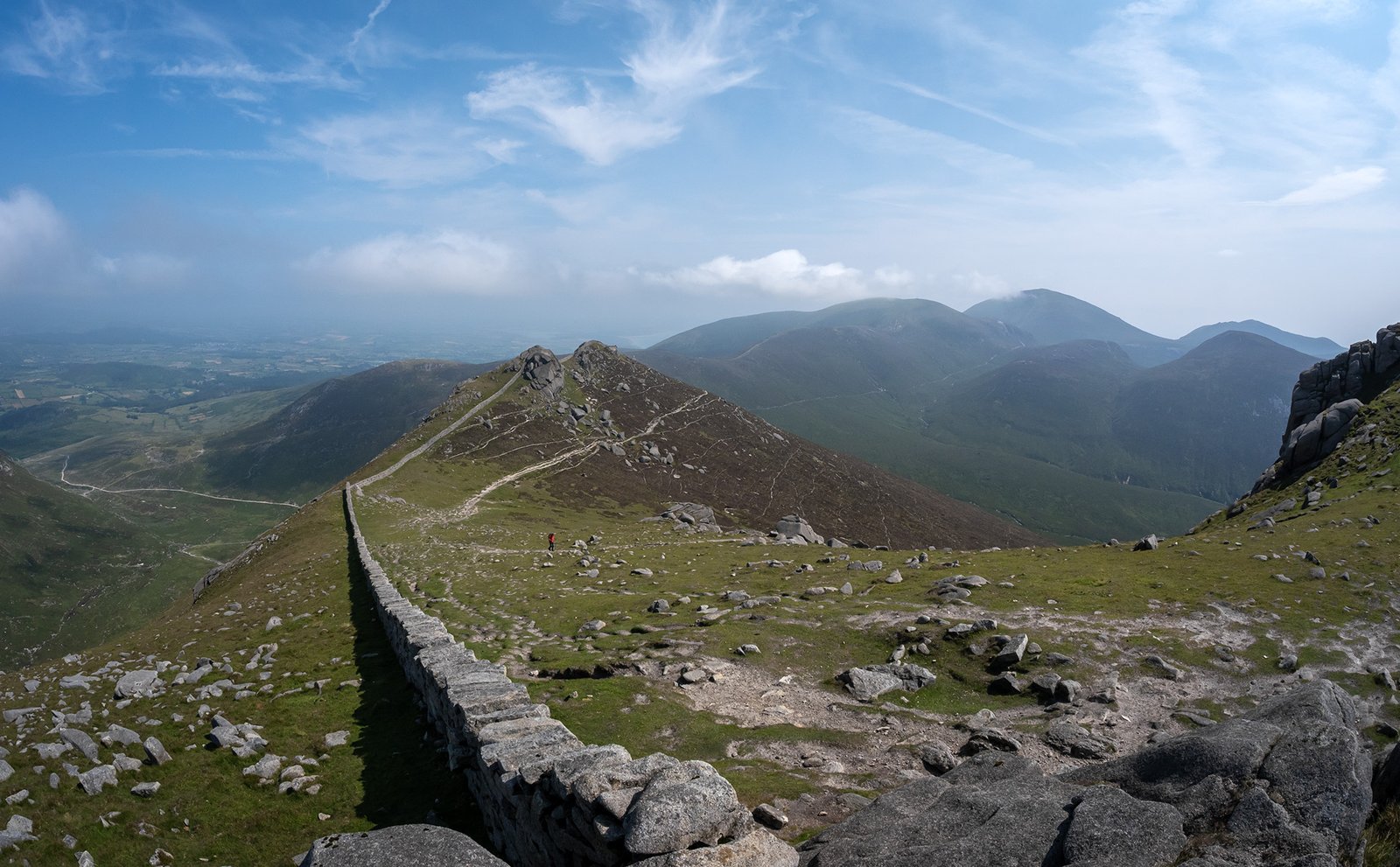
The Mournes are compact. That’s the first thing to get your head around. This isn’t a range you drive through for an hour, it’s a tight cluster of granite peaks in the southeast corner of County Down, with the big summits all within sight of each other. You can stand on one top and pick out three or four others.
Holding the whole thing together is the Mourne Wall, a dry-stone wall that runs about 19 miles and crosses 15 summits. It was built between 1904 and 1922 to enclose the catchment that supplies Belfast’s water, and it’s a serious feat of stonework.
It also doubles as the best navigation handrail in the range. When the cloud drops and you can’t see much, following the wall is often what gets you off the hill safely.
The Main Peaks
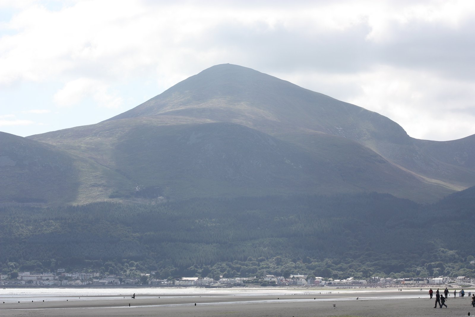
Slieve Donard is the headline act at 850m, the highest point in Northern Ireland. It rises straight up from the sea at Newcastle, which is exactly why it’s the one everyone climbs. It earns the attention, and it also gets the crowds to match.
Behind it sits Slieve Commedagh at 767m, the second highest and a lot quieter than its neighbor. Then come the two peaks the photographers actually chase: Slieve Binnian at 747m and Slieve Bearnagh at 739m.
Both are topped with tors, those wild granite towers that jut out of the summit like something built on purpose. Bearnagh’s are the drama shot of the range.
Because the summits sit so close together, strong walkers can link several in a day by following the wall. That’s the appeal of the Mournes in a sentence: more good hillwalking per square mile than anywhere else on the island.
The Views From the Top
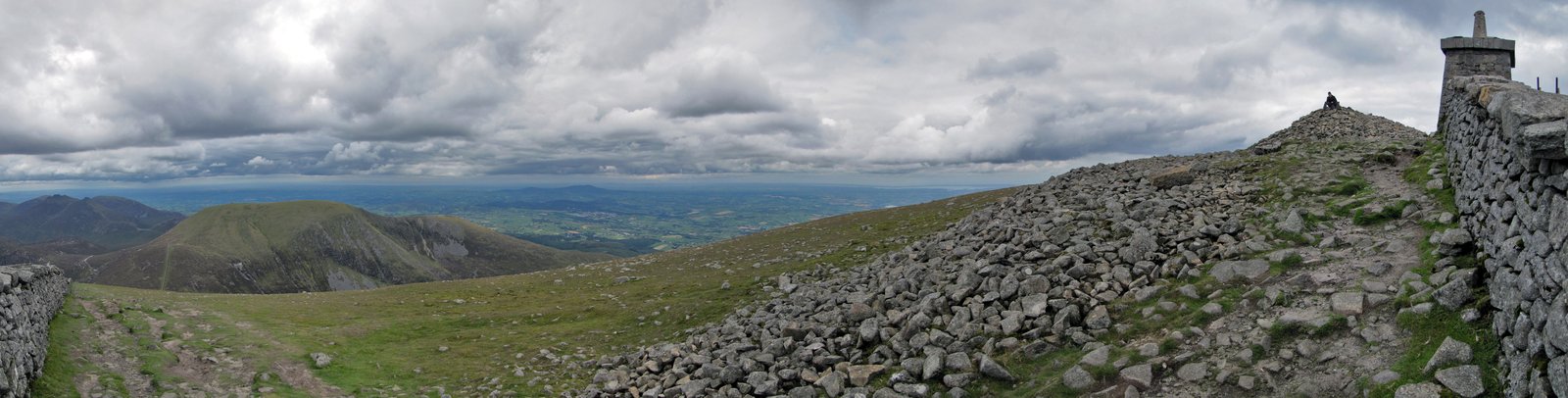
On a clear day the views up here are ridiculous. You get the Irish Sea laid out below you, the Isle of Man across the water, and the Cooley Peninsula curling south into the Republic. On a rare, properly clear day, people pick out Scotland and Wales on the horizon.
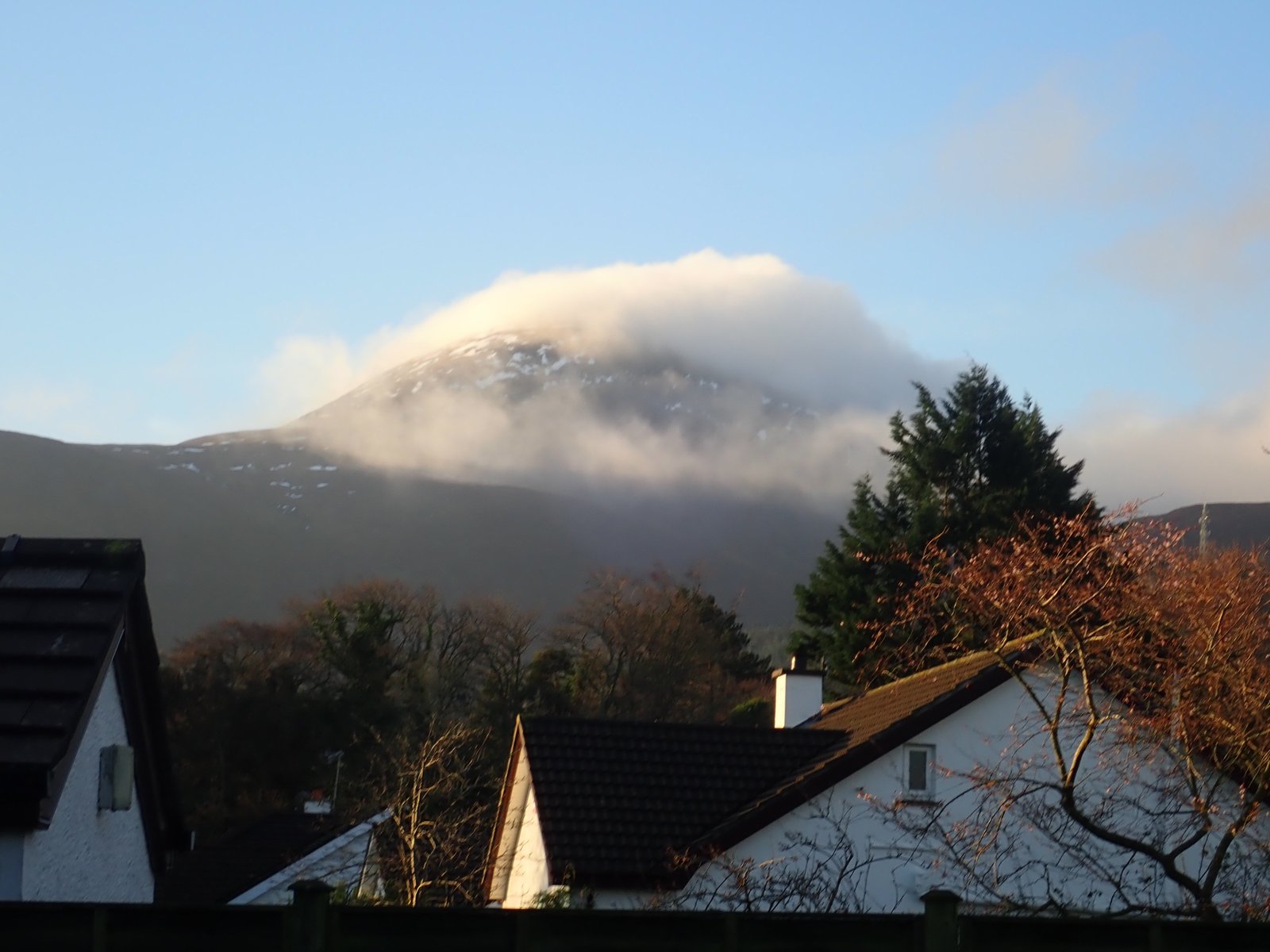
Here’s the catch, and it’s a big one. The Mournes make their own weather. These peaks sit right on the coast and pull cloud in off the sea, so a bright morning in Newcastle is no promise of a view from the summit. You can climb the whole way up and stand in a wall of grey, seeing nothing but the next 30 feet of wet granite.
Don’t let that put you off, just plan for it. Check the forecast the night before, then check it again in the morning, and if you get a clear window, drop everything and go. Those are the days people talk about for years.
The Best Mourne Mountains Walks
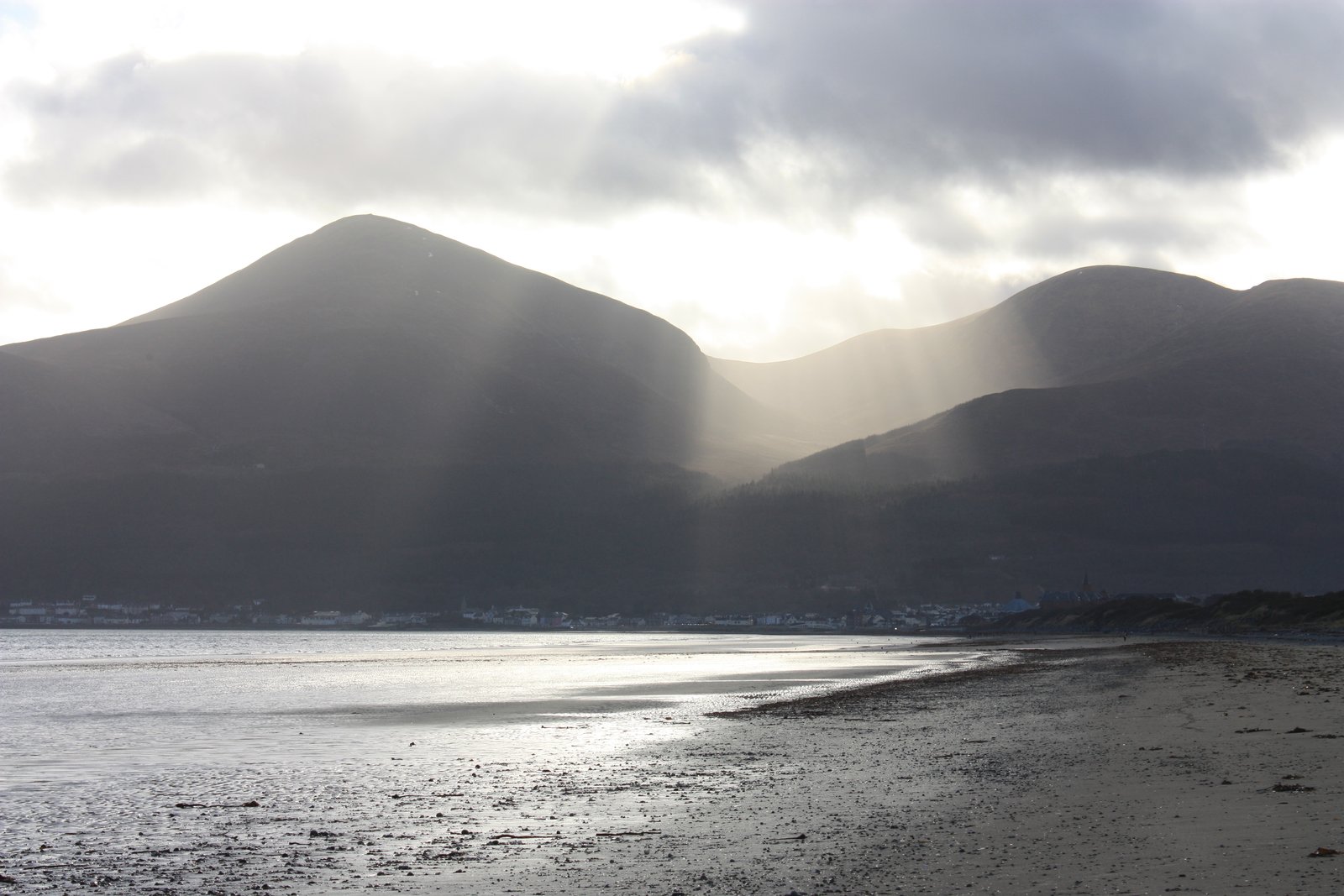
The Mournes are wall-to-wall with good walks, from short strolls off a parking area to full-day summit link-ups. These five are the ones worth planning a trip around. Between them you get the flagship peak, the best-looking route in the range, a couple of less-crowded alternatives, and one dramatic pass you can do without a summit at all.
Sort your parking before you go. The popular trailheads fill early on a good day, and by 9am on a sunny weekend you’ll be circling for a spot. Get there before the crowds or use the seasonal Mourne Shuttle Bus, which links Newcastle with the main trailheads and lets you walk point-to-point instead of doubling back to the car.
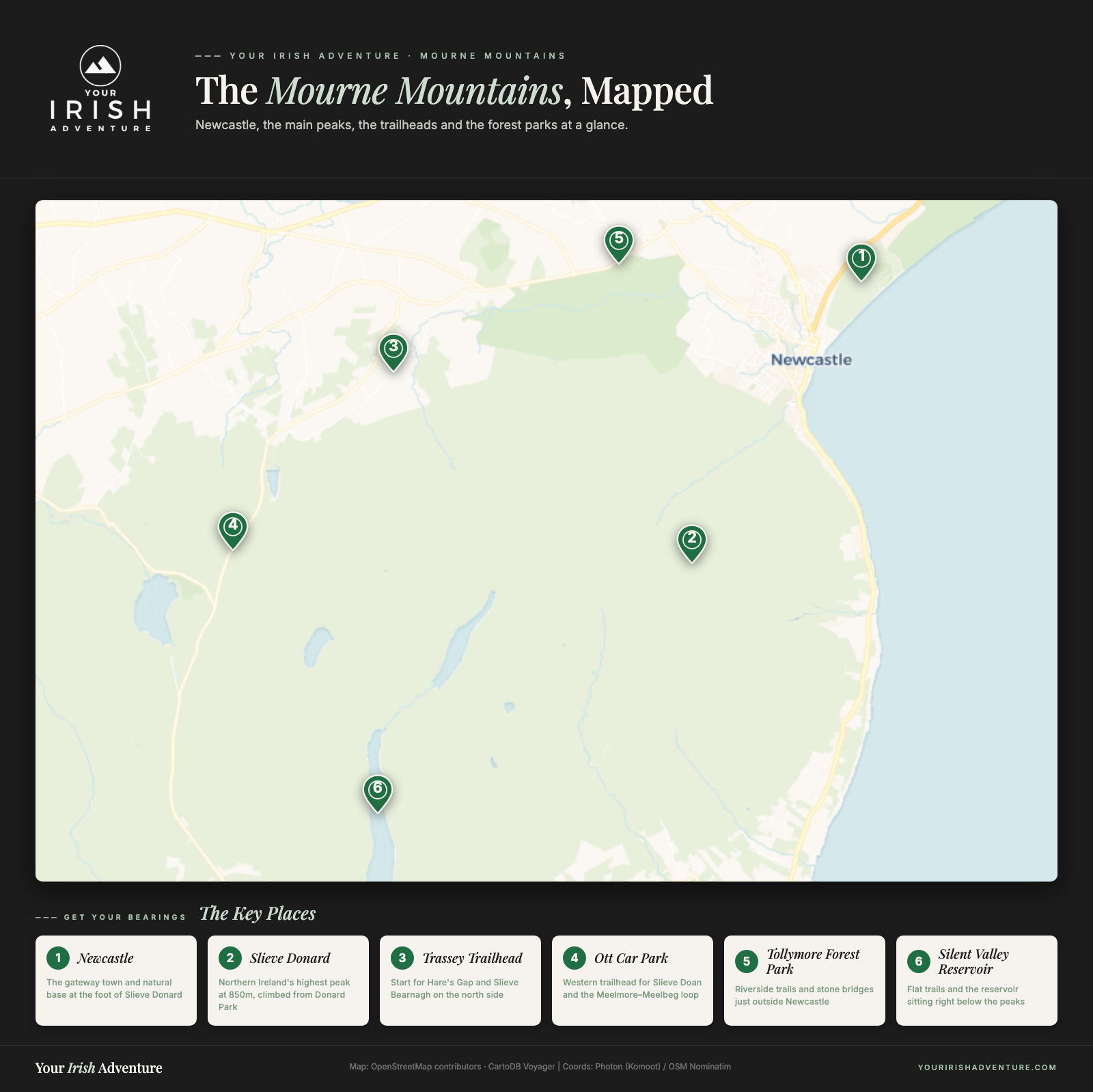
Slieve Donard via the Glen River
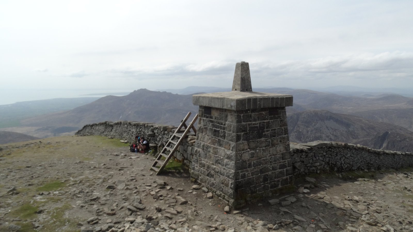
This is the big one, and the one everyone comes for. You start from Donard Park in Newcastle, follow the Glen River up through the trees, then join the Mourne Wall and climb it all the way to the summit tower at 850m. Reach the top on a clear day and the Irish Sea is right there below you.
Plan on about 9km out and back and roughly 4 to 5 hours. It’s a real climb, not a stroll, with a steady uphill grind on the wall section that has plenty of walkers stopping to catch their breath. Nothing technical, just a proper leg-burner.

Go in knowing it’s busy, easily the most walked route in the range. If you want Donard to yourself, you’re going up early or midweek. It earns the crowds, but they’re there.
Slieve Bearnagh via Hare’s Gap
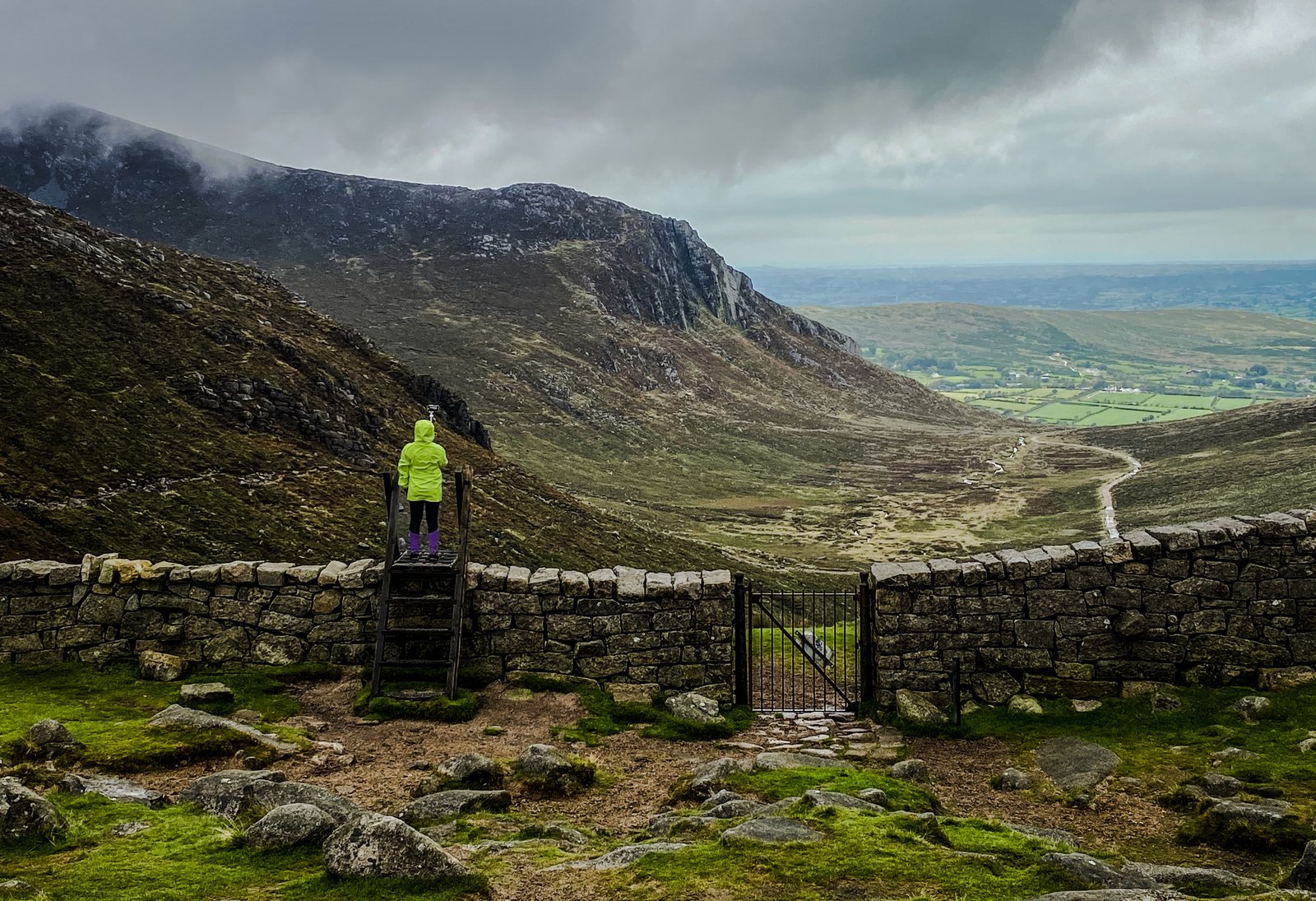
If Donard is the famous one, Bearnagh is the good-looking one. You start on the Trassey track, climb up through Hare’s Gap, then follow the wall up to Bearnagh’s summit tors, those big granite towers stacked on the top. It’s one of the best routes in the whole range.
The tors at the top are a proper scramble, hands-on-rock stuff rather than a walk-up, so this one suits people who are comfortable using their hands and don’t mind a bit of exposure. It’s not dangerous in good conditions, but it’s a step up from a path.
Parking is at the Trassey trailhead, which fills early on a fine day. Same rule as everywhere in the Mournes: beat the crowds or take the shuttle.
Slieve Doan from Ott
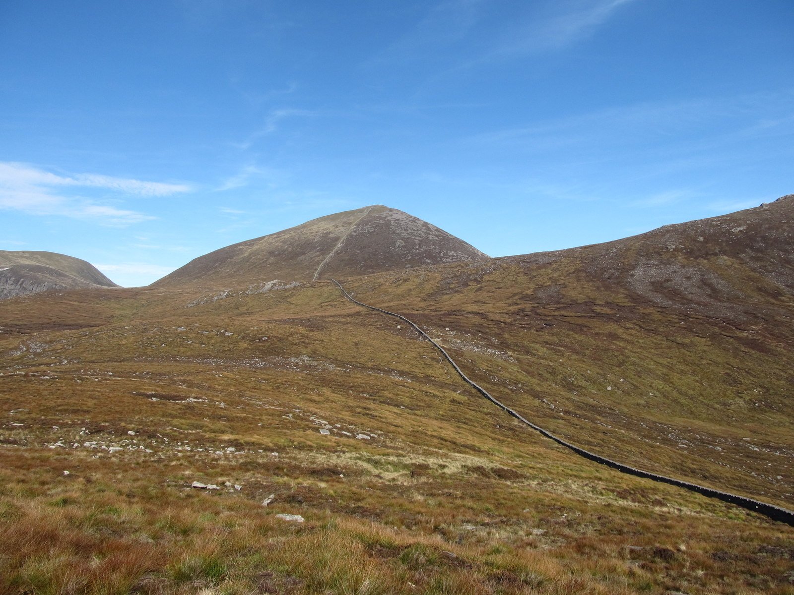
Want the Mournes without the crowds? Slieve Doan is your answer. It starts from the Ott parking area on the western side, and it’s shorter and a good bit less busy than the Donard circus. You still get a summit, still get the views, just with a fraction of the foot traffic.
This is a solid pick for a half-day, or for anyone who’s had enough of sharing a trail with a hundred other people. It’s an easier day than Donard or Bearnagh, and a good one if the weather’s iffy and you don’t fancy committing to a big climb.
Slieve Meelmore and Meelbeg Loop
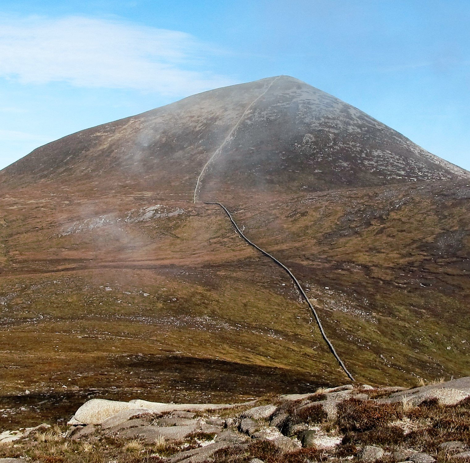
This one bags you two summits in a single loop, both following the Mourne Wall between them. You start from the Ott parking area, climb Meelmore, drop and rise again to Meelbeg, and use the wall as your handrail the whole way round. It’s a satisfying circuit that keeps you moving instead of retracing your steps.
Plan on a half to full day depending on your pace and how long you linger up top. Two peaks, a proper loop, and a good taste of what makes the Mournes special, the summits close enough together to string along a wall. If you only do one multi-top walk here, this is a great shout.
Hare’s Gap via Trassey
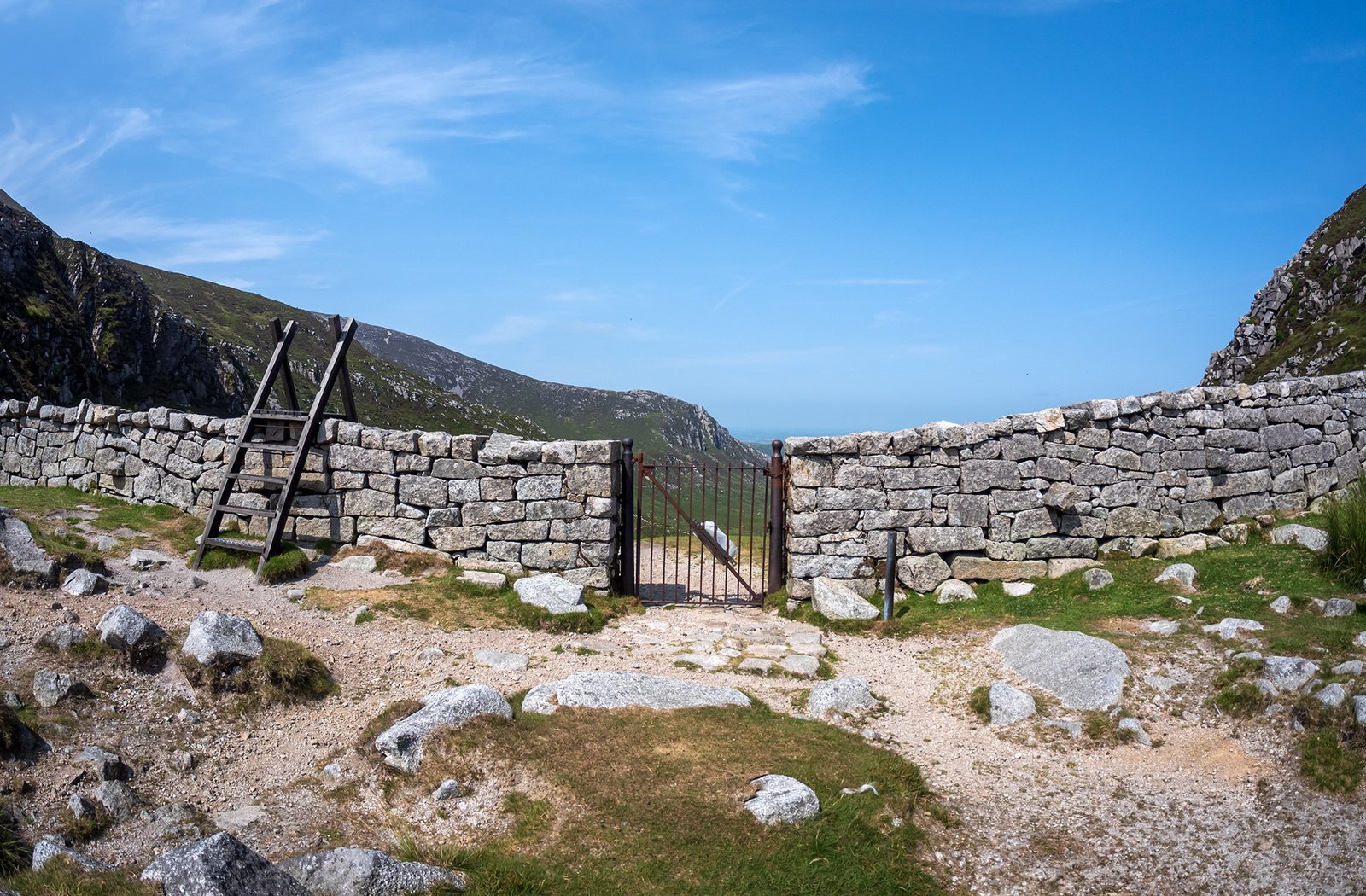
Not everyone wants a summit, and that’s fine. Hare’s Gap is the most dramatic pass in the range, a deep notch in the ridgeline that walkers have used for centuries, and you can reach it on an easy half-day from the Trassey trailhead.
You get the granite, the wall, and a real sense of the high Mournes without the full slog to a top. It’s ideal if you’re short on time, walking with mixed abilities, or just want the scenery without the summit fever.
The catch is the same one that follows you around the Mournes: the Trassey parking fills early on good days. Turn up before mid-morning on a sunny weekend or you’ll be parking a long walk from where you meant to start.
More Things to See and Do in Northern Ireland
- Titanic Belfast: The Complete Visitor’s Guide
- Giant’s Causeway From Belfast: All Day Trip Options
- Northern Ireland: A 3-Day Itinerary
Forests, Beaches, and Other Attractions in the Mournes
Not everyone wants to climb a mountain, and not every day gives you the weather for it. The Mournes have plenty going on at ground level, though. You’ve got forest parks, a reservoir ringed by easy trails, mountain-bike tracks, and one of the biggest hedge mazes in the world. Here’s where to go when you’re not chasing a summit.
Tollymore Forest Park
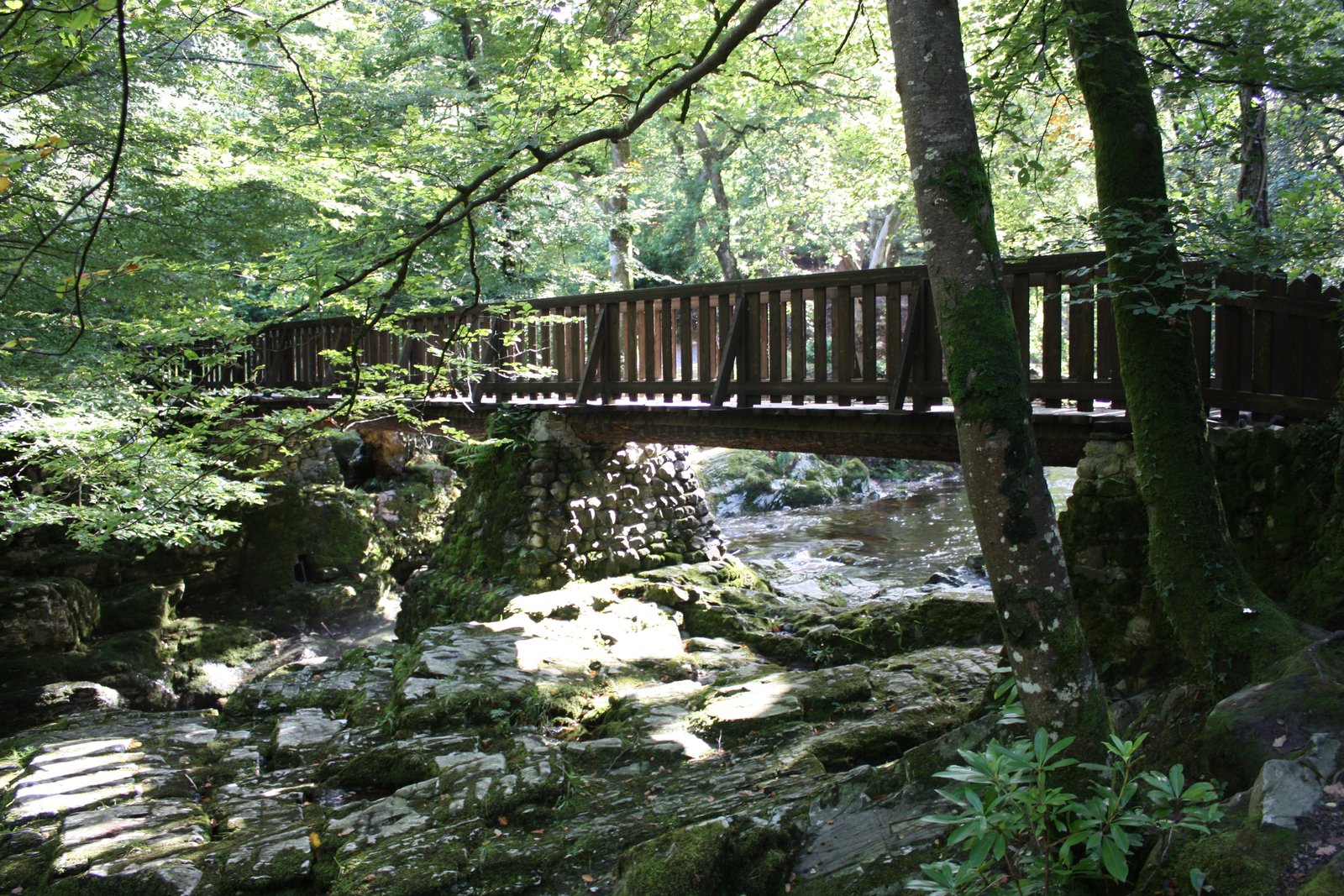
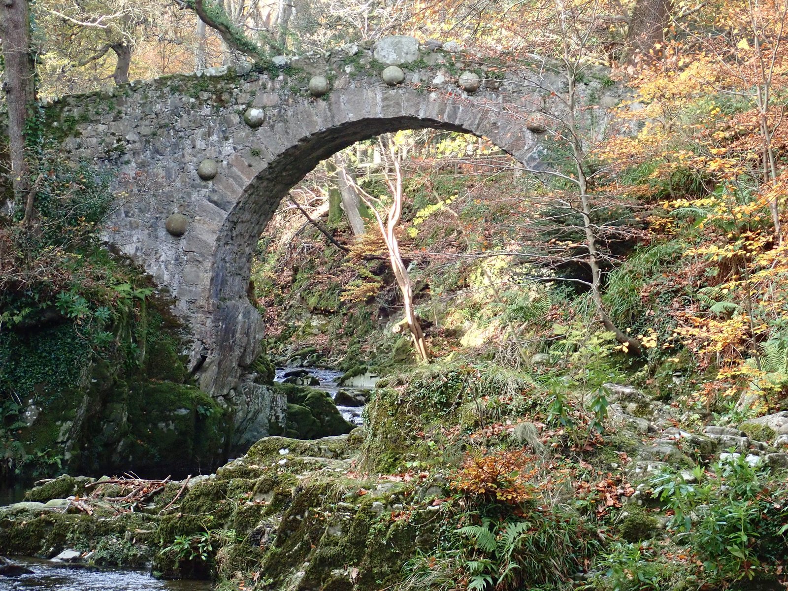
Tollymore sits just outside Newcastle and it’s the easy win of the bunch. You follow the river past ornate stone bridges and a scatter of old follies dotted through the trees. There’s a short loop and a longer one, and none of it asks much of your legs.
Game of Thrones fans will know it too. Tollymore stood in for the Haunted Forest north of the Wall, and you’ll spot why the second you walk in. It’s a low-effort day that keeps a whole car full of different people happy, the hikers included.
Silent Valley Reservoir
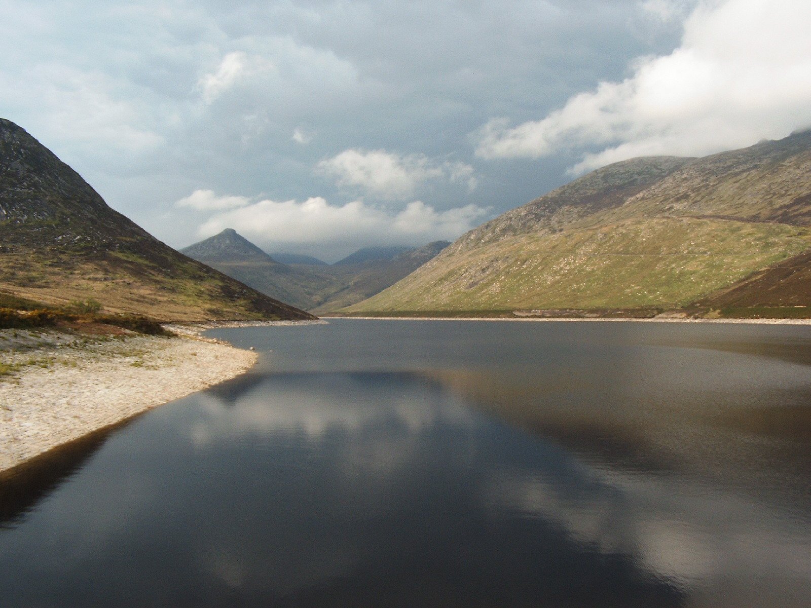
Silent Valley sits down inside the Mourne Wall’s catchment, right below the peaks, and it’s the calmest day out in the range. The trails are flat and easy, there’s a visitor center, and the reservoir itself is the main event, with the peaks rising on all sides of the water.
This is the family option, and a good one if you want to feel like you’re in the heart of the Mournes without a single steep step. It’s also a decent backup plan for a day when the tops are buried in cloud and a summit would just be a walk into grey.
Rostrevor Forest
Rostrevor is the one for anyone on two wheels. It’s a serious mountain-bike spot with proper trails cut into the hillside, and riders travel a long way to ride them. If you’ve brought a bike, this is where you point it.
Even if you’re on foot, it’s worth the climb up to the Cloughmore Stone. It’s a huge glacial erratic, a lump of granite dumped here by an ice sheet, and it sits above Carlingford Lough with a cracking view down over the water into the Republic.
Castlewellan Forest Park
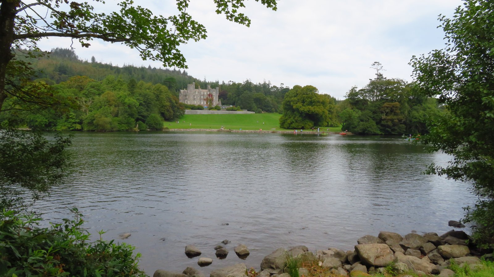
Castlewellan is the other big family day. There’s an easy lake circuit you can walk or cycle, a proper arboretum full of trees from all over, and the Peace Maze, one of the largest hedge mazes in the world. Give the kids ten minutes in that and you’ll be hunting for them.
Between Castlewellan, Tollymore, and Silent Valley, you could fill a rainy day or two without ever going near a summit. That’s the thing about the Mournes. Even when the weather shuts the mountains down, there’s a full day to be had at their feet.
More Great Hikes and Outdoor Days Around Ireland
- Hiking In Galway: 10 Best Trails For All Levels
- Cuilcagh Boardwalk Stairway to Heaven: Hiking Guide
- National Parks in Ireland: Complete Guide to All 6
Best Tours in the Mourne Mountains
Let’s be straight about this. If you’re a fit, experienced hillwalker with a map, a compass, and the sense to use them, you don’t need a guided tour to climb the Mournes. You’ll be happier planning your own day and going at your own pace.
But not everyone falls into that camp, and there’s no shame in that. If you’re new to hill walking, nervous about navigation, or you’ve never been on an exposed summit when the cloud drops, a guided walk is the easiest safe way onto these tops.
The reason comes back to the weather. The Mournes turn fast, and once you’re in the grey with no view and no path, a wrong turn off a summit is how people end up in trouble. A guide handles the navigation, reads the conditions, and keeps you on the right side of the wall when you can’t see 30 feet.
There’s a practical win too. Most day tours run from Belfast and sort the transport, so you don’t need a car or a plan for the parking that fills by mid-morning anyway. You get picked up, driven out, walked up a proper route, and dropped back. For anyone short on time or without wheels, that’s real value.
So it splits pretty cleanly. Confident hill people, save your money and do it yourself. First-timers, anyone shaky on navigation, or travelers relying on public transport, a guided walk is worth every penny and takes the biggest risk in the Mournes off your plate. Here are the trips worth a look for the Mournes and the rest of County Down.
Belfast, St Patrick, Mourne Mountains and Coast Tour
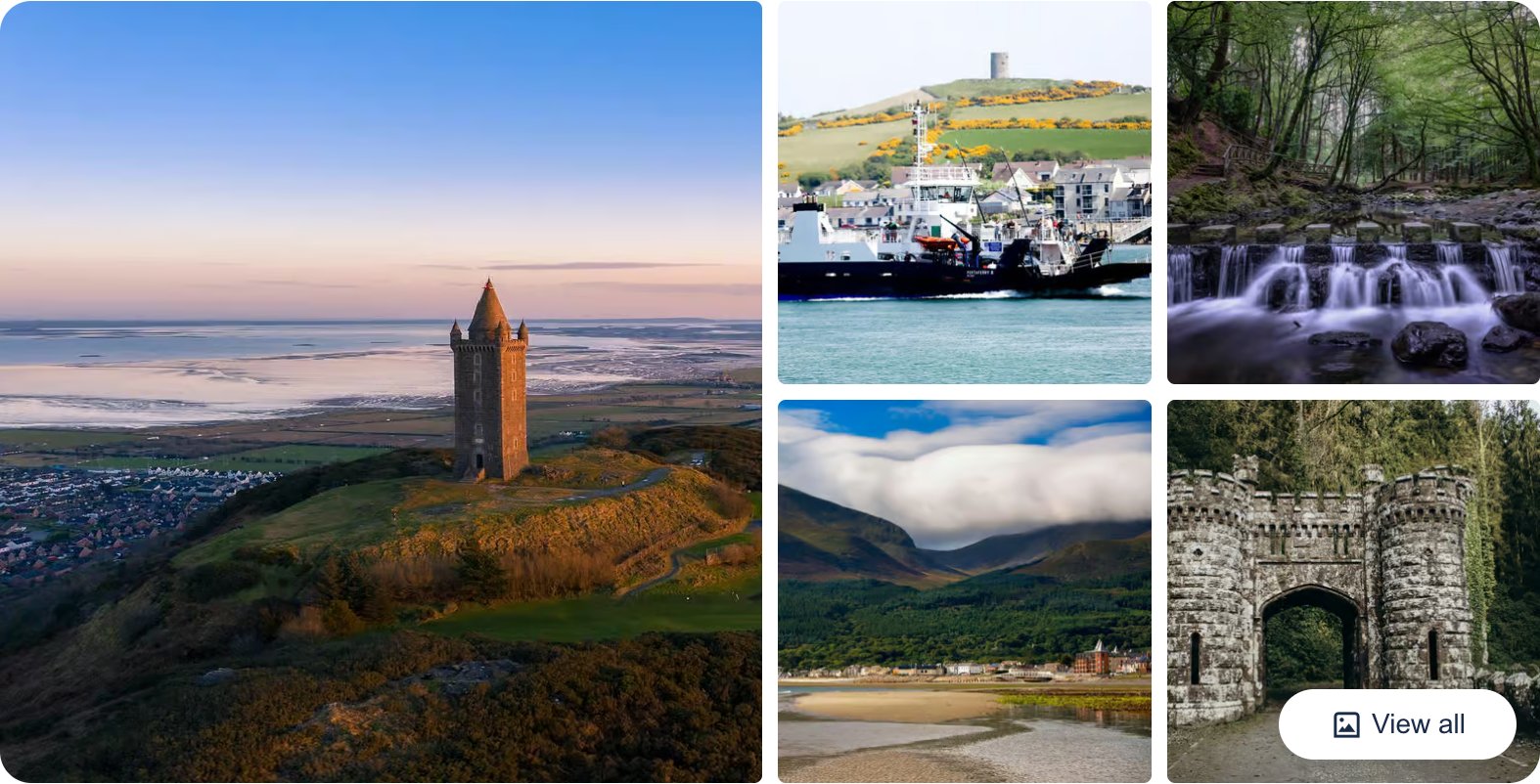
This full-day trip from Belfast runs down the County Down coast to the Mournes, with stops taking in St Patrick’s country around Downpatrick and the foot of the range. Transport and a guide are sorted, so it’s the easy pick if you don’t have a car and want the scenery without planning the route yourself.
👉 Check Belfast, St Patrick, Mourne Mountains and Coast Tour Availability and Reviews
Belfast, Game of Thrones Winterfell Locations Trek
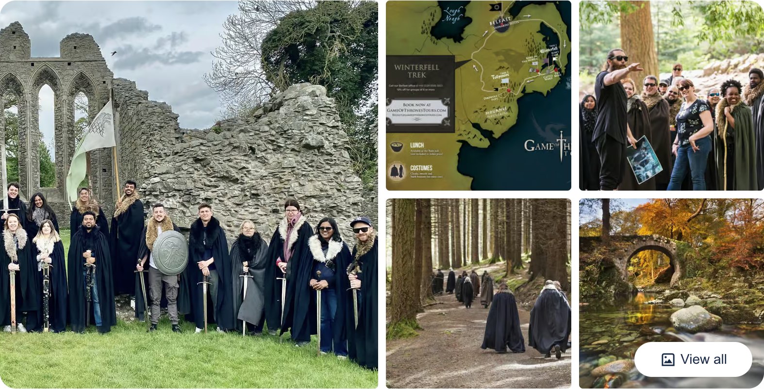
This one takes you into Tollymore Forest and the County Down filming spots on foot, with cloaks and props thrown in, so you get a walk in the Mourne foothills and the Game of Thrones angle in the same day. It leaves from Belfast and suits anyone who wants Tollymore’s trails with a bit of a show rather than a straight hillwalk.
👉 See what’s included on the Winterfell Locations Trek
Game of Thrones Studio Tour

This is the indoor option, an admission ticket to the studio in Banbridge, right on the edge of the Mournes in County Down. It’s the wet-day backup when the tops are buried in cloud, with the real sets, costumes, and props from the show under one roof.
👉 Check dates and prices for the Game of Thrones Studio Tour
Where to Stay in the Mournes
Newcastle is the obvious base, and for a first trip it’s the right one. It sits right at the foot of Slieve Donard, it’s walkable to Donard Park where the flagship climb starts, and it’s got the food, the pubs, and the beds you’ll want after a long day on the hill.
It’s also where the seasonal shuttle runs from, so basing yourself here means you can leave the car and get dropped at a trailhead. For a walking trip, that alone is worth a lot.
The Hikers House
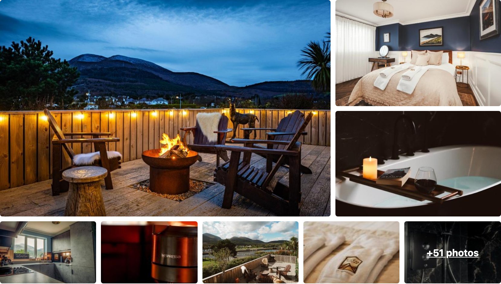
The Hikers House sits 100 metres from the centre of Newcastle, which puts you a short walk from Donard Park and the start of the Glen River climb. It’s built for exactly the trip you’re planning, so you can dry your boots and be back on the hill first thing.
It scores 9.9 from over 150 guests, with a fire-pit terrace looking straight at the mountains. Book ahead for summer weekends, because a place this well-rated and this central goes first.
👉 View The Hikers House Availability and Pricing
Cherryhill Lodge
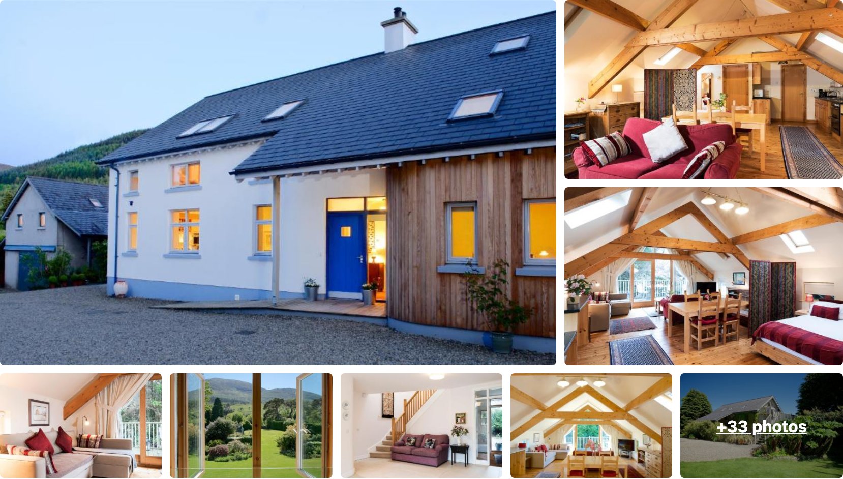
Cherryhill Lodge is a bed and breakfast on Tullybrannigan Road, about 1.5km from the centre and tucked right under the hills. It’s the mid-range pick, a proper B&B breakfast before a long day out and mountain views from the windows.
It holds a 9.7 across nearly 200 reviews, which is about as consistent as guesthouse ratings get in this town. If you want somewhere calmer than the seafront but still close to the trailheads, this is the one.
👉 View Cherryhill Lodge Availability and Pricing
Slieve Donard Resort and Spa
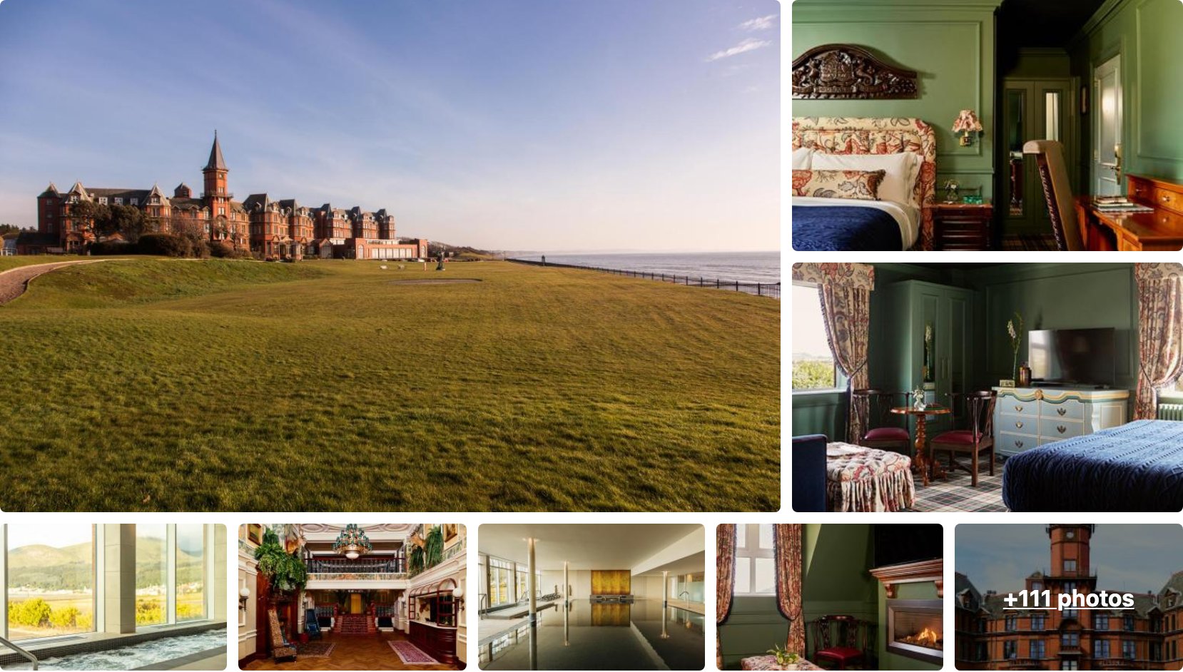
Slieve Donard Resort and Spa is the landmark red-brick hotel on the Newcastle seafront, sat right where the mountain meets the sea. This is the splurge, with a spa, a pool, and sea views, for when you want to be looked after properly after a day on the hill.
It scores 8.3 from more than 3,800 reviews, so you know what you’re getting. It’s a five-minute walk to Donard Park and the trailhead, which is hard to beat for a hotel of this size.
👉 View Slieve Donard Resort and Spa Availability and Pricing
Quieter Inland and Coastal Bases
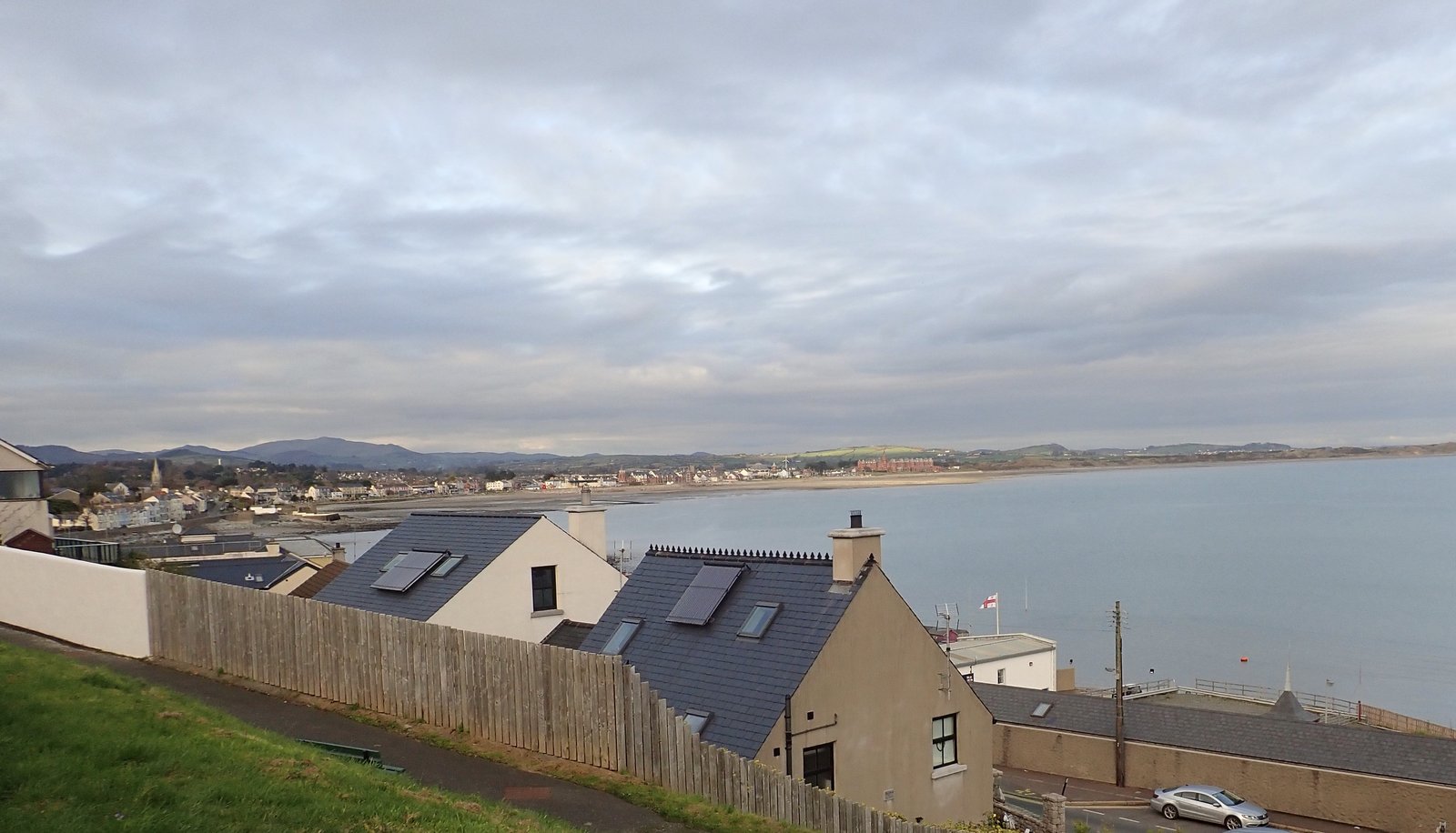
If Newcastle feels too busy for you, or you want to be closer to the western trailheads like Trassey and Ott, the smaller villages are worth a look. Rostrevor, Annalong, and Kilkeel all have B&Bs and self-catering cottages, and they’re a lot calmer at night.
Self-catering cottages inland are the pick if you’ve got a group, a car, and a plan to be out on the hills all day anyway. You trade the walk-to-the-trail convenience of Newcastle for more space, more quiet, and usually more room for your money.
My honest steer: first trip, no car, or you just want the easy option, stay in Newcastle. Second time round, or traveling as a group who’d rather cook and spread out, take a cottage in one of the villages and drive to the trailheads.
Plan the Rest of Your Ireland Trip
- Where to Stay in Belfast: Best Areas & Hotels
- A 10-Day Ireland & Scotland Itinerary
- Wild Atlantic Way 5 Day Itinerary: Kinsale to Doolin
In short
- Slieve Donard is the highest peak at 850m, a 4 to 5 hour return climb from Newcastle.
- Newcastle is the best base, about an hour from Belfast and two from Dublin.
- The Mourne Wall runs 22 miles over 15 summits, built between 1904 and 1922.
- Tollymore, Silent Valley, and Castlewellan offer easy walks with no summit required.
- Late spring to early autumn brings the longest days and the seasonal shuttle bus.
FAQs About the Mourne Mountains
Still planning your trip? Here are the questions people ask most about walking the Mourne Mountains, from climbing times to whether you need a guide.
How long does it take to climb Slieve Donard?
Plan on about 4 to 5 hours return from Donard Park in Newcastle. That’s roughly 9km out and back on the Glen River route. Add time if you’re stopping for photos at the top, and add more if the wall section slows you down, because it’s a steady grind rather than a stroll.
What’s the easiest way to see the Mournes without climbing a summit?
You’ve got three easy wins. Silent Valley gives you flat trails and the reservoir sitting right under the peaks. Tollymore Forest Park has riverside paths and stone bridges just outside Newcastle. And Hare’s Gap from the Trassey trailhead gets you into the high granite on an easy half-day, no summit required.
What’s the hardest climb in the range?
For a single peak, Slieve Bearnagh’s tors are the toughest, a proper hands-on-rock scramble at the top rather than a walk-up. For a full-on day, a Mourne Wall traverse linking multiple summits is the real test, a long, exposed slog that’s only for fit, experienced hillwalkers.
What’s the best time of year to visit?
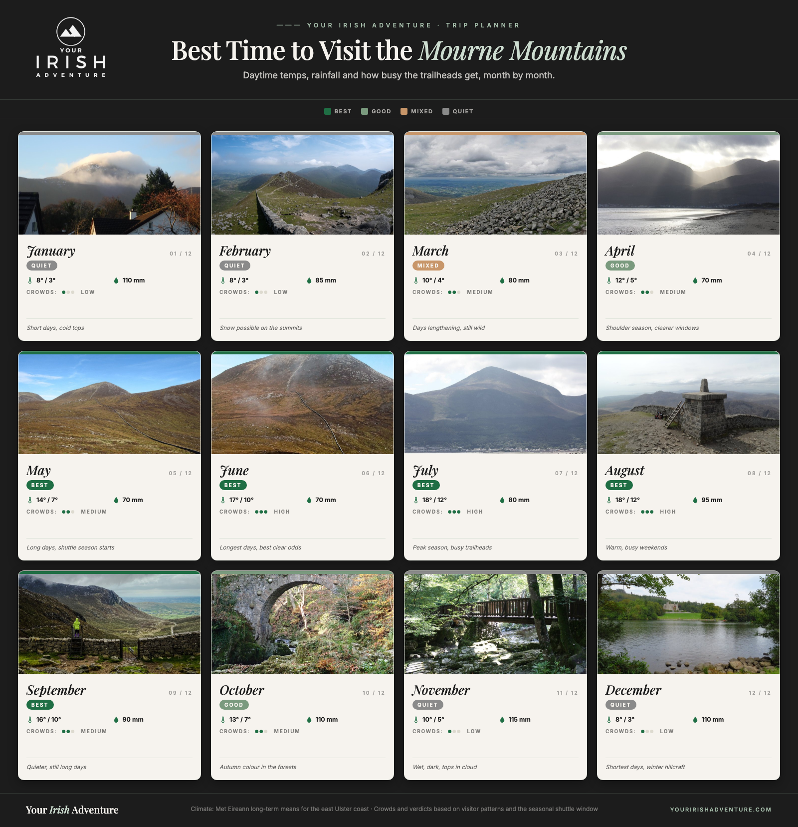
Late spring through early autumn gives you the longest days and the best odds of a clear window, and it’s also when the seasonal shuttle bus runs. Summer weekends are busiest, so the trailheads fill fast. Whatever month you pick, the weather here does what it wants, so pack for all four seasons in one day.
Do you need a guide to walk the Mournes?
No, not if you’re a confident navigator with a map and compass and you’re happy on exposed ground. Plenty of people walk these hills solo every day. But if you’re new to hillwalking, shaky on navigation, or relying on public transport, a guided walk is a smart call. These tops turn to grey fast, and a guide takes that risk off your plate.
Final Thoughts on Visiting the Mourne Mountains
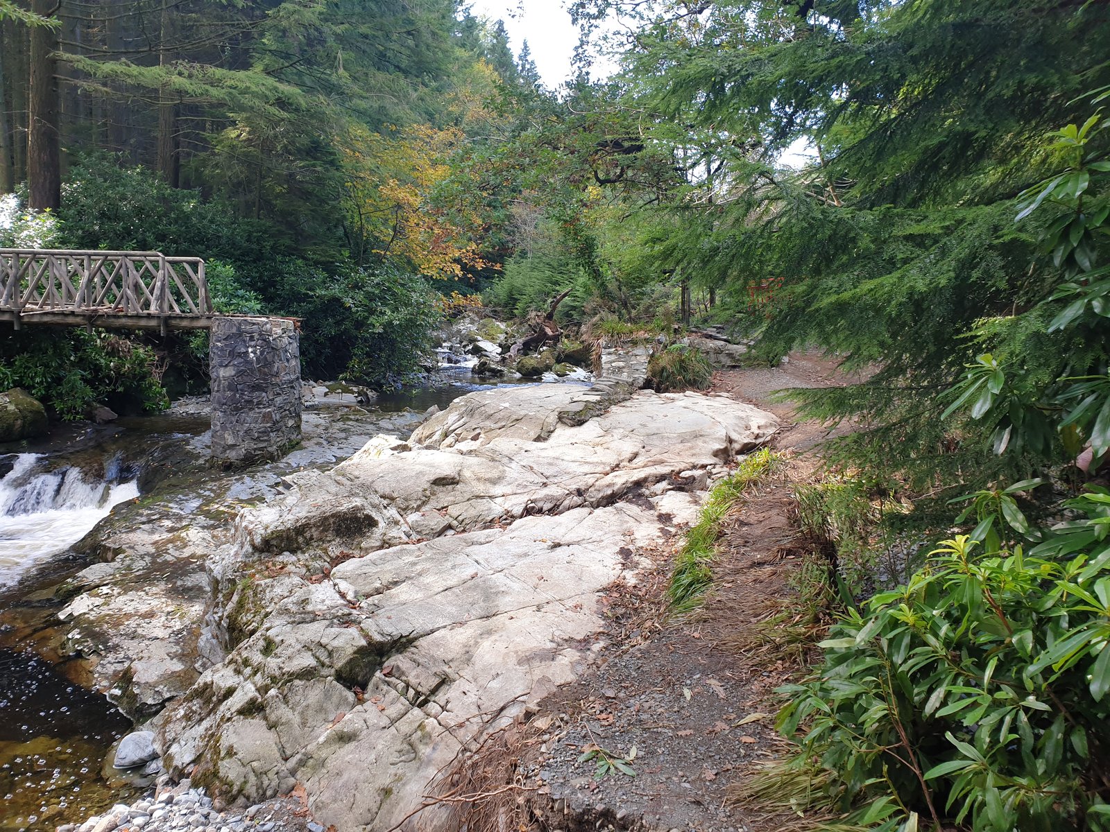
The Mournes pack Northern Ireland’s best hillwalking into one small, close-knit range, and they do it within an hour of Belfast and a shade over two hours of Dublin. For that little effort to reach them, you get more than a dozen peaks over 600m and the highest ground in the North.
Give them a full weekend, not a rushed day. You could tick Slieve Donard in an afternoon and call it done, but you’d miss the best of it. The tors on Bearnagh, the quiet from Ott, a slow day in Tollymore when the tops are socked in, that’s the range at its best, and it takes more than one morning to get around.
Go in with the right expectations and you’ll love it. Pack layers and waterproofs, sort your parking or use the shuttle, and keep this Mourne Mountains guide handy for the walks and the where-to-stay picks. The one thing that ruins a Mourne trip is turning up expecting the weather to behave.
Do that, catch even one clear window on a summit, and you’ll understand why people keep coming back. For hillwalking this good, this close to two capital cities, the Mournes are hard to beat.
Like it? Pin it!
Save this guide for later