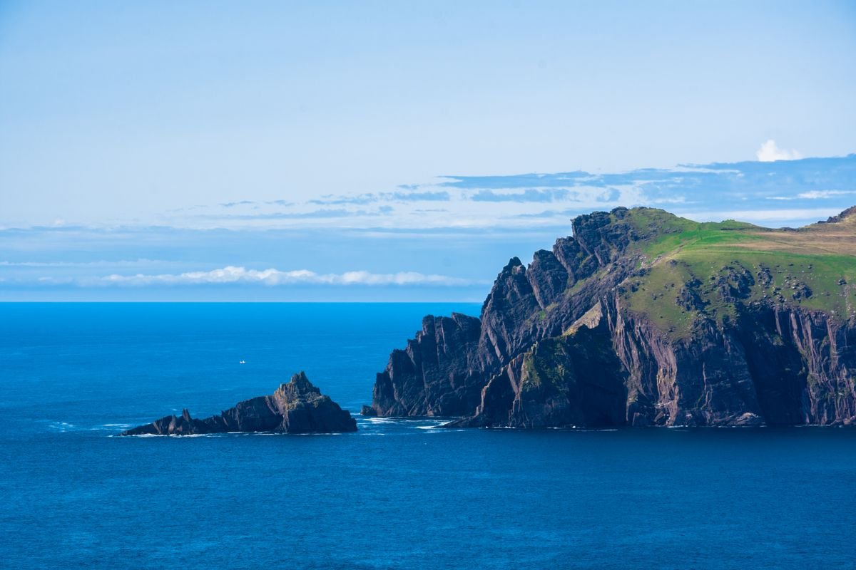
The Slea Head Drive is a 30-mile loop off the western tip of the Dingle Peninsula, and it’s the main reason to come to Dingle at all. Beehive huts, Iron Age forts, cliffs dropping straight into the Atlantic, and the Blasket Islands sitting offshore. You can drive it in a couple of hours or spend a full day and not feel rushed.
I’ll be honest with you up front. On our last trip through Ireland we arrived in Dingle in heavy rain with work to catch up on, and we only ended up driving the loop after dark. It’s our biggest regret of the whole trip, and it’s exactly why I want you to do this one properly.
The good news is the route is dead simple and hard to get wrong. Start in Dingle town, follow the R559 west, and keep the coast on your left the whole way around.
Below I’ll walk you through the route map, the stops worth pulling over for, a few add-ons beyond the loop itself, where to base yourself in Dingle, and the practical stuff for actually driving it. Here’s what we did, and what I’d tell a first-timer to check out.
More Dingle & Kerry Travel Guides
- 7 Best Places to Stay in Dingle, Ireland
- 21 Unique Things To Do in Kerry, Ireland – The Kingdom County
- Killarney National Park: A Complete Visitor’s Guide
- Weekend in Killarney: The Perfect 2 Day Itinerary
Quick Answer:
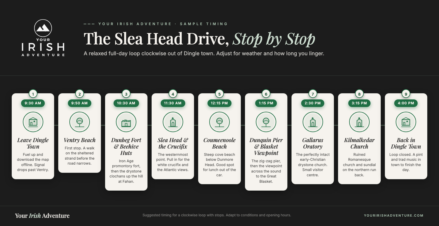
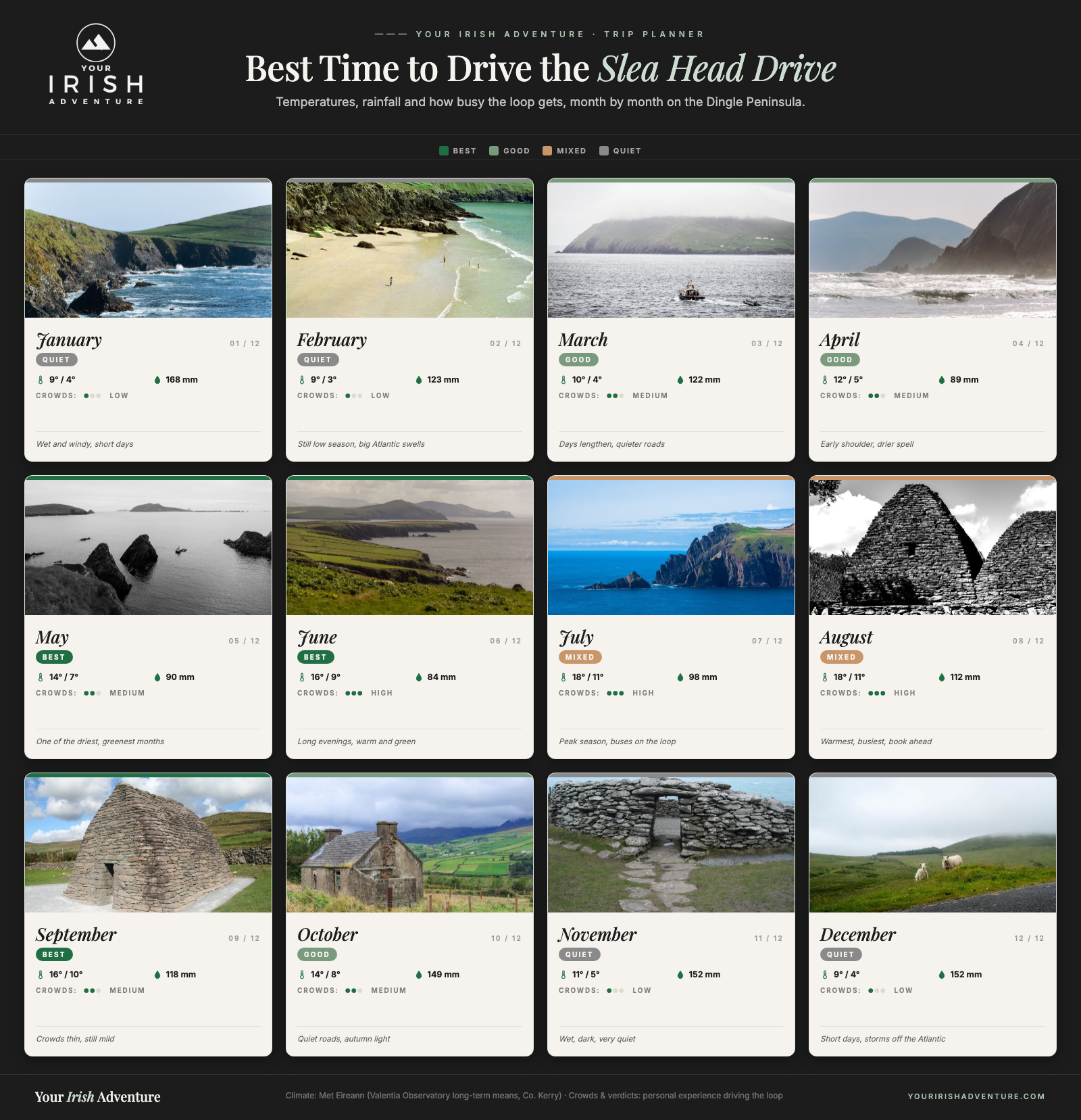
The Slea Head Drive is a signposted 30-mile loop off Dingle town in County Kerry, best driven clockwise on the R559. Plan two to three hours for the main viewpoints or a full day to walk the forts. Top stops include Ventry Beach, Dunbeg Fort, the beehive huts, Slea Head, Dunquin Pier and Gallarus Oratory.
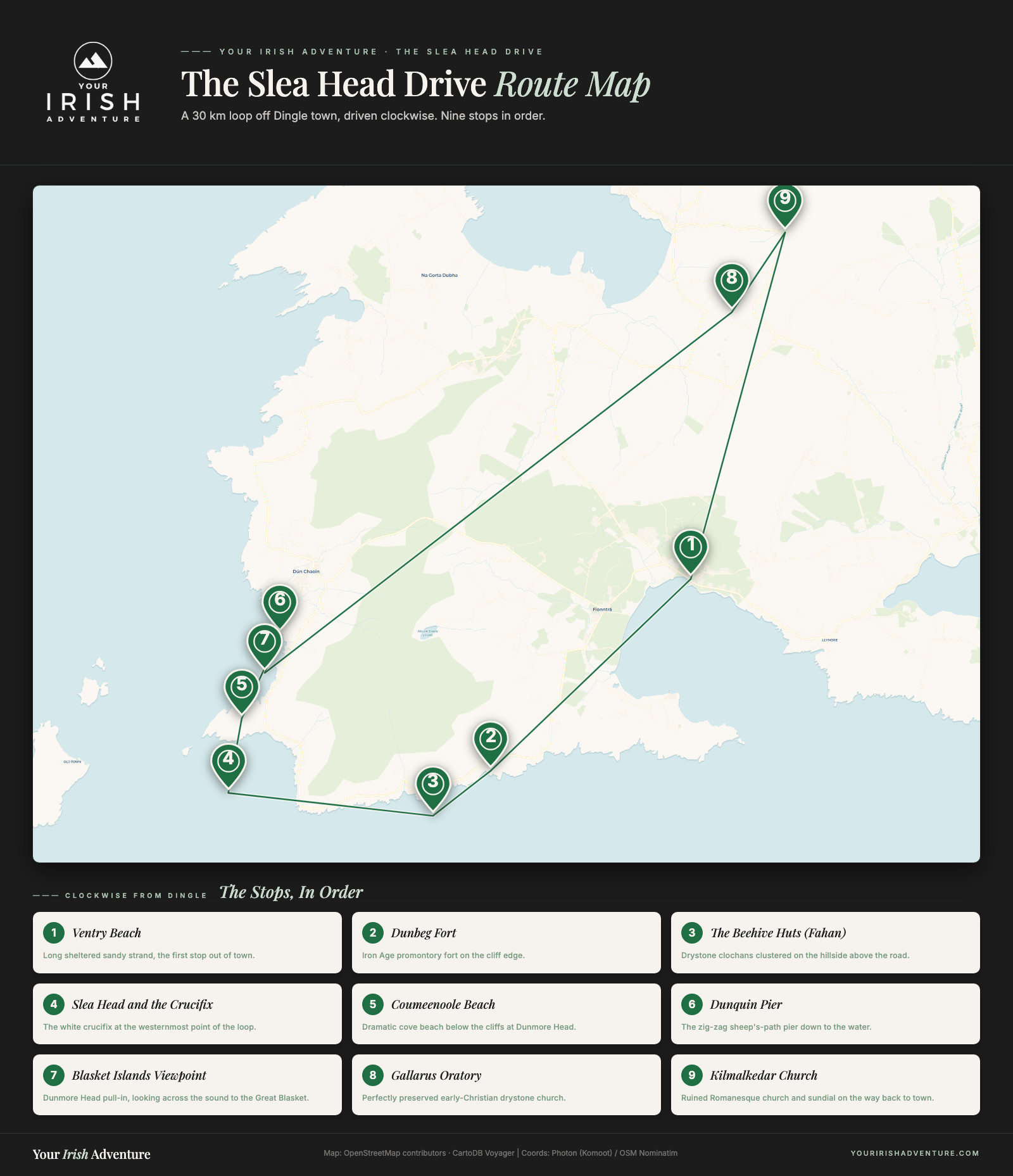
The Slea Head Drive Route Map
The whole loop is signposted, so you don’t need a paper map or a printed route. Just look for the small blue “Slea Head Drive” signs and follow them the whole way around.
Drive it clockwise. Head west out of Dingle town toward Ventry first, then carry on to Slea Head itself, up to Dunquin, back across to Ballyferriter, and into town from the north. The tour buses run this same direction, and on the narrow stretches you really don’t want to meet one coming the other way.
Plan on two to three hours if you’re stopping at the main viewpoints, or a full day if you want to walk to the forts and actually sit at a beach for a while. It’s only 30 miles, but you’ll be crawling for a lot of it, and that’s the point.
We based ourselves at the Rainbow Hostel just outside town and parked the campervan in their lot, which was a 10-minute taxi into Dingle for the evening. If you’re renting a car, any B&B in or near the town works as your start and end point, since the loop begins and finishes in Dingle either way. It’s worth booking the car ahead in summer, and you can compare car hire deals on Discover Cars before you go.
One thing that helps: download the area on Google Maps before you set off. Signal drops out past Ventry, and once you’re out at Slea Head you’re on your own with the road signs.
The Best Stops on the Slea Head Drive
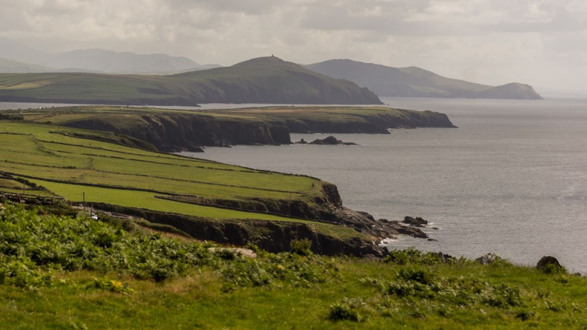
The loop is short, but the stops are the whole reason you’re out here. Here’s what to pull over for, roughly in the order you’ll hit them driving clockwise out of town.
Ventry Beach
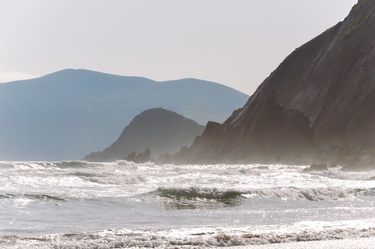
Ventry is your first proper stop, a long sweep of sand curled around a sheltered bay just a few miles west of Dingle. The water’s calmer here than anywhere else on the loop because the bay protects it, so it’s a good spot to stretch your legs before the road gets narrow.
There’s parking right by the beach and usually a coffee van in the warmer months. Give it 20 minutes and carry on.
Dunbeg Fort
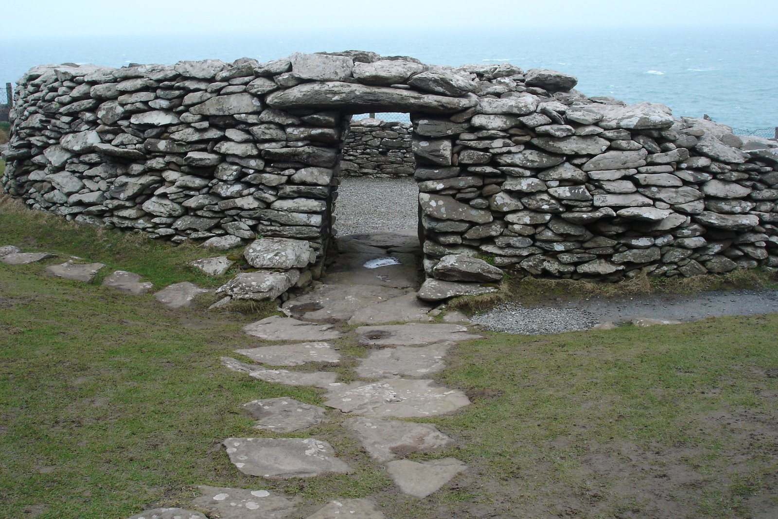
Dunbeg is an Iron Age promontory fort perched right on the cliff edge, with a stone wall and the remains of a beehive hut inside. Part of it has already fallen into the sea from erosion, so what you’re looking at is slowly disappearing.
There’s a visitor center across the road with parking and a short film, and you pay to walk down to the fort itself. Check current pricing at the door, since it changes.
The Beehive Huts (Fahan)
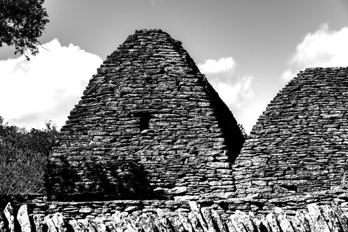
Just past Dunbeg you’ll start seeing clusters of clocháin, the dry-stone beehive huts monks built here over a thousand years ago. No mortar, just stacked stone, and some of them are still watertight.
Most sit on private farmland, and the farmers charge a few euro in cash to walk in and see them up close. Bring coins, because there’s no card machine on a hillside.
Slea Head and the Crucifix
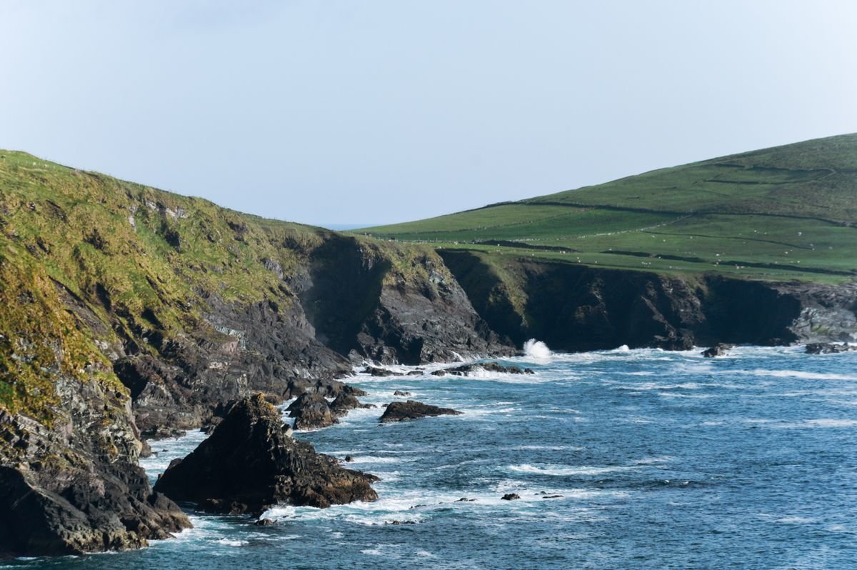
This is the point the whole drive is named after, marked by a white crucifix standing on the bend where the road hugs the cliff. It’s the westernmost tip, and the Blasket Islands sit right out in front of you across the water.
There’s a small pull-in near the crucifix, but it fills fast. If it’s full, there’s more parking a little further along, so don’t stop dead on the road for a photo.
Coumeenoole Beach
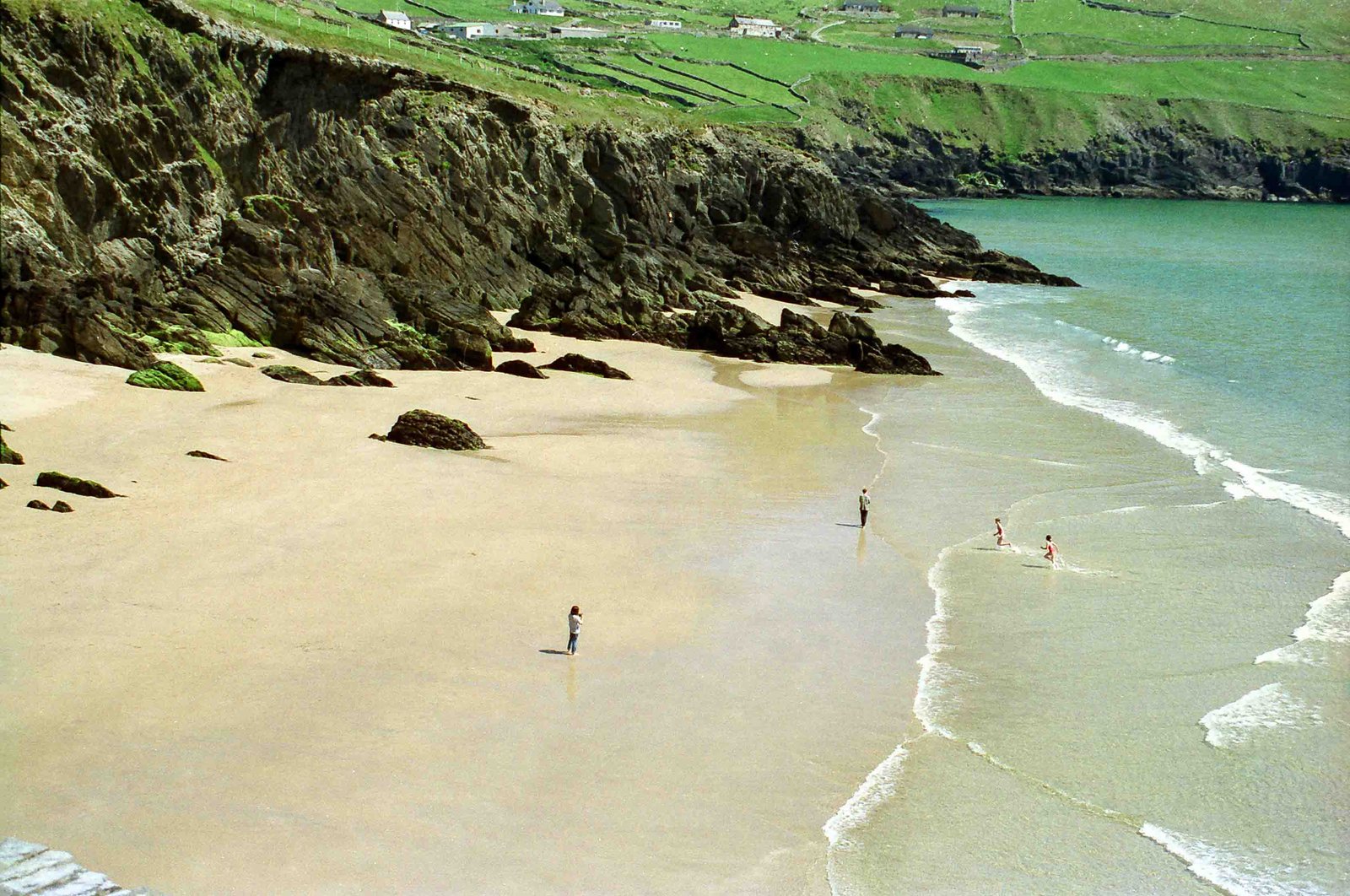
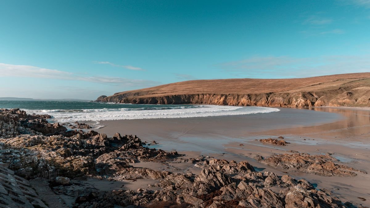
Coumeenoole is the beach they used in the film Ryan’s Daughter, a strip of sand hemmed in by tall cliffs just past Slea Head. It’s a steep walk down from the parking lot and the currents are strong, so it’s more for looking and photos than swimming.
Dunquin Pier
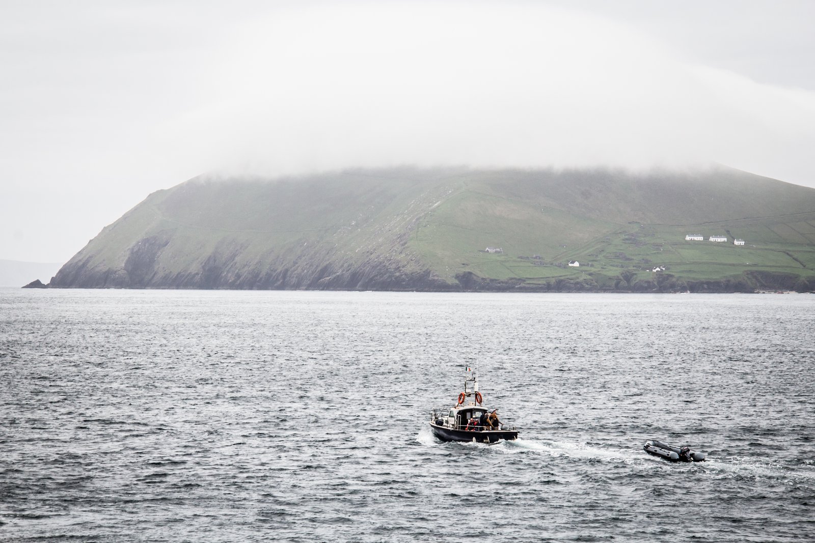
Dunquin is the one you’ve seen on Instagram, a zigzag concrete path snaking down the cliff to a tiny harbor, usually with a few sheep wandering across it. The ferry to the Great Blasket leaves from here in season.
You can walk the path down to the water and back, and it’s steeper than it looks in the photos. Worth doing for the view back up.
The Blasket Islands Viewpoint
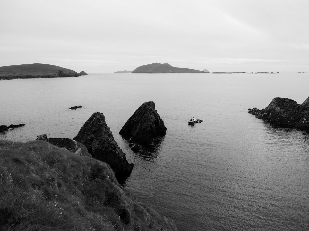
Above Dunquin there’s the Blasket Centre, which tells the story of the Great Blasket community that lived out on the island until they were evacuated to the mainland in the 1950s. The islands produced a run of well-known Irish-language writers, which is a big part of why the place matters.
Even if you skip the center, pull over at the viewpoint and look out at the islands. On a clear day you can see the whole chain.
Gallarus Oratory
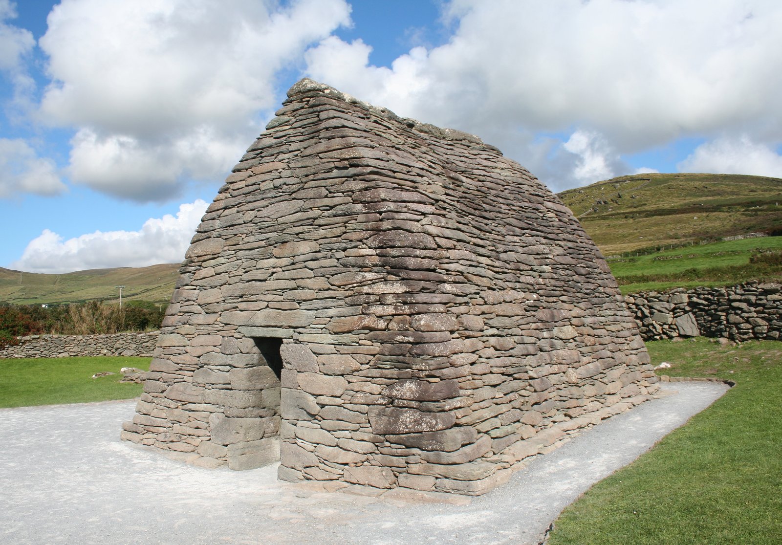
Gallarus is a small dry-stone church shaped like an upturned boat, and it’s been standing for well over a thousand years without a drop of mortar holding it together. It’s still watertight inside, which is the part that gets everyone.
It’s a quick stop, ten minutes to walk in, look at it, and duck inside. There’s a parking lot and a visitor center right beside it.
Kilmalkedar Church
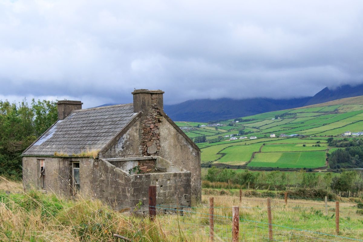
The last stop before you loop back toward town is Kilmalkedar, a ruined 12th-century Romanesque church with an old graveyard around it. There’s an ogham stone and a stone sundial in the grounds, both older than the church itself.
It’s free and quiet, and the tour buses tend to skip it, so it’s a calm one to end on before you head back into Dingle.
And when you do get back into town, go to Foxy John’s. It’s a working hardware shop by day with a bar at the back, and when we walked in there was a trad session going with a guitar and tin whistle. Pints and paint brushes under the same roof, and it’s the best possible way to end the loop.
Worth Adding On Beyond the Slea Head Loop
The loop is the main event, but the peninsula has a few more things worth your time if you build in a second day. We only had one night in Dingle on our last trip, and running out of time here is the mistake I’d tell you to avoid. If you’d rather have someone else drive while you take in the beehive huts and the peninsula, you can book the Dingle sheepdog and beehive huts tour on GetYourGuide.
The Conor Pass
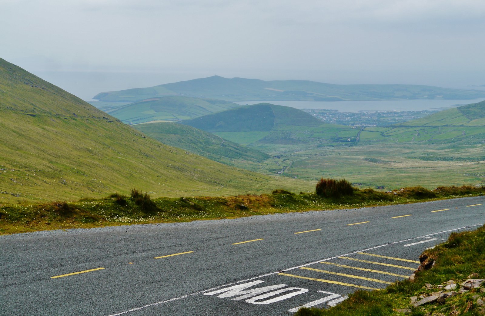
The Conor Pass is the high mountain road that climbs north out of Dingle town, and it’s one of the highest passes in Ireland. It’s a single-track road with a serious drop on one side, so take it slow and don’t attempt it in a big rental if you can help it.
There’s a parking pull-in at the top with a view back down over the whole peninsula. It’s a separate drive from the Slea Head loop, so treat it as its own short trip in or out of town.
Inch Beach
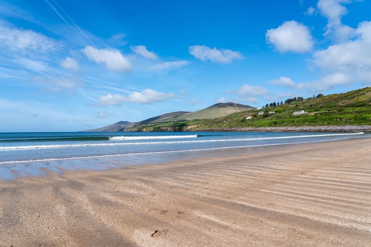
Inch is a long spit of sand that runs out into Dingle Bay, on the road in from the Killarney side. You can drive right onto the beach, and there’s a cafe at the entrance. It’s a surf spot, so you’ll usually see a few people out in the water.
This is one we didn’t make it to, and I wish we had. If you’re coming into Dingle from the east, it’s right on your way, so stop before you even reach the town.
Adare on the Way In
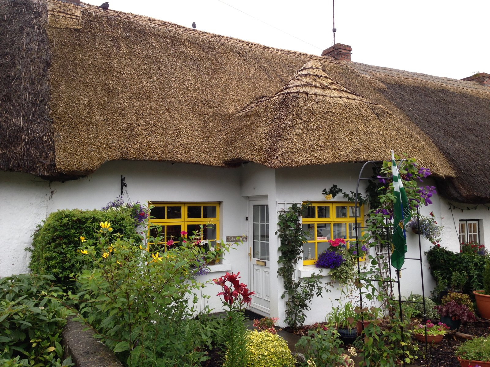
If you’re driving to Dingle from Limerick or the east, Adare is worth a stop for lunch. We pulled in on the way and had a shepherd’s pie and a Guinness before carrying on, and the row of thatched cottages through the middle of the village is the real thing, not a set piece.
A Second Night in Dingle Town
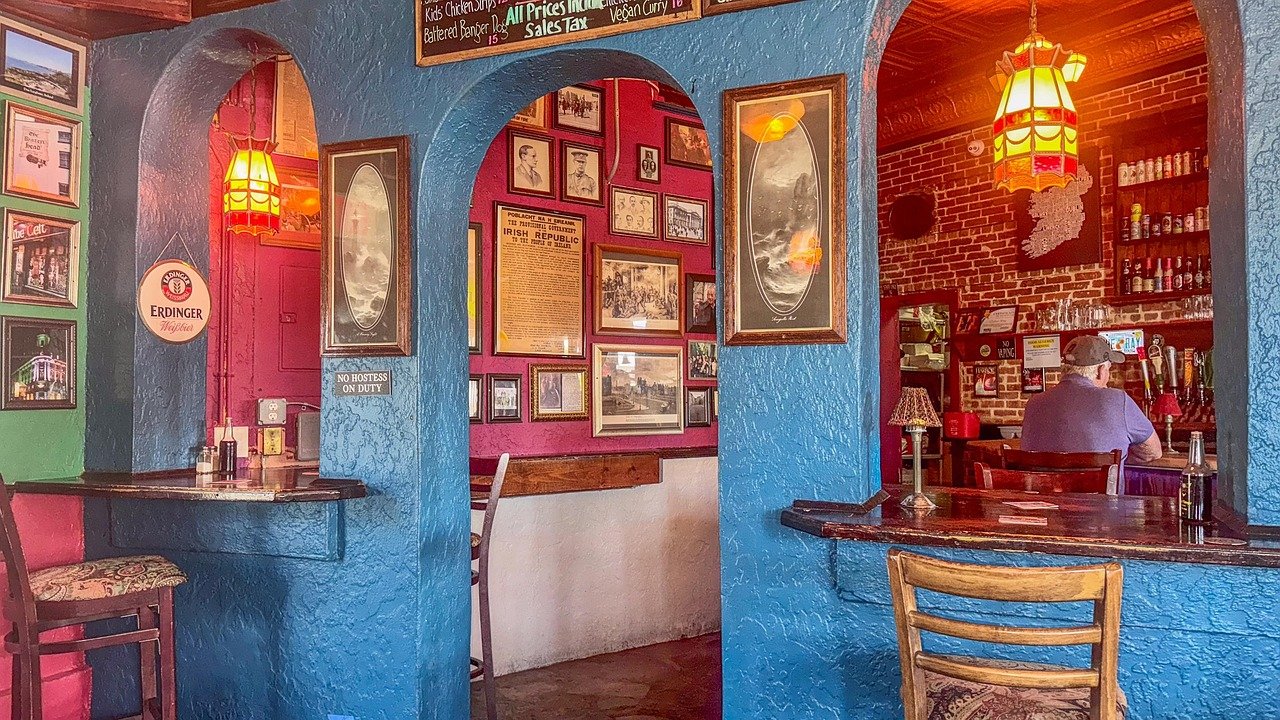
The town itself earns a proper evening. Alongside Foxy John’s, we had pints at The Dingle Pub, and the whole place is small enough to wander between the bars on foot in one night.
Give yourself two nights if you can. One for the loop, one for the town and the passes, so you’re not racing the daylight the way we ended up doing.
More Kerry Road Trips & Ireland Itineraries
- The Ring Of Kerry Drive: Itinerary, Highlights & Tips
- Wild Atlantic Way Itinerary – Ireland’s Most Epic Road Trip
- A Photographer’s Definitive Ireland Road Trip
Where to Stay in Dingle
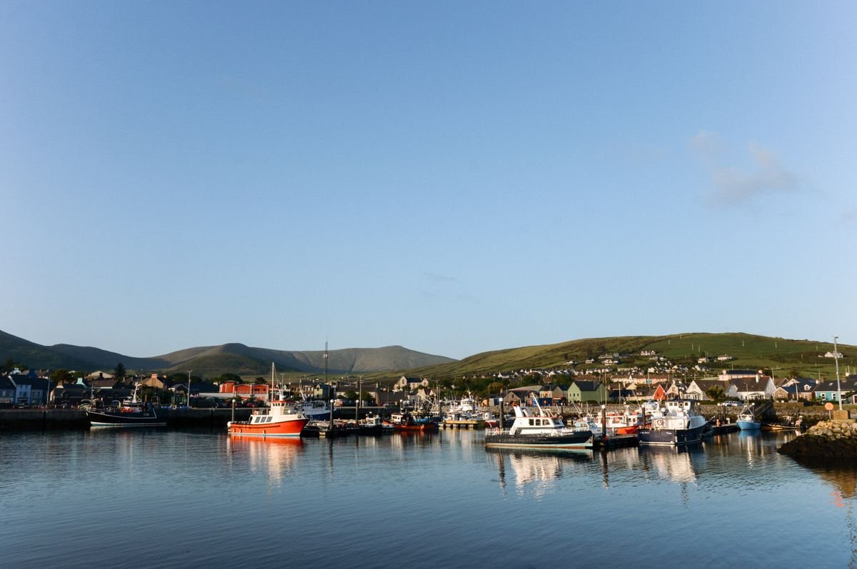
For a first-timer, I’d stay right in Dingle town. It’s small, the pubs and restaurants are all within a few streets of each other, and it means you can walk home from a session instead of sorting out a lift at midnight.
The town is packed with B&Bs and guesthouses, and that’s what most visitors book. A room in the center puts you a two-minute walk from the harbor and the main run of bars, which is where you’ll want to be in the evening. You can check availability on Booking.com to see what’s open in town for your dates.
We stayed just outside town and had to taxi in each way, which was fine, but if I did it again I’d book somewhere I could walk from. Being able to roll out of the pub and be back in bed in ten minutes is worth the slightly higher room rate in the center.
Dingle Garden Townhouse
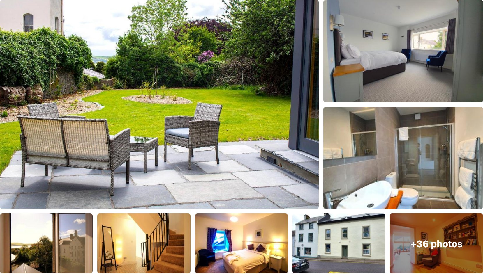
Dingle Garden Townhouse sits on Goat Street a couple of minutes’ walk up from the harbour, so it’s about as central as you can get. The rooms are modern and there’s a garden out the back to sit in if the weather plays along.
It scores 9.7 across more than 760 reviews, which for a B&B in the middle of town is as safe a bet as you’ll find. If you want to walk everywhere and skip the taxi we relied on, start here.
👉 View Dingle Garden Townhouse Availability and Pricing
Heatons Guesthouse
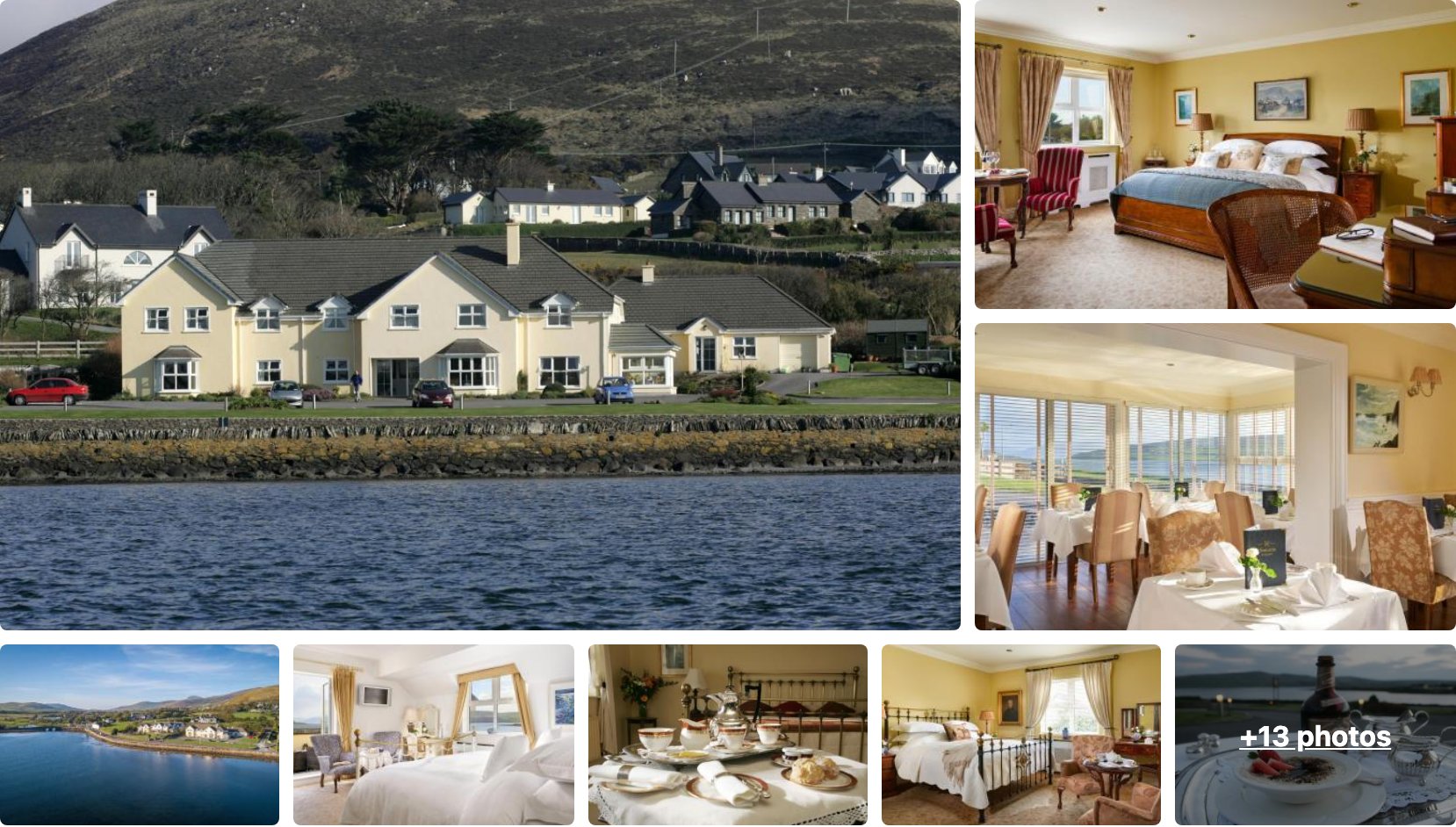
Heatons Guesthouse sits right on the water at the edge of town, a short walk or quick drive from the pubs, with rooms that look out over the harbour and the mountains behind. It’s a step up from a standard B&B, with a proper breakfast and a sea-view dining room.
It holds a 9.7 over 400 reviews, so the quality is consistent. This is the one to book if you want the town on your doorstep but a bit more comfort and a view to wake up to.
👉 View Heatons Guesthouse Availability and Pricing
Duinin House
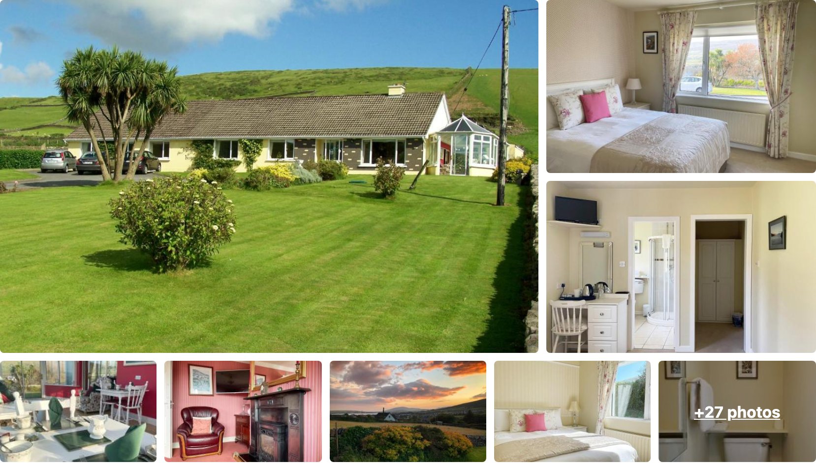
Duinin House is a B&B on the Conor Pass road just outside the center, with a big lawn out front and hills rising behind it. It’s a five-minute drive or a walkable stretch into town, and it’s the pick if you want a bit of quiet after a day on the loop.
It runs a 9.6 across more than 540 reviews, so you know what you’re getting. Handy too if you’re planning to tackle the Conor Pass, since you’re already sitting at the bottom of it.
👉 View Duinin House Availability and Pricing
Staying Out on the Peninsula
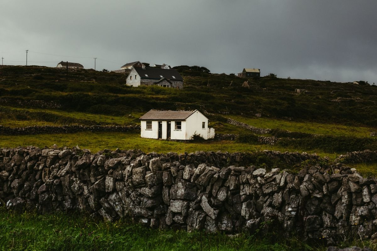
If you’d rather wake up out on the loop itself, there are guesthouses and self-catering cottages scattered around Ventry, Dunquin, and Ballyferriter. You trade the walkable pub scene for waking up next to the water, and for the Slea Head Drive that’s a fair trade.
Book ahead in summer either way. Dingle is not a big place, and the good rooms go fast once the season kicks in, so don’t leave it to the day before.
Campervans and Camping
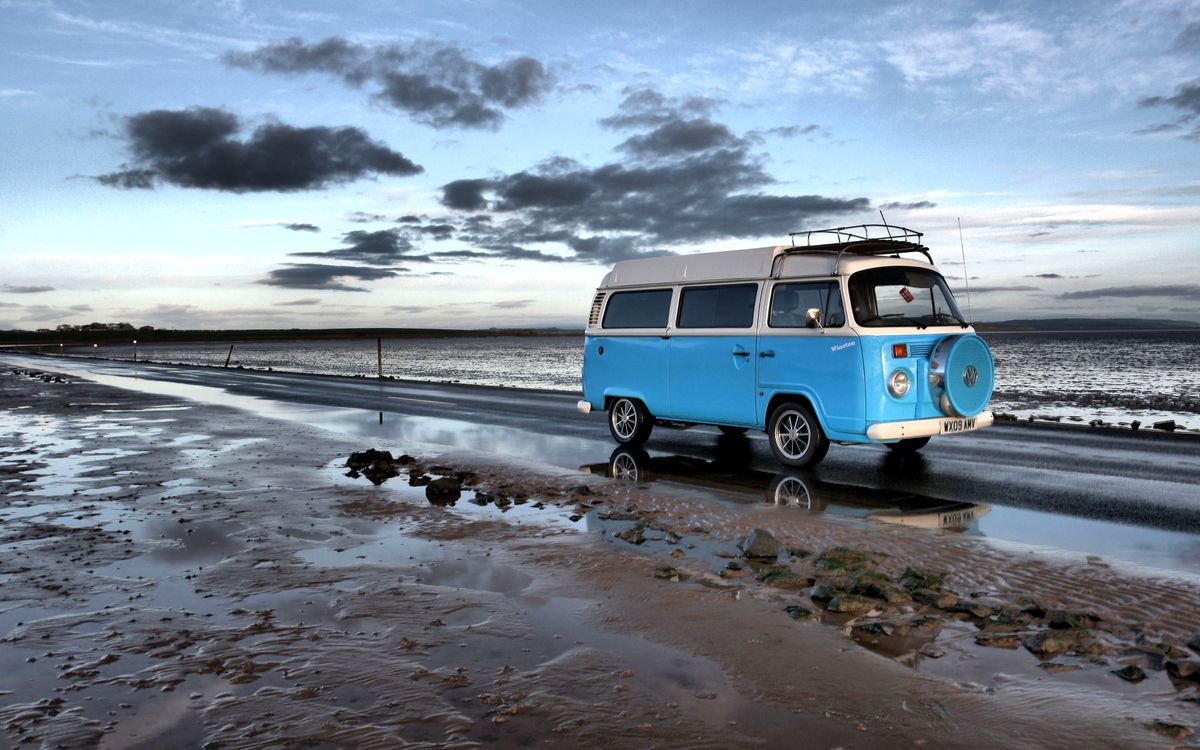
If you’re in a van like we were, there are campsites and a couple of pub car parks around the peninsula that let you stay the night. Ask inside and buy a few pints, and most places out here are happy to have you park up.
Wherever you land, my one bit of advice is to give Dingle more time than we did. A room you can actually settle into for two nights beats racing in and back out with wet weather chasing you.
Practical Tips for Driving the Slea Head Drive
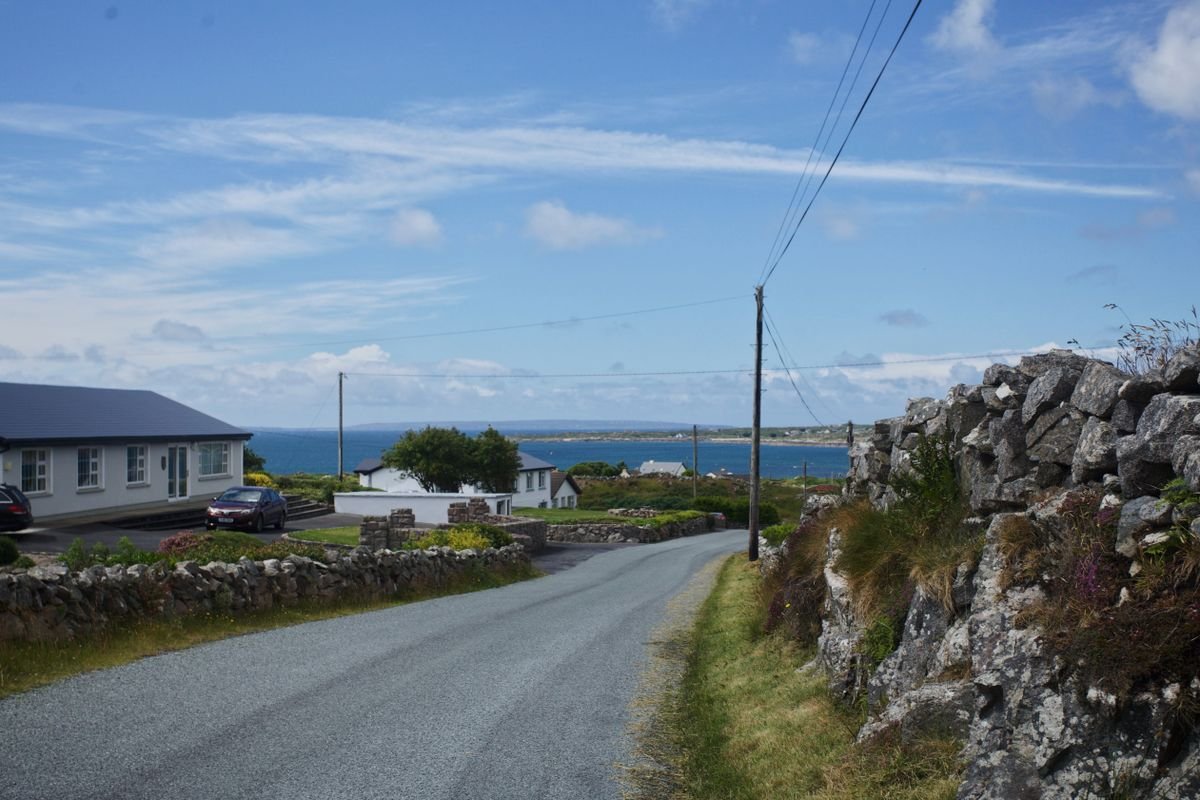
The road is narrow, and I mean actually narrow. We ended up driving the loop in the dark on our last trip, and even crawling along at walking pace there were blind bends where I couldn’t have seen a car coming until it was right on top of us. Go in daylight and give yourself room to react.
Drive it clockwise, like the tour buses do. On the tightest cliff stretches you want to be on the inside, and you don’t want to be the one reversing when you meet a bus head-on.
Time it around the buses if you can. They tend to run the loop late morning through early afternoon, so setting off early or leaving it until after 4pm gives you the road with a lot fewer of them on it.
Carry cash in coins. The beehive huts sit on private farmland and the farmers charge a few euro to walk in, and there’s no card reader out on a hillside.
Fill up before you leave Dingle town. There’s no gas station out on the loop, and the last thing you want is to be watching the fuel gauge instead of the coast.
Watch for sheep on the road, especially around Dunquin. They wander onto the tarmac and they will not move for you, so take the corners slow.
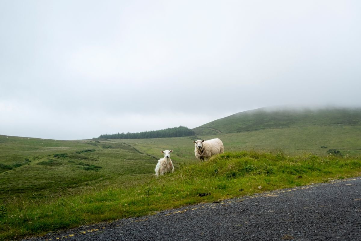
Bring a rain jacket no matter what the forecast says. The weather turns fast out here, and half the stops are short walks out to a fort or a beach with no shelter along the way.
If you’re in a big rental, take the whole loop steady and skip the Conor Pass. The Slea Head road is manageable in anything, but the pass is a different level of narrow and it’s a stressful place to learn the width of your van.
Where to Stay & What to See Around Kerry
- Where To Stay in Killarney: Best Areas and Accommodations
- Muckross House Killarney: A Complete Visitor Guide
- The Best Beaches in Ireland: 20 Picks for Every Part of the Country
Best Tours of the Dingle Peninsula
Driving the loop yourself is my pick every time, but if you’d rather leave the narrow bends and the sheep to someone else, a few guided options run the same coast. Here are the ones worth booking.
Wild Coast of the Dingle Peninsula and Slea Head Day Tour
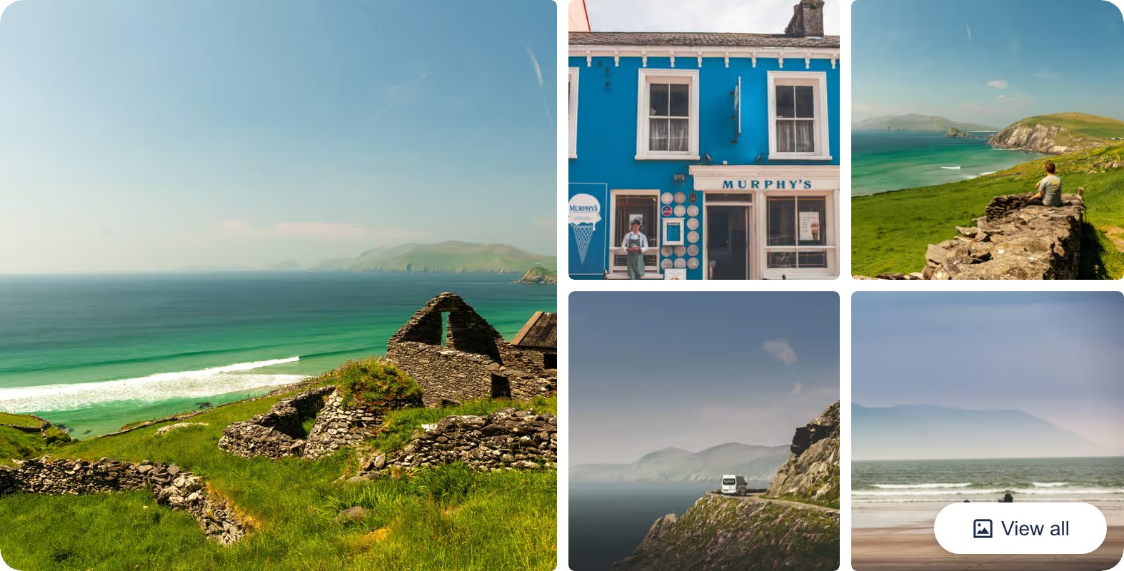
This full-day trip leaves from Killarney and runs the whole Slea Head loop, stopping at the beehive huts, Dunquin Pier, and the Blasket Islands viewpoint with a break in Dingle town. It’s the closest guided version of the drive I’ve covered here, so you see the same stops without touching the wheel.
👉 Check Wild Coast of the Dingle Peninsula and Slea Head Day Tour Availability and Reviews
Dingle Peninsula Coach Tour from Dingle Town

This one starts and finishes in Dingle town, so it suits you if you’re already staying out on the peninsula rather than driving in from Killarney. The coach handles the Slea Head loop and its viewpoints, which takes the pressure off the narrowest stretches.
👉 See what’s included on the Dingle Peninsula Coach Tour
Private Ring of Kerry and Dingle Luxury Day Tour
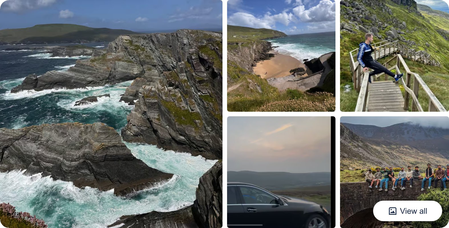
This is a private tour in a car rather than a full coach, with a driver who sets the pace and can mix the Slea Head stops with the Ring of Kerry if you want both in one day. It costs more than a group seat, but you get the peninsula on your own schedule.
👉 Check dates and prices for the Private Ring of Kerry and Dingle Luxury Day Tour
In short
- The Slea Head Drive is a 30-mile signposted loop starting and ending in Dingle town.
- Drive it clockwise on the R559 so you stay on the sea side of the narrow road.
- Allow two to three hours for viewpoints, or a full day to walk the forts and beaches.
- Don’t miss Dunbeg Fort, the beehive huts, Slea Head, Dunquin Pier and Gallarus Oratory.
- Base yourself in Dingle town and drive early or late to beat the tour buses.
Slea Head Drive FAQ
How long does the Slea Head Drive take?
Two to three hours if you only stop at the main viewpoints, or a full day if you want to walk down to the forts and sit at a beach. It’s just 30 miles, but you’ll be crawling most of it.
Can you drive the Slea Head Drive in a campervan?
Yes. We drove the whole loop in an Indie Campers van and never felt out of our depth on it. Take the blind bends slow, drive clockwise, and you’ll be fine.
Is the Slea Head Drive worth doing?
It’s the best coastal drive on the Dingle Peninsula and the main reason to come out here at all. Iron Age forts, thousand-year-old beehive huts, the Blasket Islands offshore, and cliffs the whole way. Do it.
Which direction should you drive it?
Clockwise, west out of Dingle town toward Ventry first. That’s the way the tour buses run, and on the tight cliff stretches you want to be on the inside rather than reversing to let a bus past.
Do you need a guided tour?
No. The loop is fully signposted with small blue “Slea Head Drive” signs, and driving it yourself lets you stop where you want and skip the crowds at the busy pull-ins. Just download the area on Google Maps first, because signal drops out past Ventry.
What should you do in Dingle after the drive?
Head into town for the pubs. It’s small enough to walk between the bars in one night, and a trad session is easy to stumble into. That’s how we ended our loop, and it’s the right way to do it.
The Slea Head Drive: Final Word
If you only do one drive on the whole west coast of Ireland, make it this one. Thirty miles of Iron Age forts, thousand-year-old beehive huts still holding out the rain, and the Blasket Islands sitting offshore the entire way around. It packs more into a short loop than anywhere else we drove.
The one thing I’d change about how we did it is simple: give it daylight and give it time. Set off in the morning, drive it clockwise, stop where you feel like stopping, and roll back into Dingle for a pint by evening.
Do that and you’ll have the day we didn’t. That’s the whole point of me writing this one, so you don’t leave the Dingle Peninsula wishing you’d stayed longer.
Like it? Pin it!
Save this guide for later