We spent about two weeks driving Ireland on our last trip, most of it hugging the west coast, and this wild atlantic way 5 day itinerary is the tightest version of that drive: Kinsale up to Doolin, with the best of West Cork, Kerry and Clare packed into five days.
Is five days enough? Yes, as long as you don’t try to see everything. You can get the best of this stretch in five days if you pick your stops and keep moving. Try to cram in every peninsula and you’ll spend the whole trip in the car.
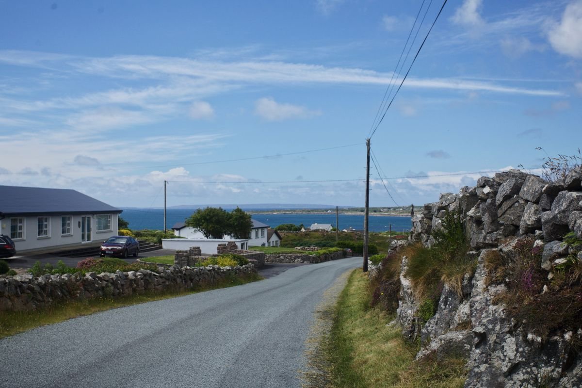
We did it by campervan in autumn, but a rental car works exactly the same on this route, and for a first trip to Ireland it’s the easier choice. Every town, road and viewpoint below is the same whether you’re sleeping in a van or checking into a B&B.
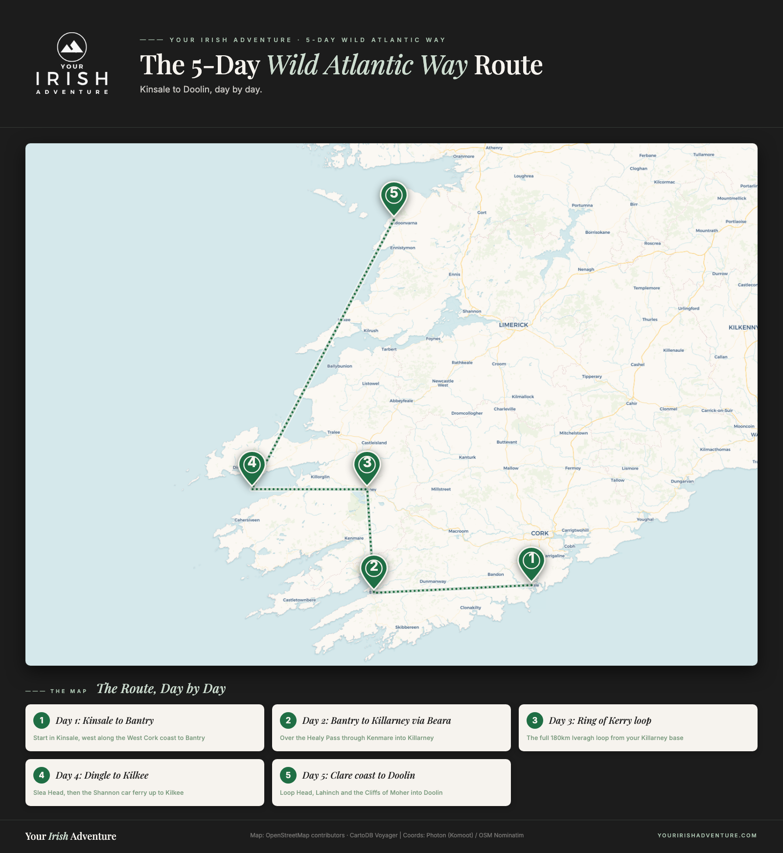
Below is the route day by day, from Kinsale to the Beara, around the Ring of Kerry, over to Dingle and up the Clare coast to Doolin. I’ve also added where we’d stay each night, and the stops I’d cut first if you’re short on time.
More Wild Atlantic Way Road Trip Guides
- Wild Atlantic Way Itinerary – Ireland’s Most Epic Road Trip
- 9 Best Places On The Wild Atlantic Way Route
- A Photographer’s Definitive Ireland Road Trip
Quick Answer:
This Wild Atlantic Way 5 day itinerary runs south to north, Kinsale in Cork to Doolin in Clare, one coastal drive with a set bed each night. Day 1 is West Cork, Day 2 the Beara and Killarney, Day 3 the Ring of Kerry, Day 4 Dingle and Slea Head, and Day 5 the Clare coast and Cliffs of Moher. You will need a rental car.
Day 1. Kinsale to Bantry via the West Cork Coast
A lot of visitors fly into Cork to start this drive, and Cork city is worth a day or two of its own if you can spare it. We couldn’t. On our last trip a storm pinned us down and we only managed a quick dinner at Le Bon Crubeen before pushing on, so Cork is on our list for next time.
For this itinerary, start in Kinsale, about 30 minutes south of Cork city. From there you’re following the West Cork coast west through Clonakilty and Skibbereen to Bantry, roughly a 2.5-hour drive if you drove it straight, but you won’t, because the stops below are the whole point of Day 1.
Explore Kinsale Town
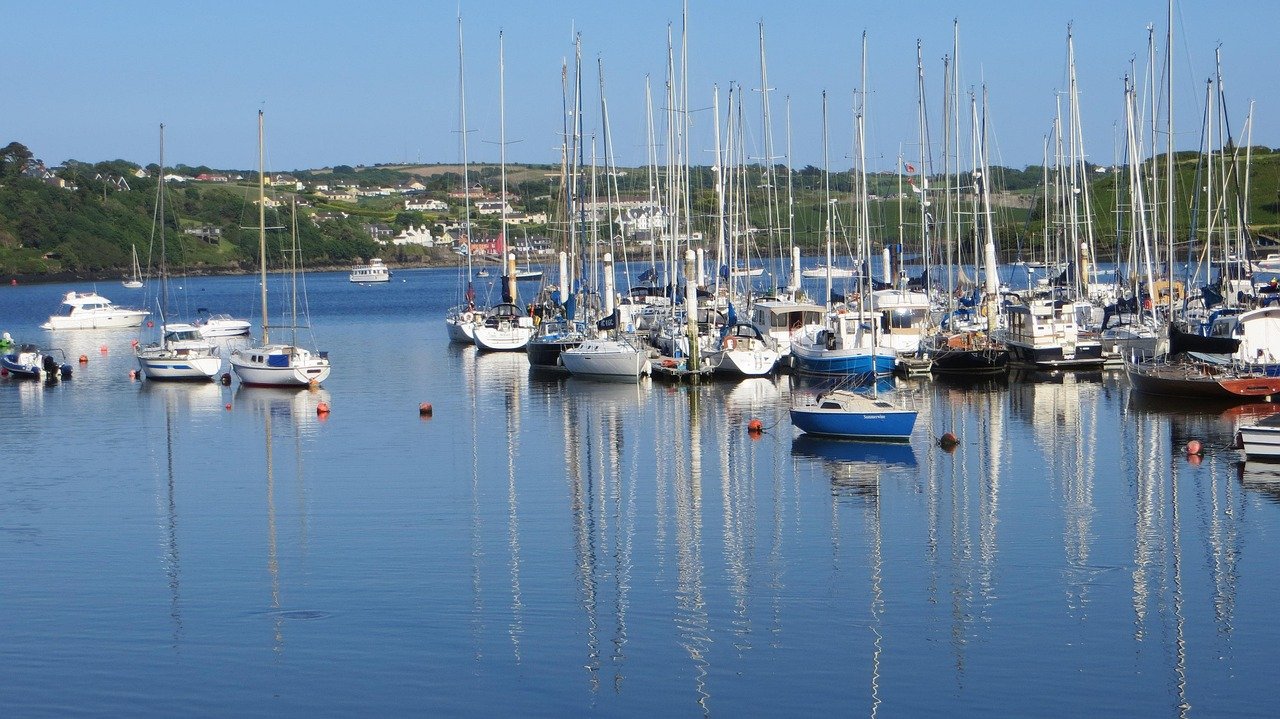
Kinsale is a colorful harbor town of narrow streets and painted shopfronts, and it has a reputation as the food capital of Ireland for good reason. Spend the morning wandering the town center, then head out to Charles Fort.
Charles Fort is a huge star-shaped fort from the 1600s sitting right on the water at Summercove. Entry is around €5 and it’s worth an hour to walk the walls and look back across the harbor.
Walk the Scilly Walk
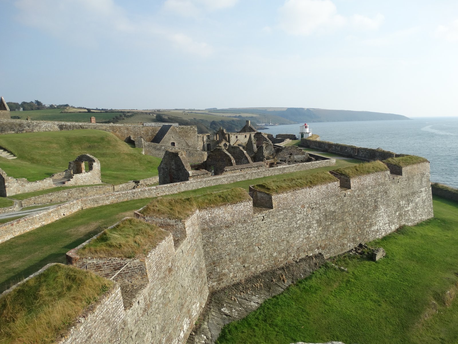
The Scilly Walk is the best way to get from Kinsale out to Charles Fort. It’s a wooded coastal path that hugs the shoreline through the Scilly neighborhood and on to Summercove, and you get water views most of the way.
Plan on about 30 to 40 minutes each way on foot. Do the walk out, tour the fort, then grab a pint at the pub in Summercove before heading back into town.
Swim at Inchydoney Beach
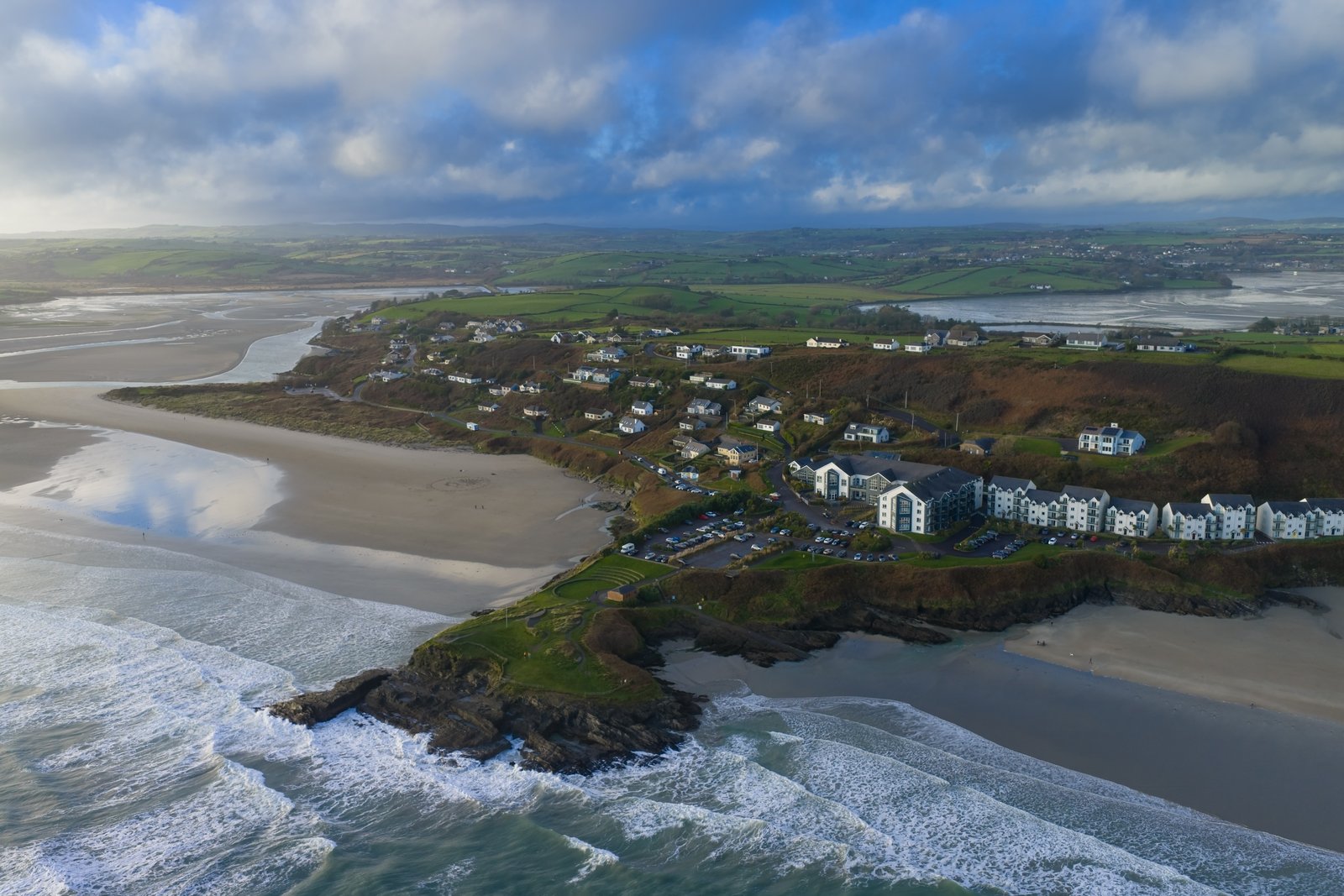
Leaving Kinsale, your next stop is Inchydoney Beach, just outside Clonakilty. It’s a wide blue-flag beach split by a headland, popular with surfers, and one of the best swimming beaches in West Cork.
The water is cold, so pack a towel and don’t overthink it. Even in autumn people are out in wetsuits. From here it’s about an hour on to Bantry, where you’ll spend the night.
Day 2. Bantry to Killarney via the Beara Peninsula
Day 2 takes you off the main tourist track and onto the Beara Peninsula, the wilder finger of land between the Ring of Kerry and West Cork. From Bantry it’s a short drive up to Glengarriff, then over the mountains and down to Kenmare before you finish the day in Killarney.
This is a shorter driving day on paper, but Beara rewards you for slowing down. Don’t try to loop the whole peninsula in one day. Take the Healy Pass shortcut across and save the full ring for a return trip.
Visit Glengarriff and Garinish Island
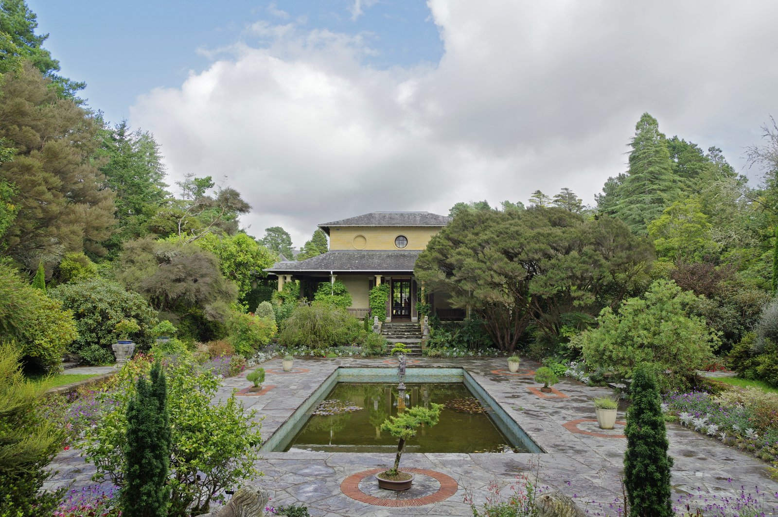
Glengarriff is a small village at the top of Bantry Bay and the jumping-off point for Garinish Island. The island, also called Ilnacullin, is known for its Italian-style gardens, and the boat ride out passes a colony of harbor seals hauled out on the rocks.
The ferry runs from the village pier and the crossing takes about 15 minutes. Budget a couple of hours for the boat and the gardens combined, and check the current ferry and garden admission prices before you go.
Drive the Healy Pass
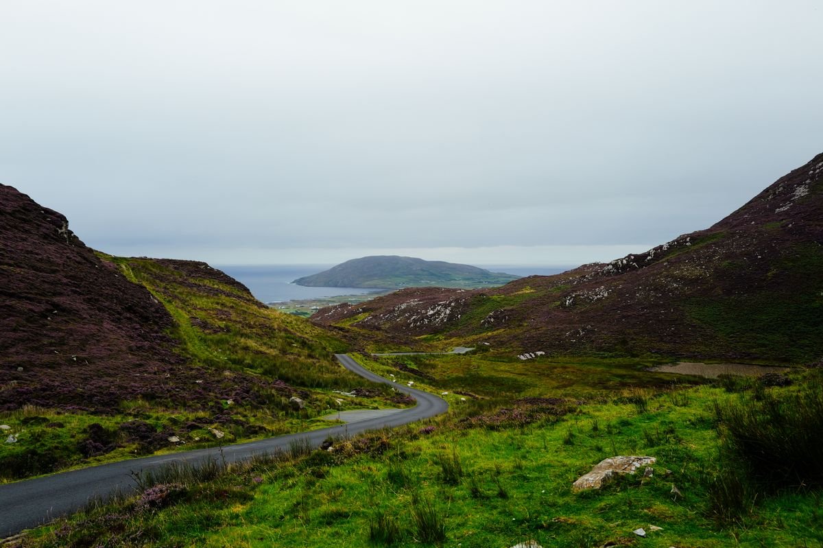
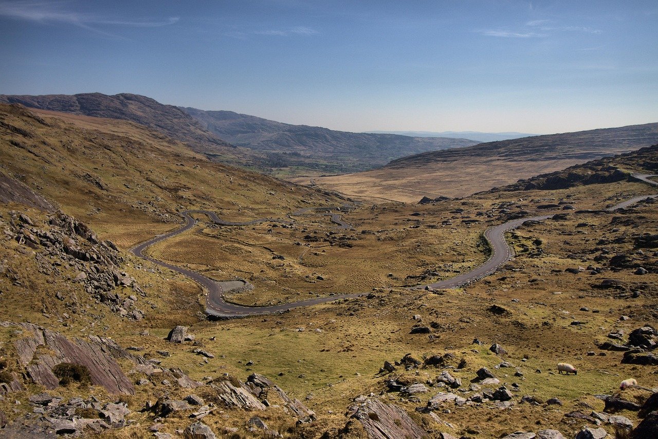
From Glengarriff, the Healy Pass is the way to cut across the spine of the Beara Peninsula into Kerry. It’s a narrow, twisting mountain road (the R574) that climbs through the Caha Mountains in a series of hairpins, with sheep on the road and long views back down both sides.
Take it slow, especially if you’re in a bigger vehicle, and pull in at the top to look back over the valley. It drops you down toward Lauragh, from where it’s an easy run along the water into Kenmare.
Stop in Kenmare
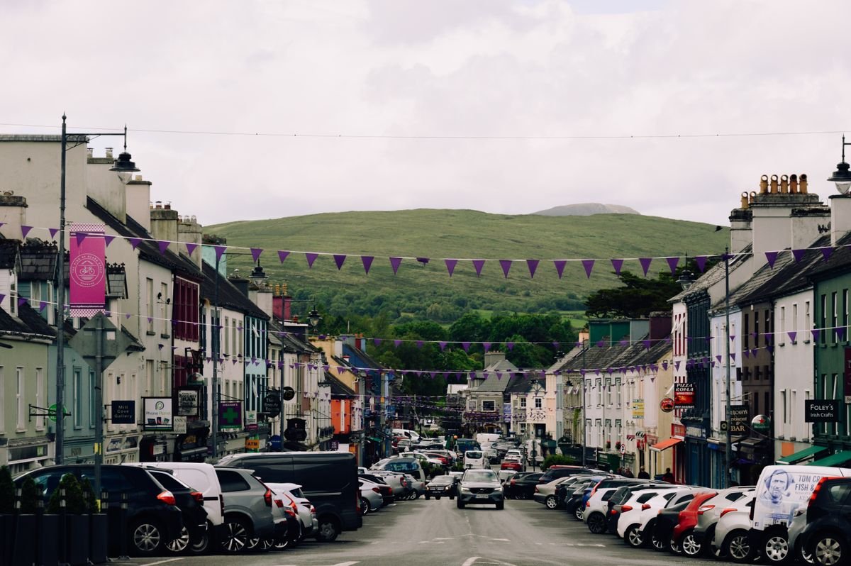
Kenmare is a colorful little town of painted shopfronts, and it’s a good spot to stretch your legs and grab a drink. We had a pint at O’Connor’s on our last trip. The main street leans a bit touristy in parts, with some gimmicky shops, but the real reason to stop is just off it.
The Kenmare Stone Circle is a Bronze Age ring of standing stones on the edge of town, free to visit, and easy to walk right past if you don’t know it’s there. We had it quiet and to ourselves in shoulder season. Give it half an hour, then push on the last stretch to Killarney.
We based ourselves in Killarney for two nights at Fleming’s White Bridge Caravan and Camping Park on the Muckross Road. We had it basically to ourselves in shoulder season and the owner was lovely. If you’re not camping, Killarney town has plenty of hotels and B&Bs, and it makes a great base for the next two days.
Day 3. Loop the Ring of Kerry from Killarney
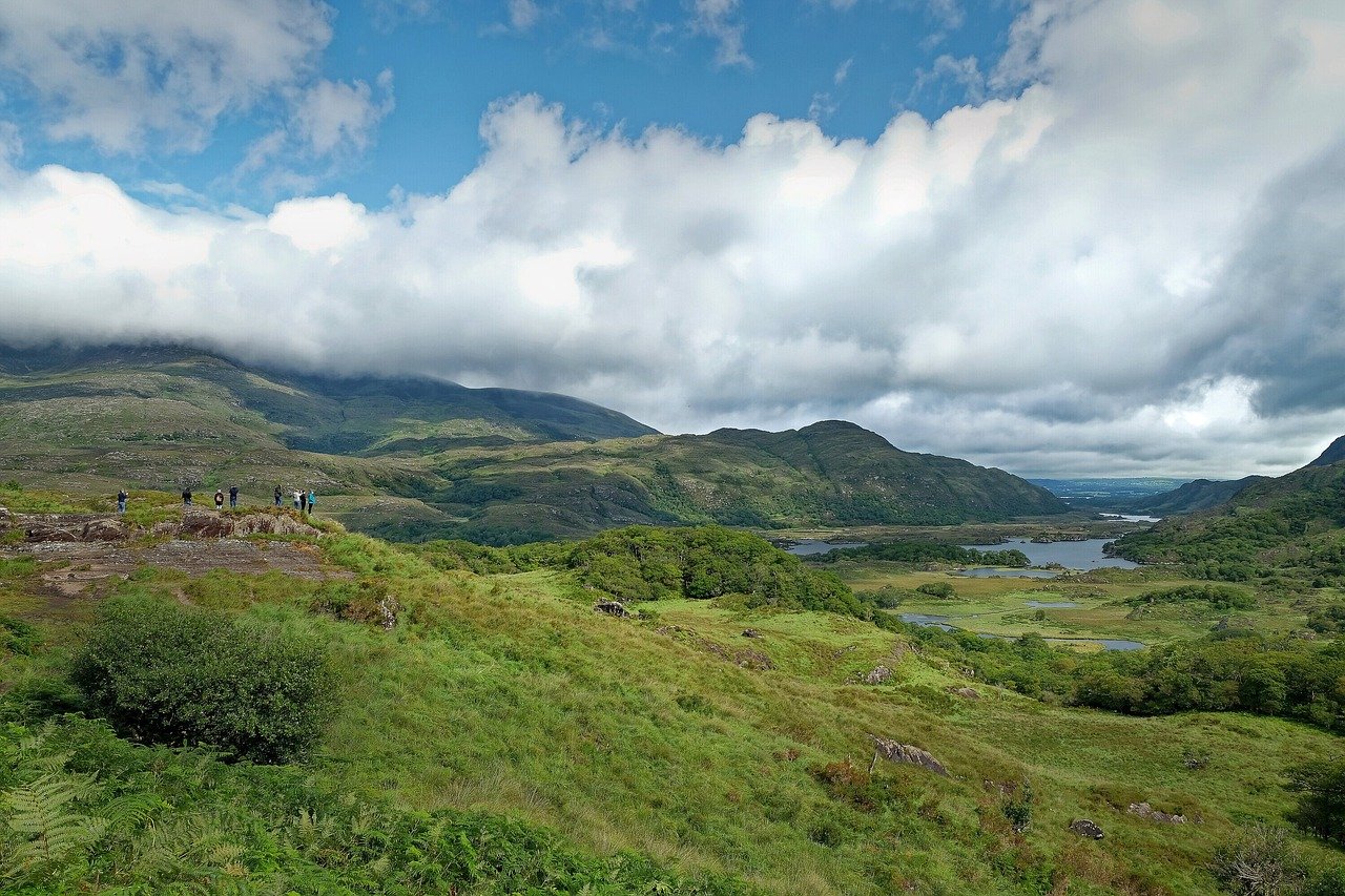
Day 3 is the big one, the full Ring of Kerry loop from your Killarney base and back. It’s about 180km around the Iveragh Peninsula, and you’ll want most of the day for it, so get an early start and pack food for the road.
We drove it on a Wednesday in early October, well into shoulder season, so the road was quiet. A named storm was rolling in behind us, which meant we pushed through rather than lingering at every viewpoint. That’s the one thing to watch on this loop: your day is only as good as the weather.
Drive the Main Ring Road
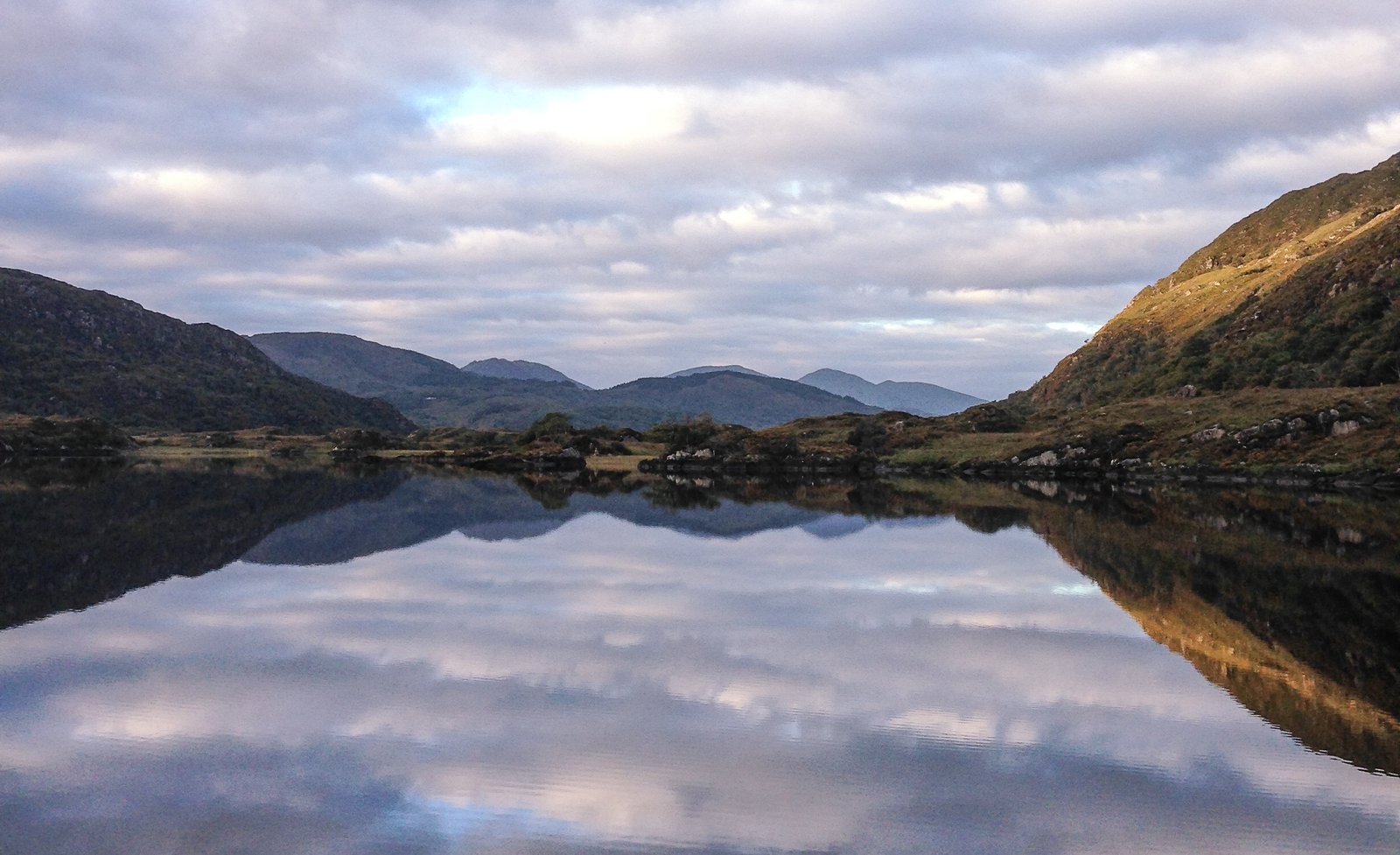
Take the N70 clockwise out of Killarney toward Kenmare. Clockwise is the standard direction here and it keeps you from meeting tour buses head-on, since the big coaches are required to run the other way.
From Kenmare the road runs along the water through Sneem and Waterville and up toward Cahersiveen before looping back. We had low cloud sitting on the hills most of the day, and I’ll be straight with you: the coastal viewpoints weren’t at their best.
In good sun this drive is one of the best in Ireland, so if you wake up to clear skies, stop at every pull-in you can. If you’d rather leave the driving to someone else for the day, you can book a Ring of Kerry day tour from Killarney on GetYourGuide and just watch the coast go by.
The stop I’d tell any first-timer to make is Staigue Fort. It’s an Iron Age dry-stone ring fort up a narrow boreen off the main road, and most cars drive straight past the turn. We turned up it and had one of the best-preserved ring forts in the country almost completely to ourselves.
Back in Killarney that evening we ate at Bombay Palace, which was a solid Indian feed after a long day in the car. Then it’s an early night, because Day 4 crosses to Dingle.
Detour the Skellig Ring
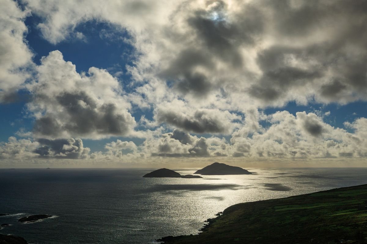
If you have the time and the weather, add the Skellig Ring. It’s a narrow loop that branches off the main route near Waterville and runs out past Portmagee and Ballinskelligs, and it takes in the coast that stares out at the Skellig islands.
The roads are tighter and less suited to big vehicles than the main N70, so take it slow. On a clear day you can see Skellig Michael offshore, the monastic island from the Star Wars films. Boat trips out to the island run from Portmagee in season and sell out fast, so book well ahead if that’s on your list.
We didn’t get to the Skellig Ring on our last trip because the storm cut our day short, so it’s near the top for next time. If you’re racing the clock or the forecast, this is the first thing I’d cut and save for a return trip.
Things to Do in the Towns Along This Route
- 21 Unique Things To Do in Kerry, Ireland – The Kingdom County
- 28 Unique Things To Do in Clare: Ireland’s Foodie Trail
- 15 Best Things To Do in Doolin, Ireland
Day 4. Killarney to Kilkee via Dingle
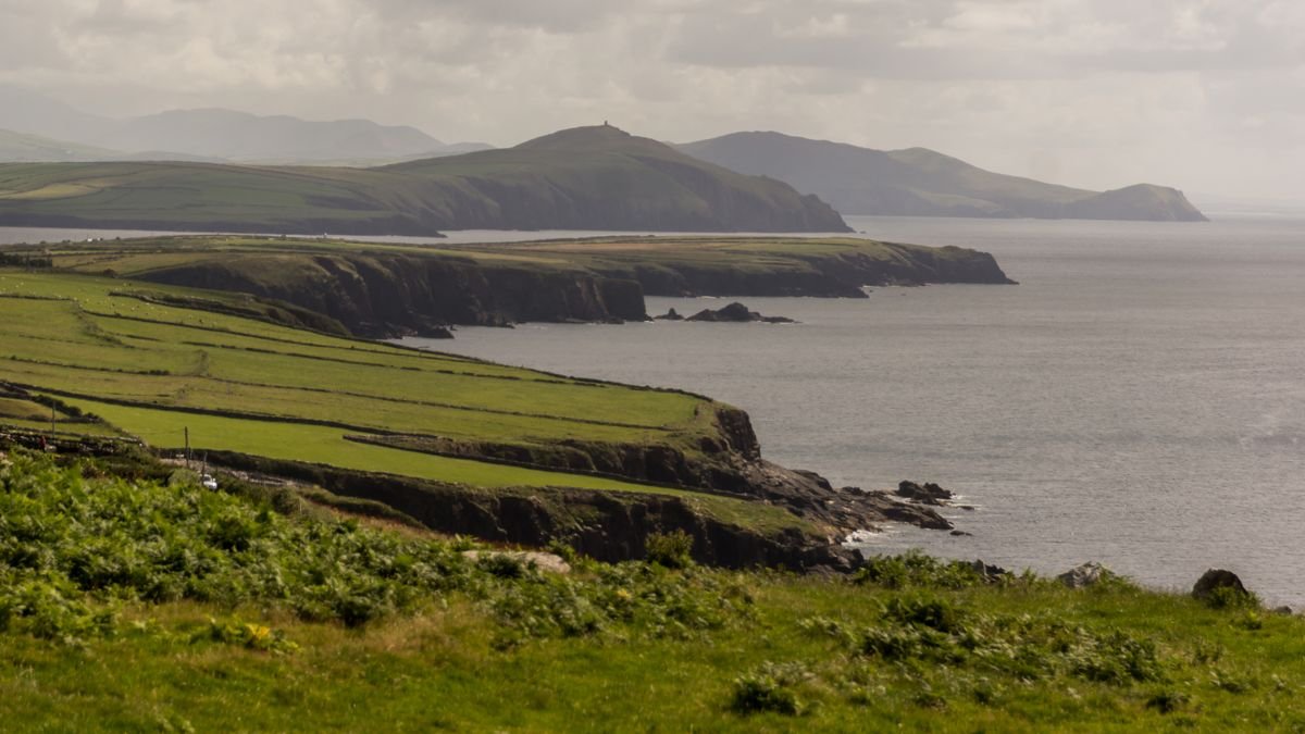
Day 4 leaves Killarney behind and heads for the Dingle Peninsula, then carries on north across the Shannon to Kilkee in County Clare. It’s about two hours from Killarney to Dingle town, then another few hours up the coast once you factor in the ferry.
I’ll give you the honest version of our day here. We arrived in Dingle in heavy rain with work still to do, so we only saw the town at night and never drove Slea Head in daylight. That’s the biggest regret of our last trip, and the reason I’d tell you to give Dingle more time than we did.
Stop at Inch Beach
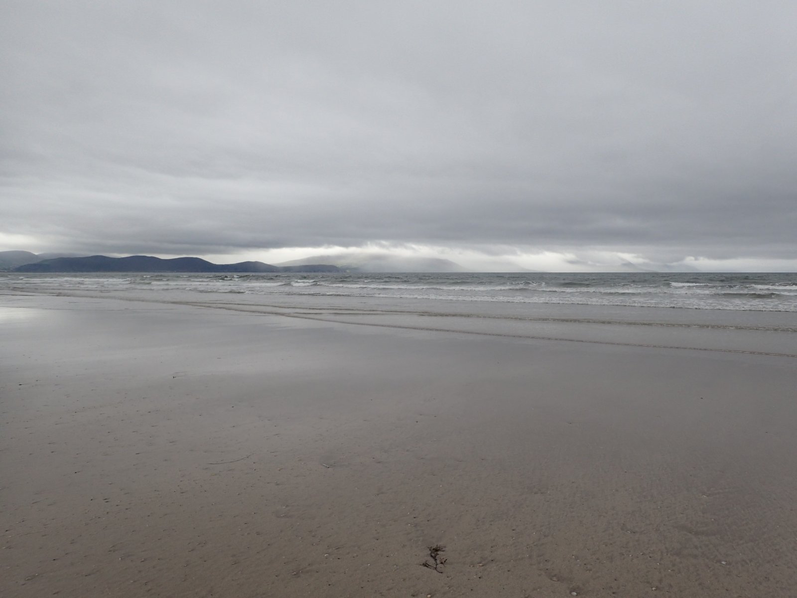
On the road into the Dingle Peninsula you’ll pass Inch Beach, a long spit of sand that runs out into Dingle Bay. It’s a popular surf and swimming spot with a cafe right by the parking lot, and it’s an easy place to stretch your legs before the town.
If the weather’s with you, walk out along the sand. We drove this stretch in the rain and pushed straight through, and it’s one stop I’d tell you not to skip if the sun’s out.
Explore Dingle Town
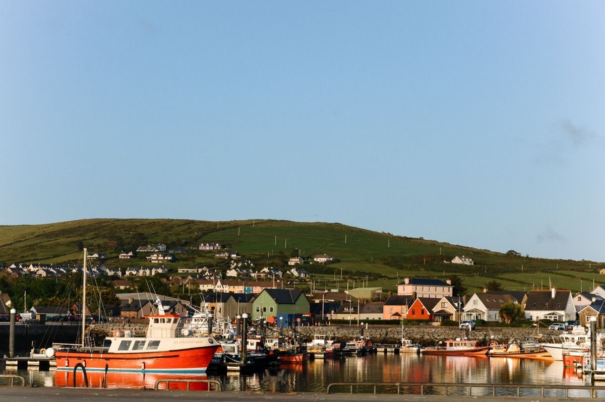
Dingle is a working harbor town with real character, and it comes alive in the pubs at night. The one you have to do is Foxy John’s, a hardware shop by day that turns into a pub after dark. You order a pint at the back next to the shelves of tools, and on our night there a duo was mid-session on guitar and tin whistle.
We parked the van at the Rainbow Hostel just outside town, which lets campervans use their lot, and took a 10-minute taxi in for the evening. If you’re not in a van, book a B&B or guesthouse in town and stay two nights if you can. Dingle deserves it.
Drive the Slea Head Loop
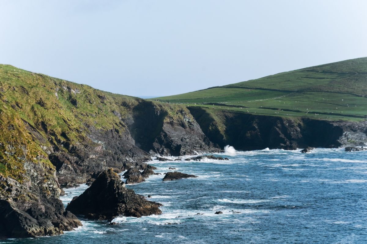
The Slea Head Drive is the loop out of Dingle town around the western tip of the peninsula, and it’s the main reason to come here. It runs past ancient beehive huts, sea cliffs and beaches, with the Blasket Islands offshore, and it’s one of the best coastal drives in the country.
We only drove it in the dark, so I can’t give you my own verdict on the views, and that stings. Do it in daylight, take your time, and it’ll be the highlight of your day. It’s a narrow one-way loop in places, so drive it clockwise and go slow. If you want the local context on the beehive huts and farms out this way, you can book a Dingle Peninsula tour on GetYourGuide.
Take the Shannon Car Ferry
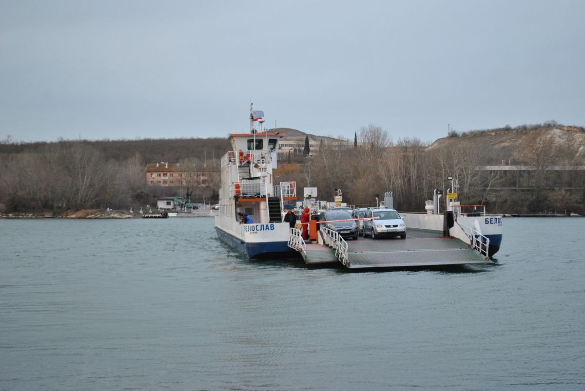
To get from Dingle up to Kilkee you have two choices: drive the long way around through Limerick, or take the Shannon car ferry and cut a big chunk off the trip. Take the ferry.
It runs between Tarbert on the Kerry side and Killimer in Clare, the crossing takes about 20 minutes, and you stay in your car. Check the current sailing times and fare before you set off, then it’s a short drive on to Kilkee for the night, ready for the Clare coast in the morning.
Day 5. The Clare Coast to Doolin
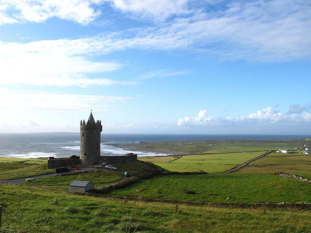
Day 5 is the last leg, up the Clare coast from Kilkee to Doolin, and it saves two of the best cliffs in Ireland for the finish. It’s a short drive on the map, but between Loop Head, a lunch stop and the Cliffs of Moher you’ll want the whole day for it.
Doolin is where you’ll end up, a tiny village that’s the trad music hub of Clare and where the Aran Islands boats leave from. Sort your bed there first, then work your way up the coast.
Drive Out to Loop Head Lighthouse
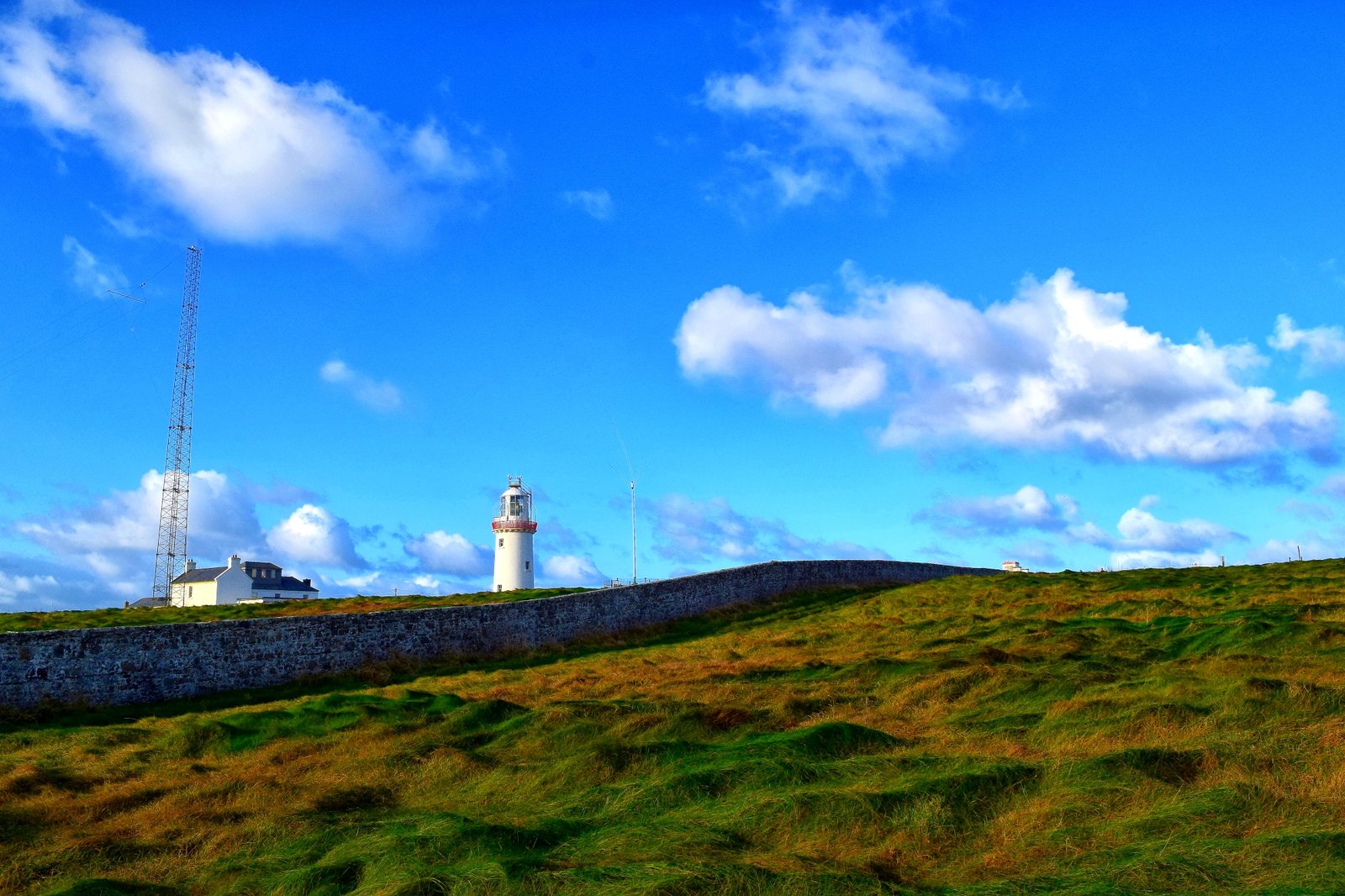
Start with Loop Head, out at the very tip of the peninsula past Kilkee. This was the biggest surprise of our last trip. We walked the clifftop path toward the lighthouse with almost nobody else around, and it gave us some of the best photos of the whole two weeks.
The cliffs here are sheer black rock dropping straight into the Atlantic, with sea stacks off the point. I lay flat on the clifftop grass and looked over the edge, which is not for everyone, but the drop is a real one.
There are no facilities out here, so bring water or a thermos. A car is essential, there’s no bus, and the roads are narrow, so take it slow if you’re in anything big.
Stop for Lunch in Lahinch
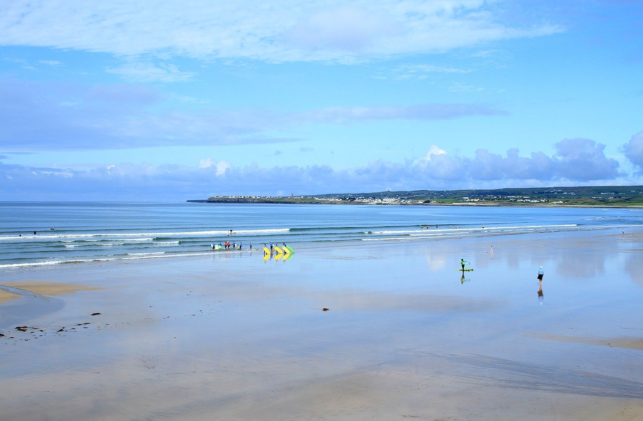
Heading north up the coast, Lahinch is the natural spot to break for lunch. It’s a surf town with a wide beach, a proper break that draws surfers year round, and a strip of cafes, pubs and chippers along the front.
Grab a bite, walk the promenade, and watch the surfers if the swell’s up. From here the Cliffs of Moher are only about 15 minutes further on, so it’s an easy afternoon into the last big stop.
See the Cliffs of Moher
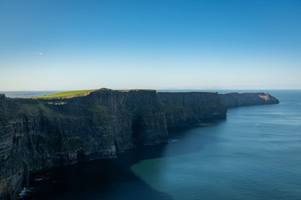
The Cliffs of Moher are the headline attraction of the Clare coast, and there are two ways to see them. The busy way is to park at the visitor center and walk the fenced viewing area. We’d point you to the other way instead.
We hiked the coastal path up from Doolin, a narrow trail hugging the cliffside with a sheer drop to the ocean on one side and cows grazing on the farmland on the other. It’s more effort and it thins out the crowds. We did about two hours return. For a different angle on the cliffs, you can book the Cliffs of Moher boat tour from Doolin on GetYourGuide and see the full height of them from the water.
We had it overcast, which was moody over the cliffs but not ideal for photos, and it’s the reason Loop Head edged them out for us that day. The scale of the place in person still lands. Dress in layers and expect wind even on a calm day.
We camped at Nagle’s Camping and Caravan Park in Doolin, walking distance to the Cliffs trailhead and the pubs. If you’re not in a van, Doolin’s B&Bs book up fast in season, so book early. Gus O’Connor’s has poured pints since 1832, and it’s the right place to end this drive over fish, chips and mussels.
Where to Stay Along the Route Each Night
Here’s the quick version of where to sleep each night on this Wild Atlantic Way 5 day itinerary. We did the whole route by campervan and named our actual campsites back in the day sections, but every one of these towns has B&Bs, guesthouses and hotels that put you in exactly the same spot.
Night 1, Bantry: Seafort Luxury Hideaway
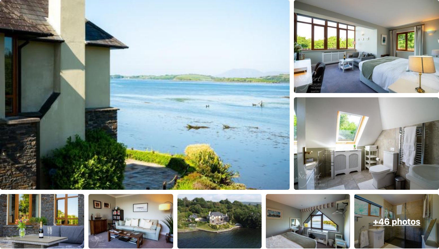
Seafort Luxury Hideaway sits over Bantry Bay at the head of the harbor, which is exactly where you want to be on Night 1. Bantry is a small harbor town with plenty of B&Bs and guesthouses, and it puts you close to the Beara for an early start on Day 2.
It scores 9.8 from more than 180 guest reviews, with water views from the rooms and a quiet spot just outside the town center. Book it for the first night so the drive down to Bantry has a bed waiting at the end of it.
👉 View Seafort Luxury Hideaway Availability and Pricing
Nights 2 and 3, Killarney: Gormans Country Home
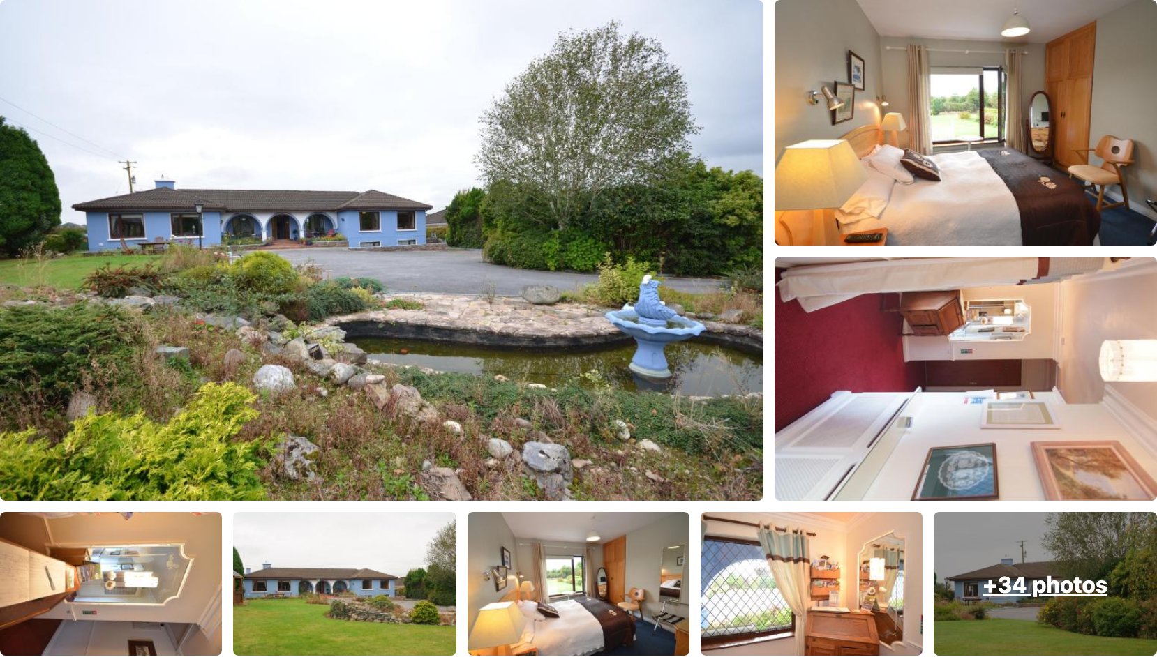
Gormans Country Home is a good base for the two nights you spend in Killarney, the best hub on this trip. The town is walkable, the food and pubs are good, and you can reach both the Ring of Kerry and Dingle from here, so unpacking once in the middle of the route takes the pressure off the two biggest driving days.
It sits on the Tralee Road just outside the center and scores 9.1 from over 120 reviews. Two nights here is the one place on the route we’d book for a double stay.
👉 View Gormans Country Home Availability and Pricing
Night 4, Kilkee: Sycamore Lodge

Sycamore Lodge is a guesthouse just outside Kilkee, the small seaside town in County Clare where you land after the Shannon ferry. It’s quiet in shoulder season and well placed for Loop Head first thing on Day 5.
It scores 9.7 from more than 180 reviews, with a big breakfast and rooms set back in the countryside. A solid stop for the night before the run up to Doolin.
👉 View Sycamore Lodge Availability and Pricing
Night 5, Doolin: Mountain Aven Guest House
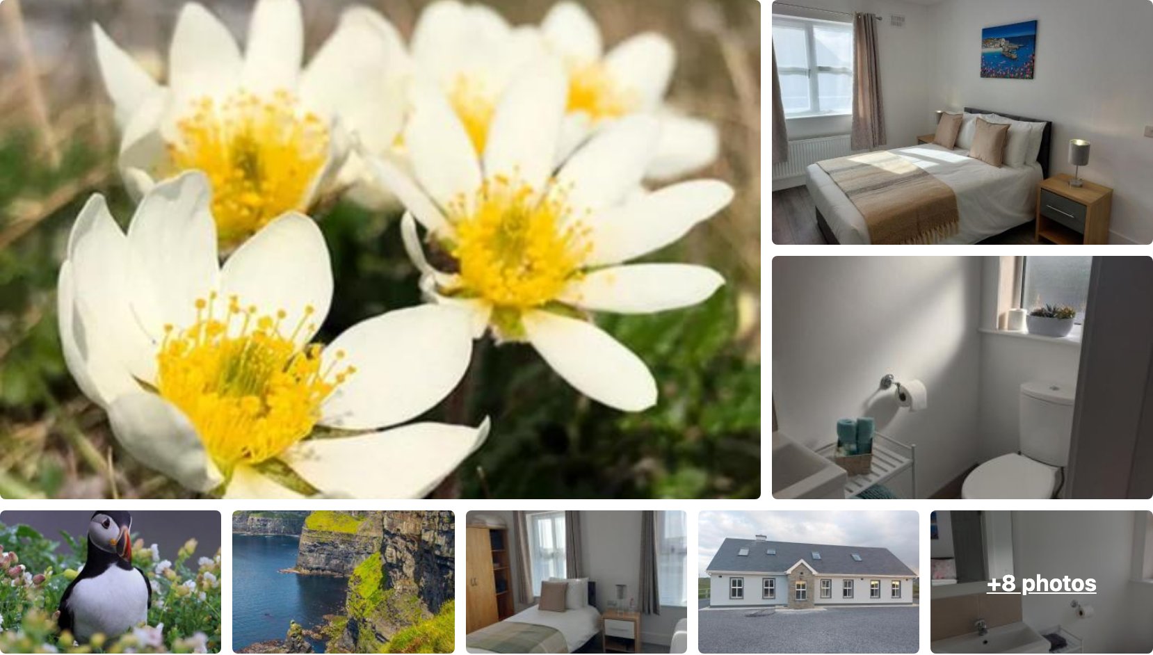
Mountain Aven Guest House is our pick for the last night in Doolin. The village is tiny and it books up fast in season, so lock in your bed here before anything else on the route.
It scores 9.6 from over 1,100 reviews, which is a lot of feedback for a village this size, and it’s walking distance to the pubs and the Cliffs trailhead. Book it early and the rest of the route stays flexible.
👉 View Mountain Aven Guest House Availability and Pricing
One planning note: base yourself in Killarney for two nights rather than moving hotels every single day. Unpacking once in the middle of the trip takes the pressure off the two biggest driving days, the Ring of Kerry and the run to Dingle.
If you have a bigger vehicle, factor in parking. Town centers like Killarney and Dingle are tight, so we tended to stay just outside and taxi in for the evening. Check current rates and book Doolin early, and the rest of the route has enough beds that you can stay flexible.
Where to Stay Along the Wild Atlantic Way
- Where To Stay in Killarney: Best Areas and Accommodations
- 7 Best Places to Stay in Dingle, Ireland
- Where to Stay in Doolin: Best Areas & Hotels
- Where To Stay in Cork: Best Areas and Accommodations
Best Tours Along the Wild Atlantic Way
You can drive this whole route yourself, but a few stretches are better handed to someone who knows the road. If you’d rather not fight for parking on the Ring of Kerry or you want to get out on the water at the Cliffs of Moher, these are the tours we’d book. Most run from Killarney, Dingle or Doolin, so they slot straight into the days above.
Ring of Kerry Full-Day Tour from Killarney
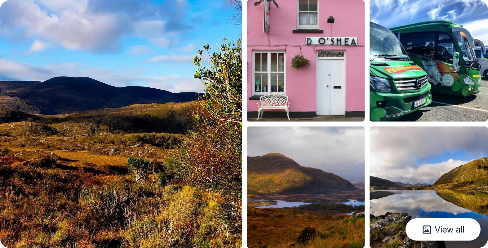
This is the full 180km loop done as a day trip out of Killarney, so you get the coastal views and the mountain passes without driving the narrow bits yourself. It runs about eight hours with stops at Killorglin, Sneem and the Kerry viewpoints, which is exactly the Day 3 loop above if you’d rather leave the car at the hotel.
👉 Check Ring of Kerry Full-Day Tour Availability and Reviews
Gap of Dunloe Walking and Boat Tour from Killarney
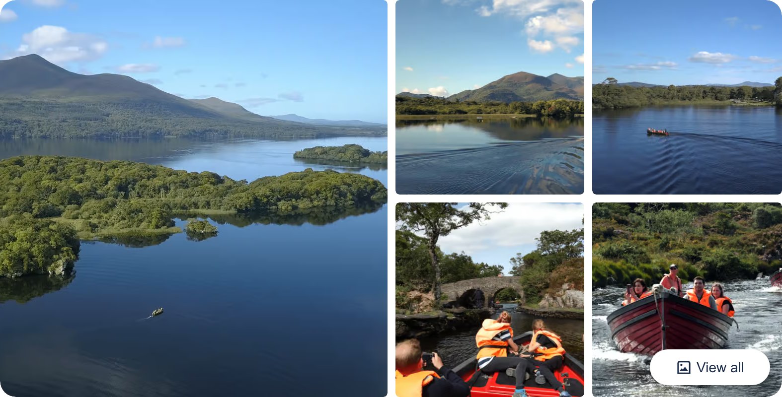
If you’ve built in a spare day around Killarney, this pairs a walk through the Gap of Dunloe with an open boat trip across the three lakes of Killarney National Park. It’s a half to full day depending on the option, and you finish back in Killarney, so it fits neatly on either of your two nights in town.
👉 See what’s included on the Gap of Dunloe Tour
Dingle Sheepdog Show, Beehive Huts and Petting Farm Tour
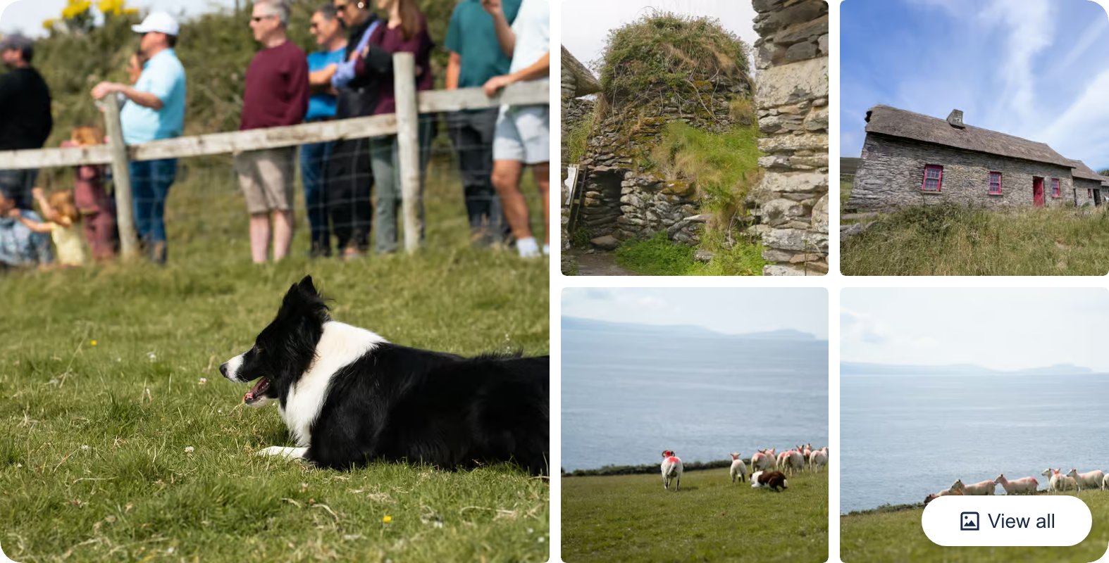
A private stop out on the Slea Head Loop that works a working sheepdog demonstration, the ancient beehive huts and a small petting farm into one visit. It’s a good add-on for Day 4 in Dingle, especially with kids, and it puts you at two of the Slea Head sights we mention above without hunting for them yourself.
👉 Check dates and prices for the Dingle Sheepdog and Beehive Huts Tour
Cliffs of Moher Boat Tour from Doolin
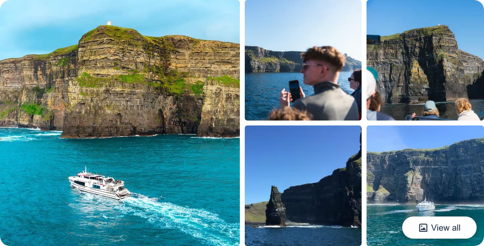
You see the Cliffs of Moher from the clifftop on Day 5, but the view from the water below is the one people remember. This is a roughly one-hour boat trip out of Doolin pier that runs along the base of the cliffs past An Branán Mór sea stack, and it’s the easiest way to add a different angle to your last day.
👉 Check Cliffs of Moher Boat Tour Availability and Reviews
Inisheer Day Trip from Doolin
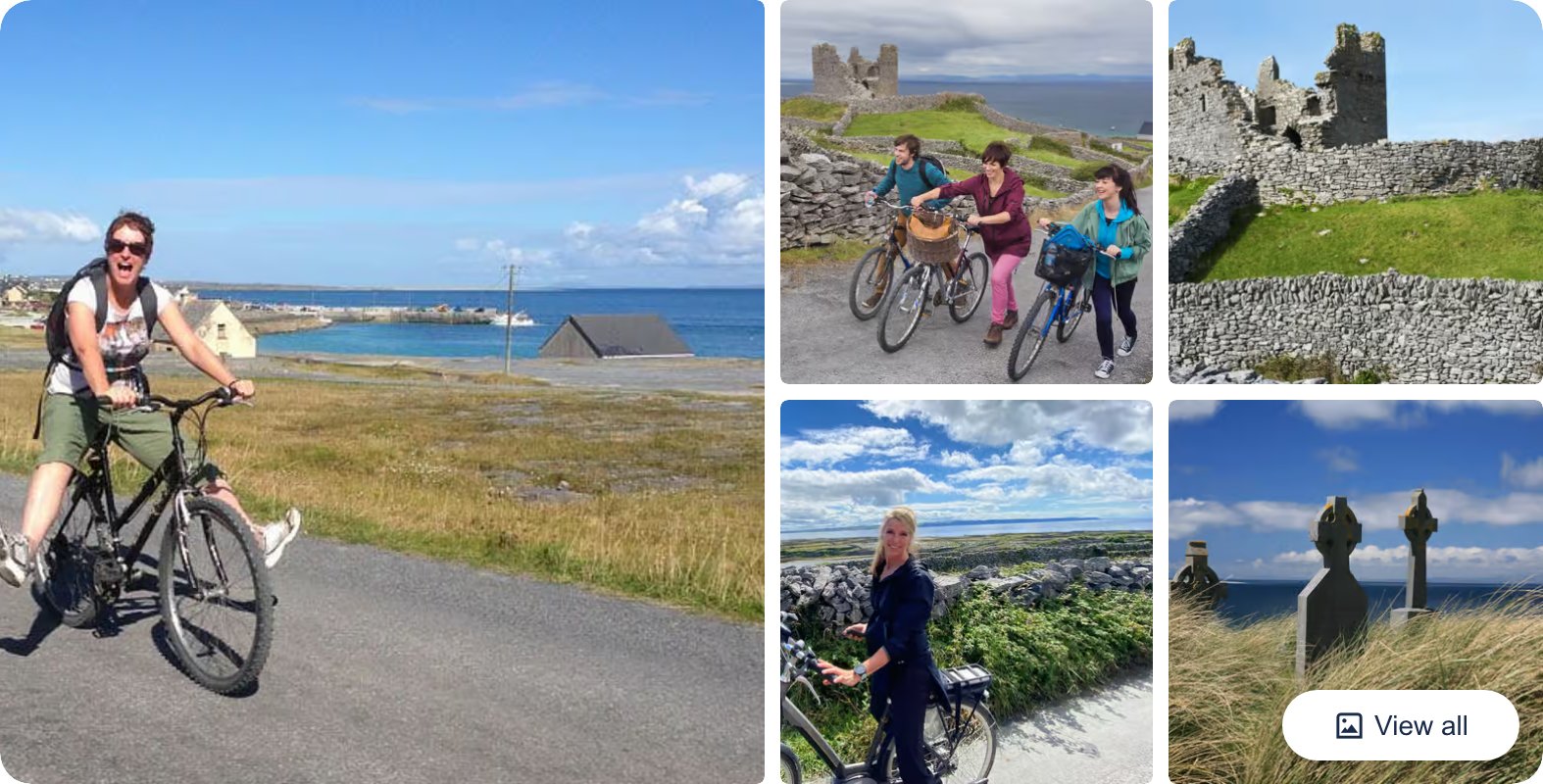
If you’ve got a sixth day and you’re basing yourself in Doolin, the ferry across to Inisheer is worth it. This trip covers the return crossing plus a bike or tractor tour of the smallest Aran Island, taking in O’Brien’s Castle, the stone walls and the Plassey shipwreck. It’s a good way to end the route out on the islands rather than back in the car.
👉 See what’s included on the Inisheer Day Trip
Wild Atlantic Way 5 Day Itinerary Questions Answered
A few things come up again and again when people plan this drive, so here are the straight answers before you go.
Whenever you go, your days live and die by the weather. The coastal viewpoints need sun to be worth stopping for, so build in a bit of slack and don’t lock every hour. And before you land, it’s worth a minute to compare car hire deals on Discover Cars, because the good ones sell out in season.
How much driving is this each day?
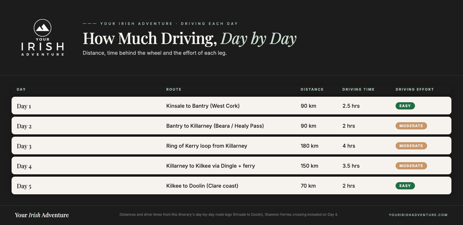
Most days are two to four hours of actual driving, but you’ll be out the whole day once you add the stops. The Ring of Kerry loop is the longest single stretch at around 180km, and the run to Dingle feels long because of the ferry. None of it is a slog if you start early.
Do I really need a car?
Yes. This route runs on tiny coastal roads with almost no public transport, and half the best stops (Loop Head, Staigue Fort, the Healy Pass) have no bus at all. Rent a car or a campervan and book it early, because the good ones sell out in season.
When is the best time to drive it?
We drove it in autumn, well into shoulder season, and the quiet roads and empty campsites made it easier. Late spring and early autumn hit the sweet spot: fewer crowds, better odds of a bed, and the towns still open.
Can I do this route in reverse, Doolin to Kinsale?
You can, and it works the same. We wrote it north from Kinsale so you finish on the Cliffs of Moher and Doolin’s pubs, which is a strong ending. If you’re flying into Shannon rather than Cork, flip it and run the days backward.
What if I have more than five days?
Add a day in Cork city at the start, and give Dingle a second night so you can drive Slea Head properly. With a week you could also add Galway and Connemara north of Doolin, which is where we’d keep going if you have the time.
In short
- Drive south to north, Kinsale in Cork to Doolin in Clare, so you never backtrack
- Five days: West Cork, the Beara, Ring of Kerry, Dingle and the Clare coast
- You need a rental car; public transport does not cover these coastal roads
- Base each night in Bantry, Killarney (two nights), Kilkee and Doolin
- Go late spring or early autumn for quieter roads and better odds of a bed
Final Thoughts on This 5-Day Route
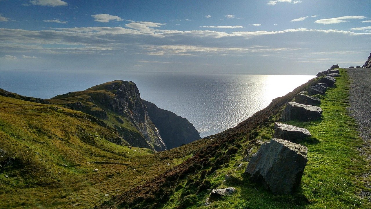
Five days from Kinsale to Doolin gets you the best of the southwest coast without the whole trip turning into a car seat. West Cork, the Beara, the Ring of Kerry, Dingle and the Clare cliffs, all in one clean run north.
The one thing I’d say again: don’t try to catch every stop. The trips that go wrong here are the ones where people chase every peninsula and every viewpoint and spend the week exhausted. Pick your days, start early, and leave the rest for next time.
We came away with a short list of regrets, and they’re the useful kind. We’d give Dingle two nights instead of racing through it in the rain, and we’d hold out for a clear day on the Ring of Kerry. Loop Head we’d do exactly the same, and it turned out to be the surprise of the whole two weeks.
If this is your first time in Ireland and you’ve got roughly a week, this is the drive I’d point you to. Rent the car, book your beds in Killarney and Doolin early, and keep an eye on the forecast. Do that and five days on this coast is hard to beat.
Like it? Pin it!
Save this guide for later