Ireland is split into 32 counties across four provinces, and if you’re planning a trip you’ll hear those county names constantly, from Cork to Donegal to Clare. Knowing how the counties of Ireland actually fit together makes the whole country a lot easier to plan around.
We’ve driven a big chunk of it. On our last trip we went Dublin to Cork over about two weeks, and even then we only really scratched a handful of counties properly. That’s the honest reality: nobody sees all 32 in one go, and trying to would be a mistake.
So this is a reference guide, not an itinerary. It’s the thing to skim when you’re working out where Kilkenny sits, why six counties up north are a separate jurisdiction, or which region is worth your week.
Below I’ll run through all four provinces county by county, explain how the 32 counties and 4 provinces split works, and give you the practical stuff on renting a car and picking one region per trip instead of racing the whole island.
More Ways to Explore Ireland’s Towns and Regions
- The Prettiest Small Towns in Ireland
- The Most Beautiful Towns In Ireland You Need To Visit
- Scenic Towns and Villages in Ireland: 18 Best Picks
- 15 Best Seaside Towns in Ireland To Visit This Summer
Quick Answer:
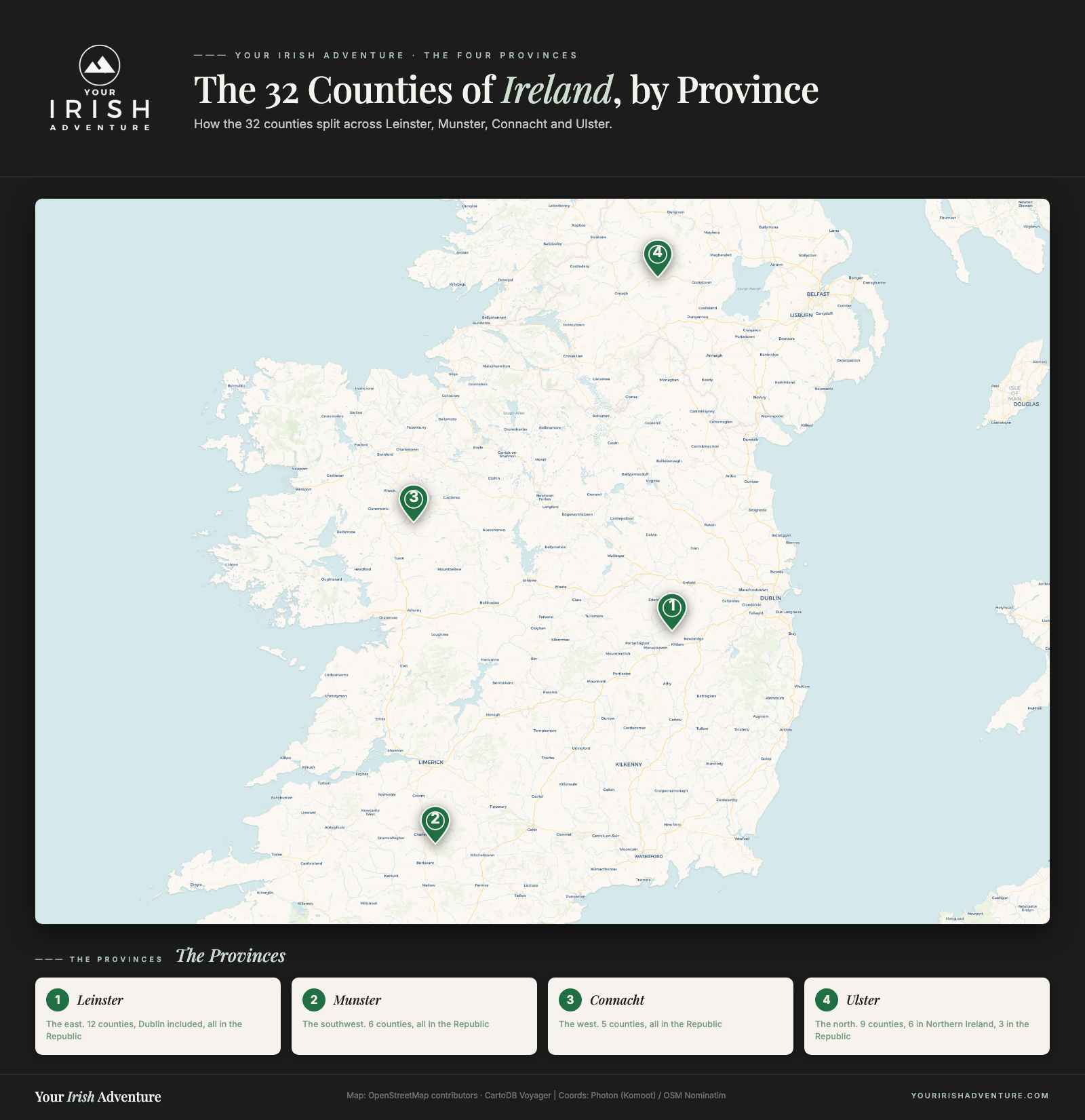
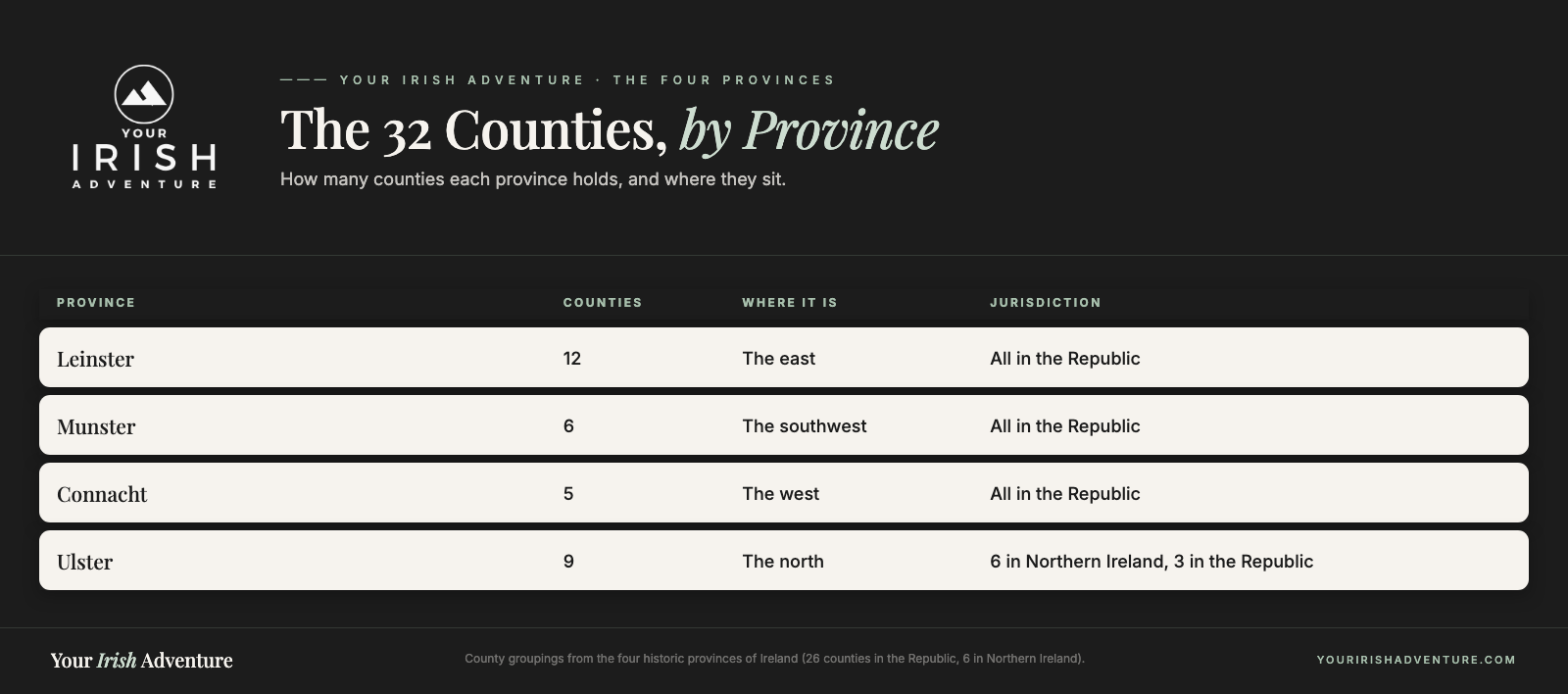
The counties of Ireland number 32, grouped into four historic provinces: Leinster in the east, Munster in the southwest, Connacht in the west, and Ulster in the north. Twenty-six sit in the Republic and six in Northern Ireland, part of the UK. The provinces aren’t administrative units now, but they’re still how any county gets placed.
Leinster
Leinster is the eastern province and the one most visitors land in first, because Dublin is here. It’s twelve counties running from the capital down the coast to Wexford and inland across the flat midlands. If you fly in, this is where your trip begins.
County Dublin
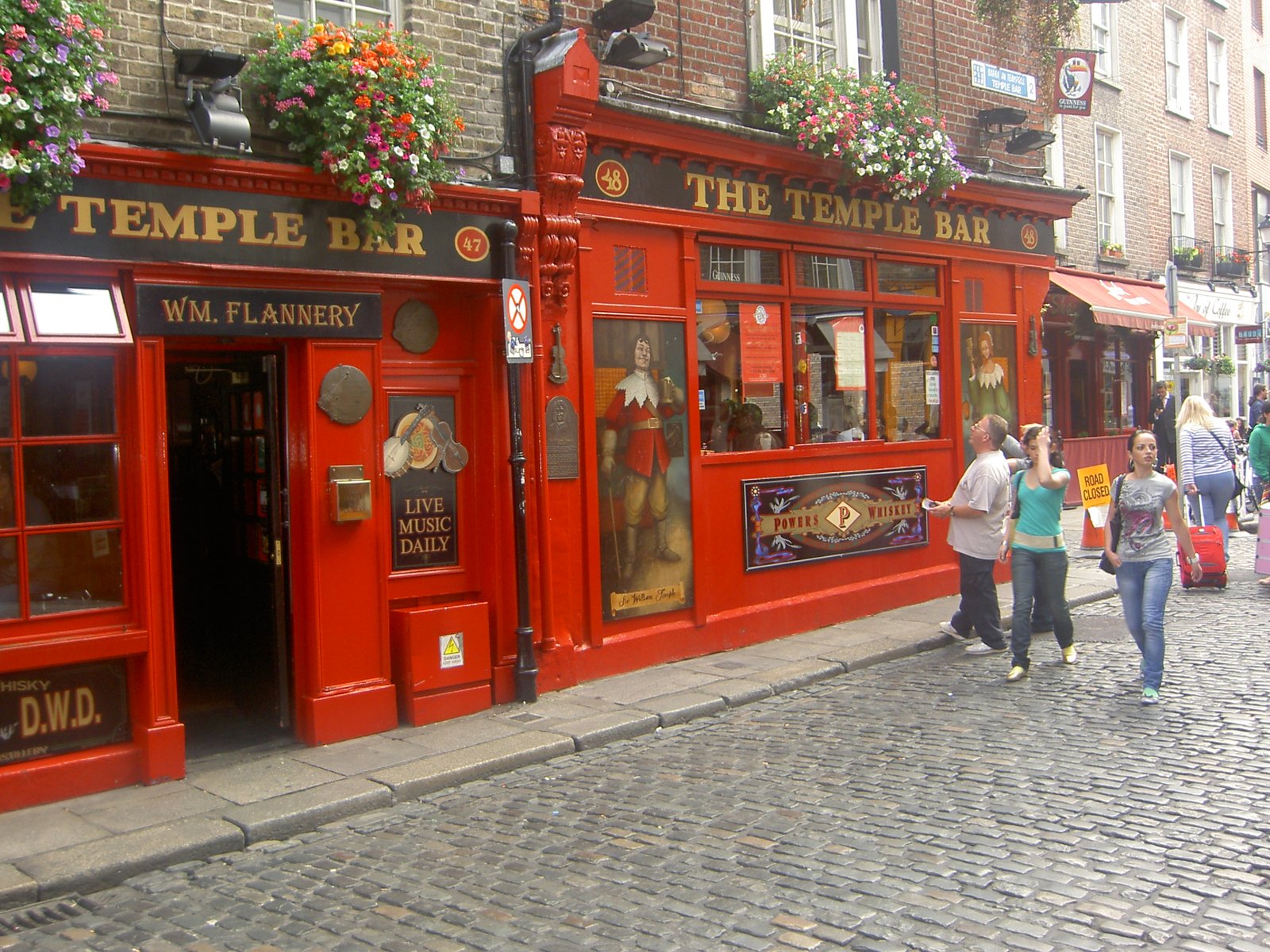
Most trips start here, and ours did too. We dropped our bags at Fitzsimons Hotel in Temple Bar and walked straight into Darkey Kelly’s on Fishamble Street for our first pints. The Jameson Distillery tour on Bow Street is worth every euro.
Where to Stay in Dublin
County Wicklow
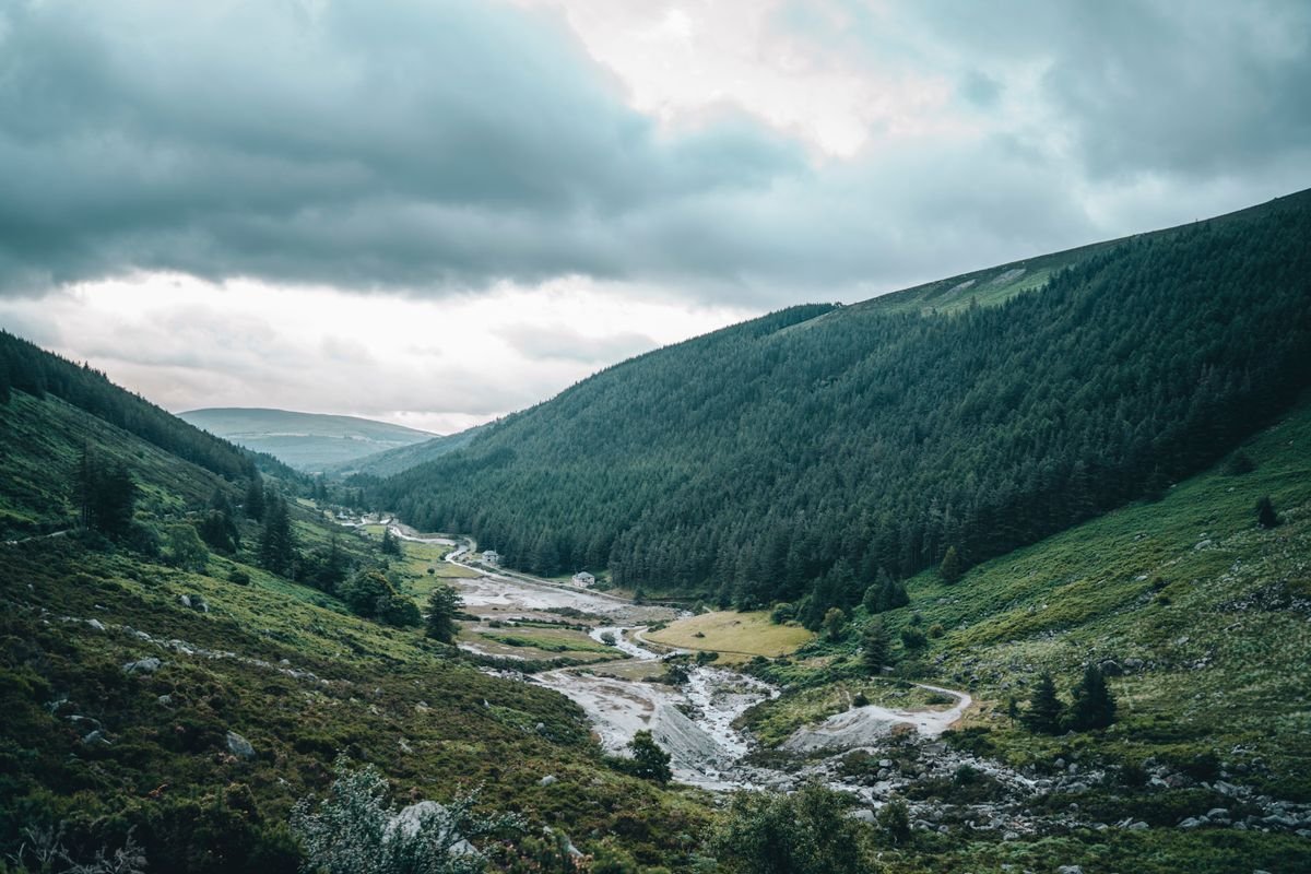
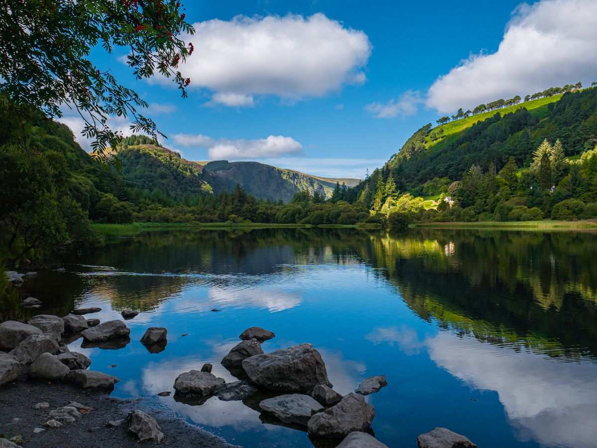
Just south of Dublin, this is the mountain county. Glendalough‘s monastic ruins sit beside two dark lakes, and the whole Wicklow Mountains area is the easiest wild scenery you’ll reach from the capital.
County Wexford
Down in the sunny southeast corner, Wexford is all long sandy beaches and Hook Head, where one of the oldest working lighthouses in the world still runs today.
County Carlow
One of the smallest counties, and easy to drive through without stopping. The reason to stop is the Brownshill Dolmen, a Neolithic tomb whose capstone is one of the heaviest in Europe.
County Kildare
This is horse country. The Irish National Stud and the flat plains of the Curragh make Kildare the center of Irish racing, all within easy reach of Dublin.
County Meath
Meath holds some of the oldest history in the country. Newgrange in the Boyne Valley is a passage tomb older than the pyramids, and the Hill of Tara was the seat of the ancient High Kings.
County Louth
Ireland’s smallest county still fits in the Cooley Peninsula and the medieval village of Carlingford, which sits on a lough right up against the Northern Ireland border.
County Longford
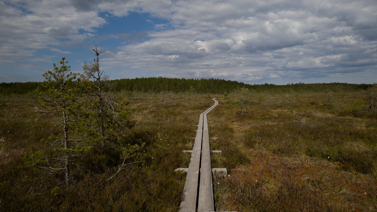
Longford is a county you drive through rather than to, and that’s fine. The one thing worth pulling over for is the Corlea Trackway, an Iron Age wooden road lifted out of the bog and now kept under cover.
County Westmeath
Athlone is the anchor here, sitting on the Shannon with a castle right on the river. Give the county an afternoon and spend it at Belvedere House and its walled gardens.
County Offaly
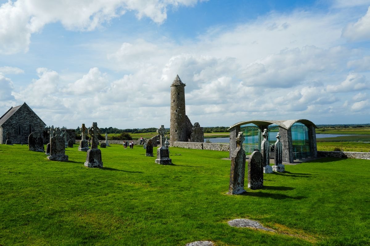
Offaly’s big draw is Clonmacnoise, a monastic site on the banks of the Shannon and one of the most important early Christian ruins in the country. The Slieve Bloom Mountains run along its western side.
County Laois
Pronounced “leesh” and easy to get wrong. The Rock of Dunamase, a ruined hilltop fortress, is the county’s landmark, with the Slieve Bloom walking trails shared with Offaly next door.
County Kilkenny
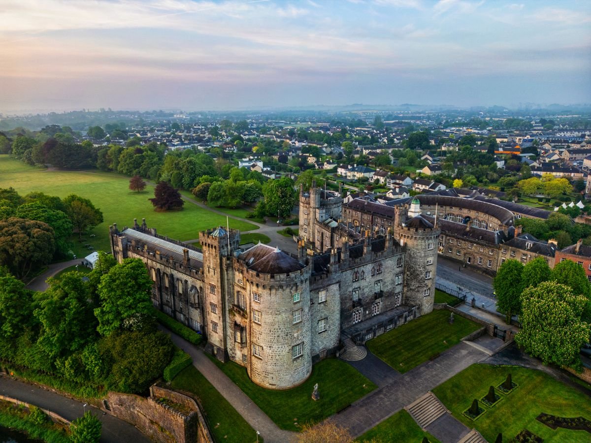
We camped at Tree Grove just outside town and walked the Canal Walk along the river to reach Kilkenny Castle, about 30 minutes on foot. A wander through the Butter Slip, a narrow medieval alley, and a Guinness at The Pumphouse made for a full day.
More Ireland Itineraries and Road Trips
- Wild Atlantic Way Itinerary – Ireland’s Most Epic Road Trip
- A Photographer’s Definitive Ireland Road Trip
- 9 Best Places On The Wild Atlantic Way Route
Munster
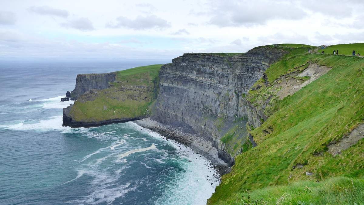
Munster is the southwest, and for a lot of people it’s the reason they came to Ireland. Six counties covering the wildest coastline in the country, from the Cork harbor towns up to the Cliffs of Moher. We spent the back half of our last trip here and could have used a week more.
County Cork
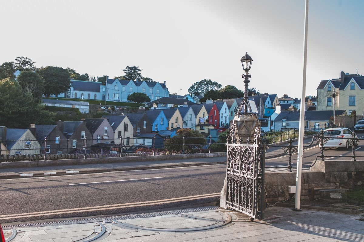
The biggest county in Ireland, and the one we got least right. A storm kept us pinned in Cobh and we only stopped for a meal at Le Bon Crubeen before pushing on. Cork city deserves a full day or two. Give it the time we didn’t.
County Kerry
We had two nights in Killarney and camped at Fleming’s White Bridge on the Muckross Road, basically to ourselves. We walked Killarney National Park in heavy rain out to Muckross Abbey, which held up fine in the mist. The Ring of Kerry drive is the county’s headline act, and if you’d rather not drive it yourself you can book a Ring of Kerry day tour on Viator straight out of Killarney.
👉 Read our full guide to Killarney National Park.
Where to Stay in Killarney
County Limerick
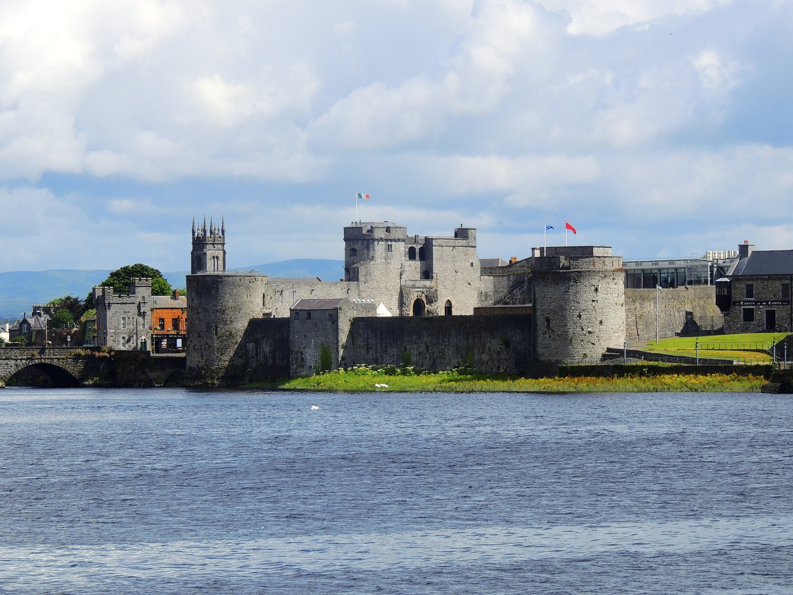
We pulled into Adare for lunch on the way to the coast, a Guinness and a shepherd’s pie in a village pub while looking out at the row of thatched cottages. Limerick city, on the Shannon, has King John’s Castle if you want more than a lunch stop.
County Clare
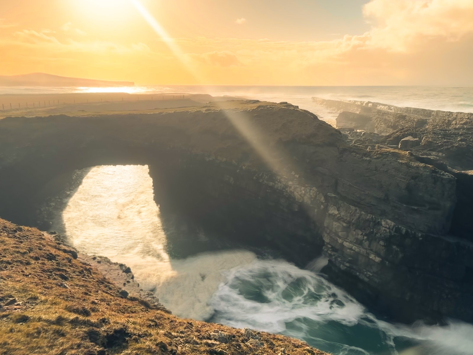
We based ourselves at Nagle’s in Doolin and hiked the narrow Cliffs of Moher path from the village, cows grazing on one side and a sheer drop on the other. Loop Head impressed us more though, wilder and far less crowded. Dinner was at Gus O’Connor’s, open since 1832.
County Tipperary
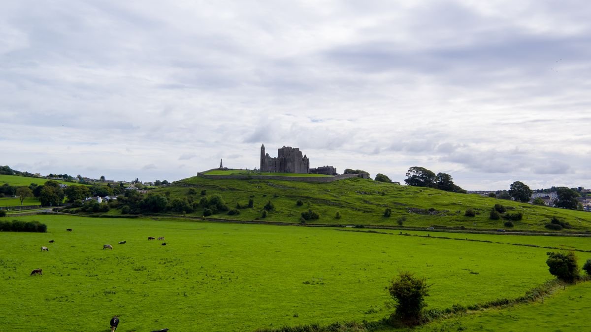
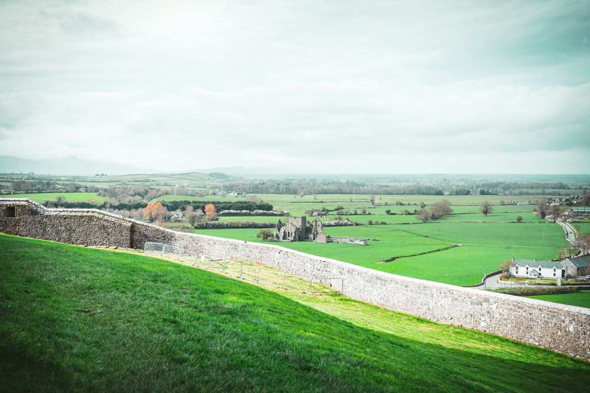
We nearly drove straight past Nenagh, and I’m glad we didn’t. We climbed the spiral staircase to the top of Nenagh Castle’s round tower, then ate the best fish and chips of our whole trip at the Hibernian Inn. The Rock of Cashel is the county’s famous sight.
👉 See our complete guide to the Rock of Cashel.
County Waterford
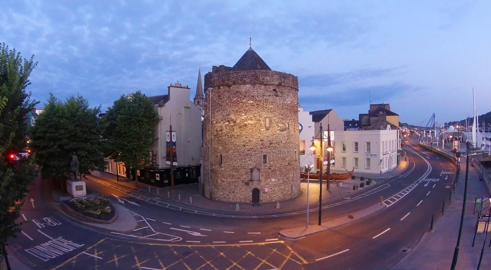
Ireland’s oldest city, founded by the Vikings over a thousand years ago, and still the home of Waterford Crystal. The Copper Coast drive west of the city runs along cliffs, coves, and old mining sites.
Connacht
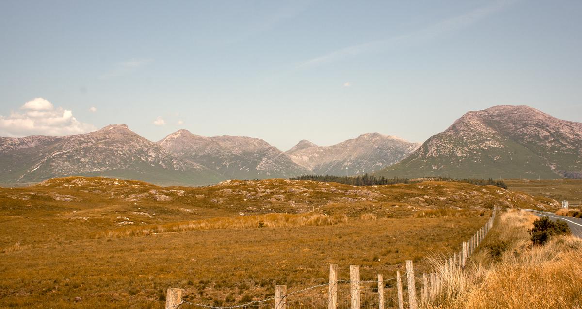
Connacht is the west, five counties along the Atlantic, and it’s the wildest and least populated of the four provinces. This is where you get the bare bog, the stone walls, and the coastline you picture when you think of Ireland. Galway is the hub, and for most trips it’s the way in.
County Galway
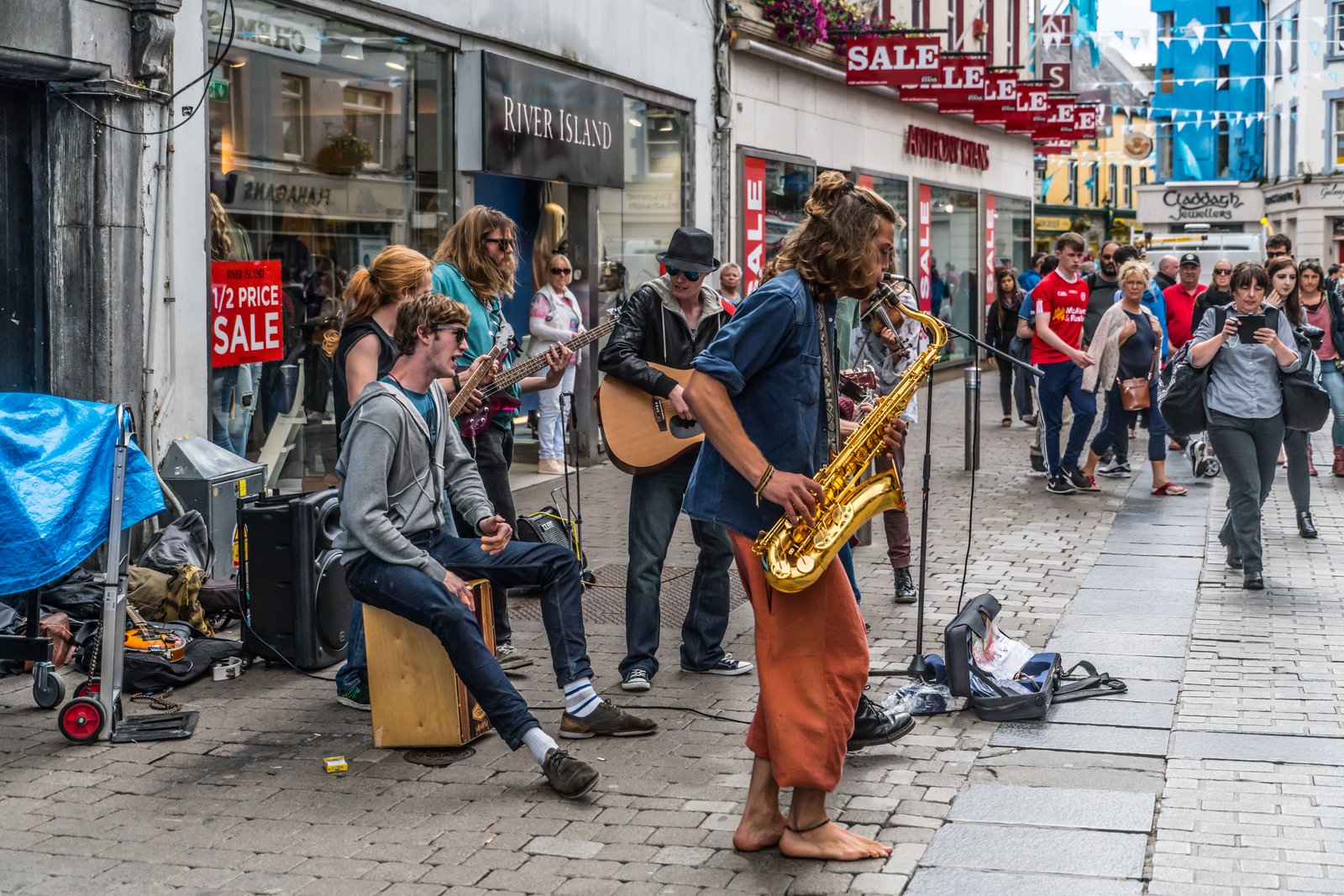
We camped at O’Hallorans in Salthill and taxied into the city, though it’s an easy town to base in if you’d rather browse places to stay in Galway on Booking.com. Off the cab and we could already hear a session going in Monroe’s Tavern on Dominick Street, 20 people mid-tune. We ate chips from Prátaí on Shop Street and drank in Tig Coilí. The trad is everywhere and always good.
One warning: book your dinner ahead. We couldn’t get into Kai or Oscar’s Seafood Bistro, both booked out, and ended up on chips instead. The music turned out better than we’d hoped and the food scene was the one letdown.
County Mayo
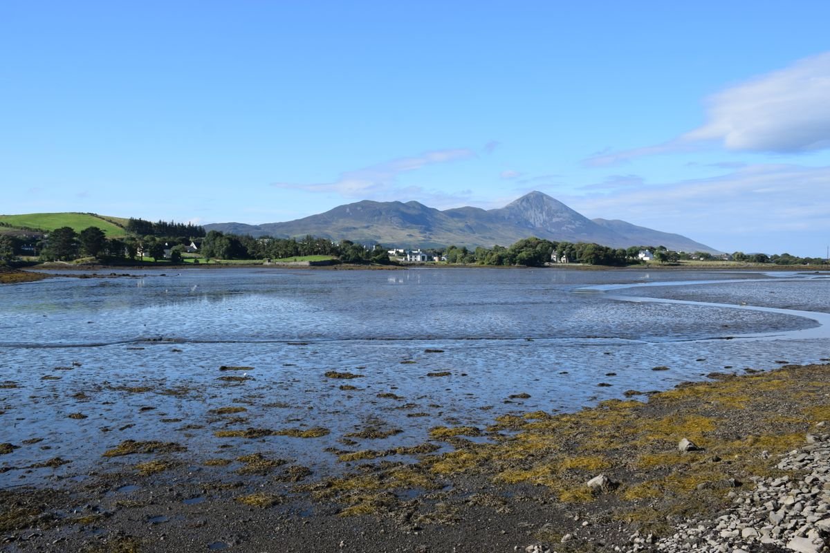
North of Galway, Mayo is the county for Croagh Patrick, the pilgrimage mountain some climbers still summit barefoot. Out at the end of a causeway sits Achill Island, where Keem Bay is one of the best beaches in the country. Westport is the town to base yourself in.
County Sligo
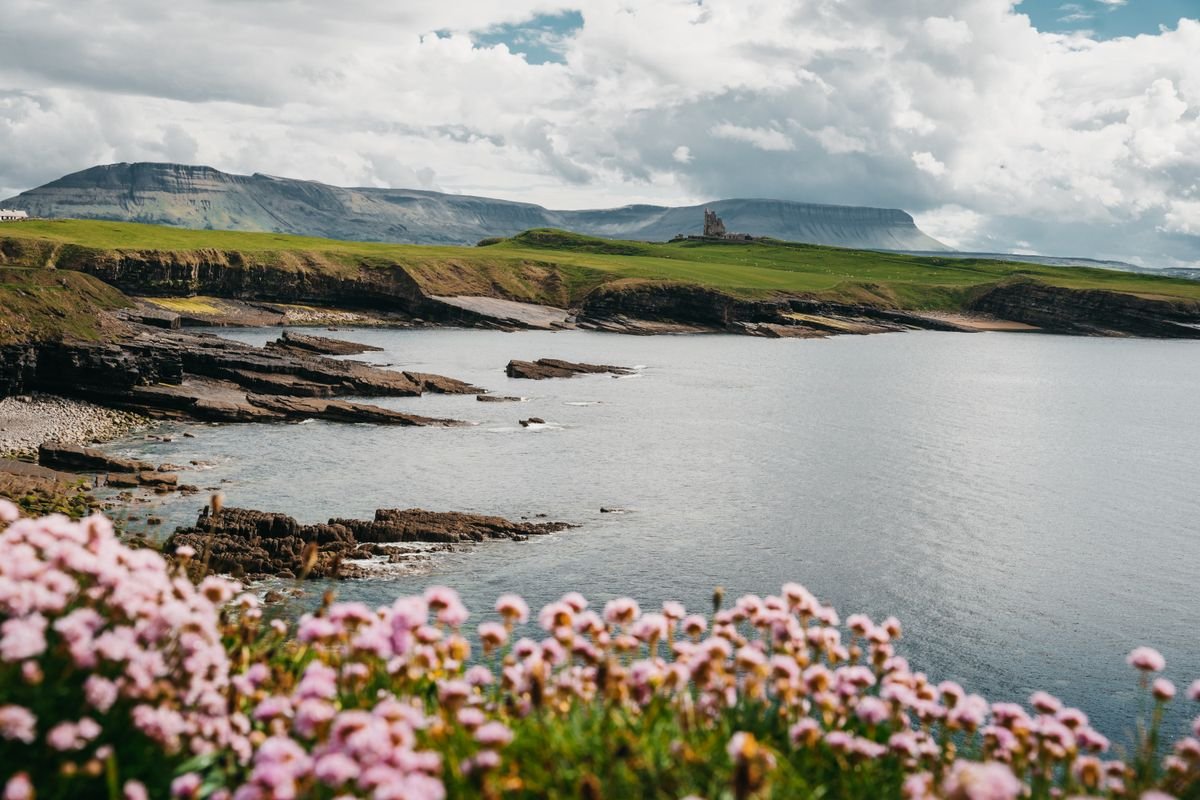
This is Yeats country, and the flat-topped Benbulben is the mountain you’ll recognize from every postcard. Surfers head for Strandhill and Enniscrone, and the poet himself is buried in Drumcliffe churchyard, right under that same mountain.
County Roscommon
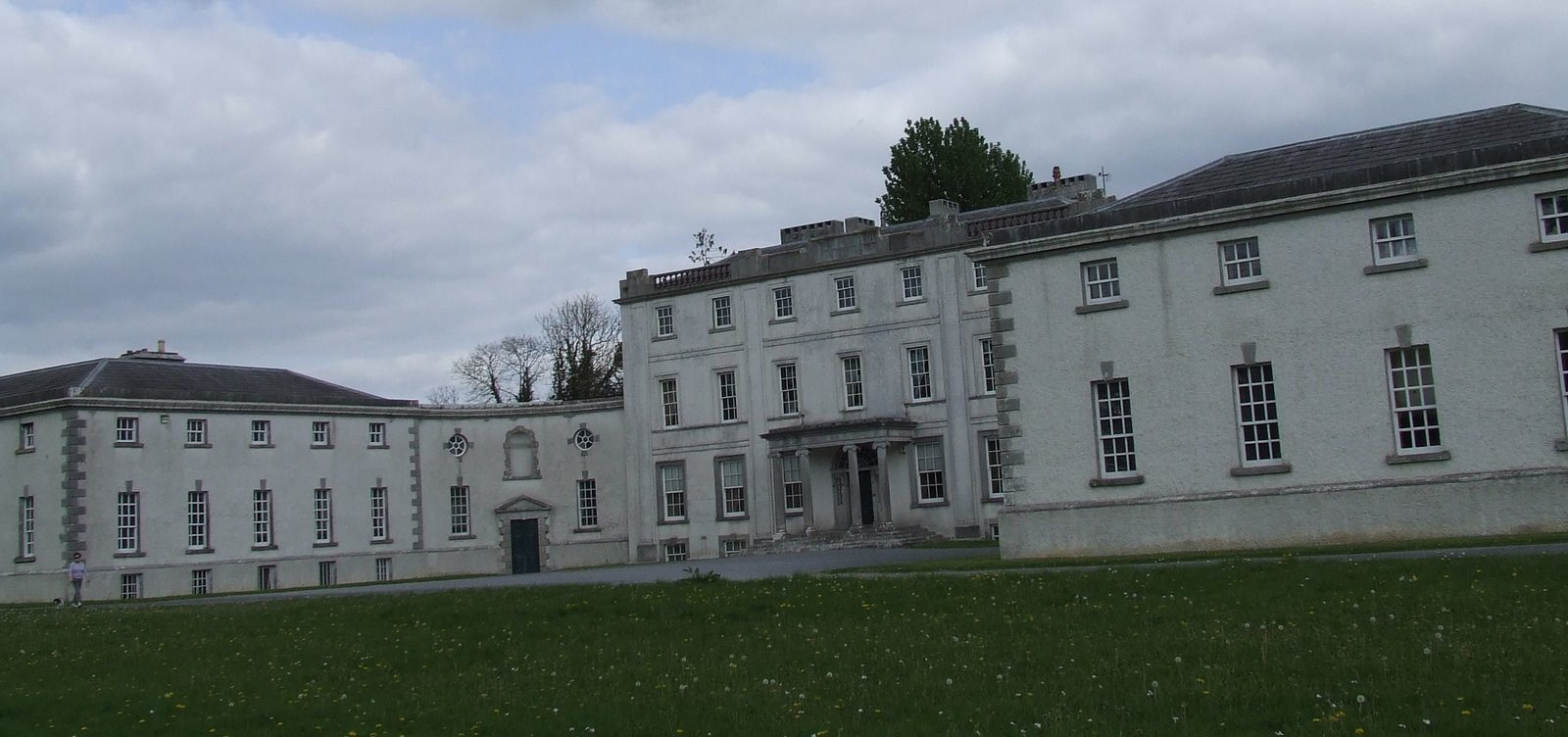
Landlocked and mostly a county you drive through, but there’s one real reason to pull over. Rathcroghan is an ancient royal site of ancient burial mounds and ring forts, the seat of the old kings and queens of Connacht. Strokestown Park and its Famine Museum are worth an hour too.
County Leitrim
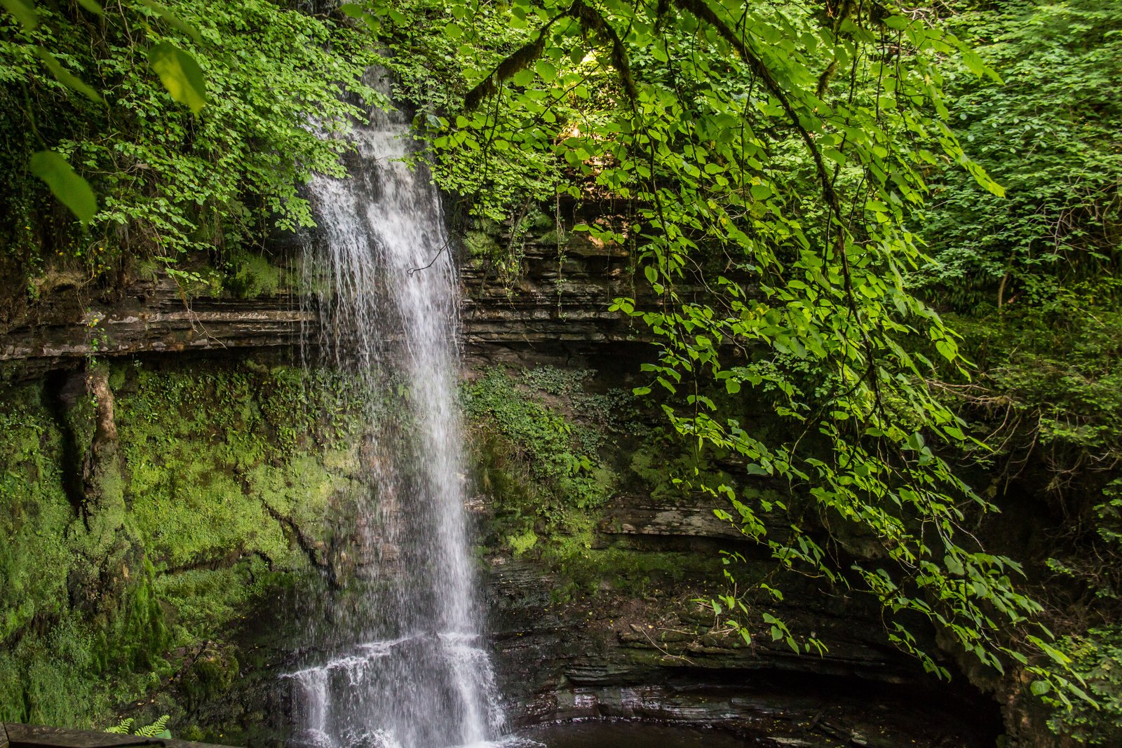
Leitrim is the least populated county in Ireland, and Lough Allen splits it almost in two. The one stop worth a detour is Glencar Waterfall on the Sligo border, a thin drop through the trees that Yeats wrote about.
Ulster
Ulster is the north, nine counties in total, and here’s where it gets confusing. Six of them sit in Northern Ireland, a separate jurisdiction that’s part of the UK, while three stay in the Republic. You cross an invisible border with no checkpoint, but you do switch from euros to pounds.
County Donegal
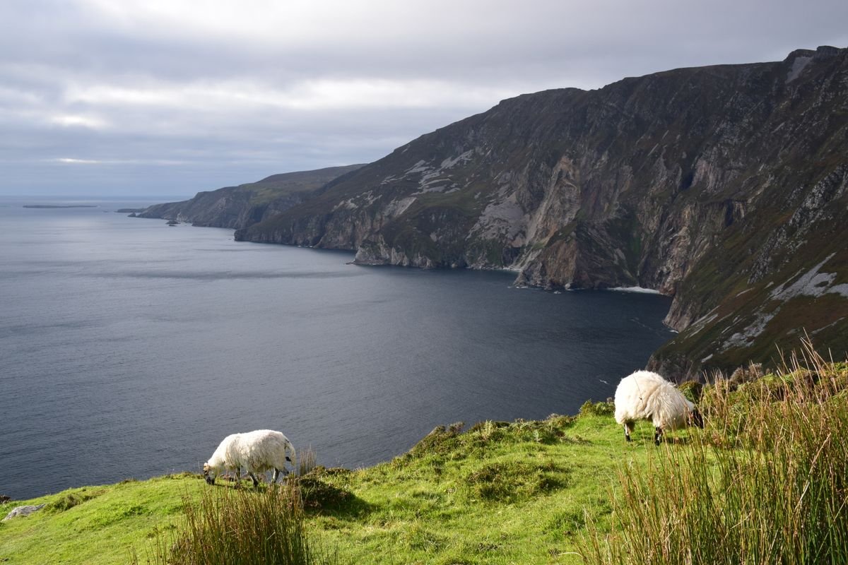
The remote northwest corner, and one of the wildest counties in the country. Slieve League has sea cliffs nearly three times higher than the Cliffs of Moher, and Glenveagh National Park backs them up with mountains and a lakeside castle.
County Cavan
They call this the county of a thousand lakes, and it isn’t far off. The River Shannon rises here at the Shannon Pot, and the Marble Arch Caves run underground on the Fermanagh border.
County Monaghan
Small, hilly drumlin country and the home ground of poet Patrick Kavanagh. Rossmore Forest Park and the lakes around Monaghan town are the reason to slow down here.
County Antrim
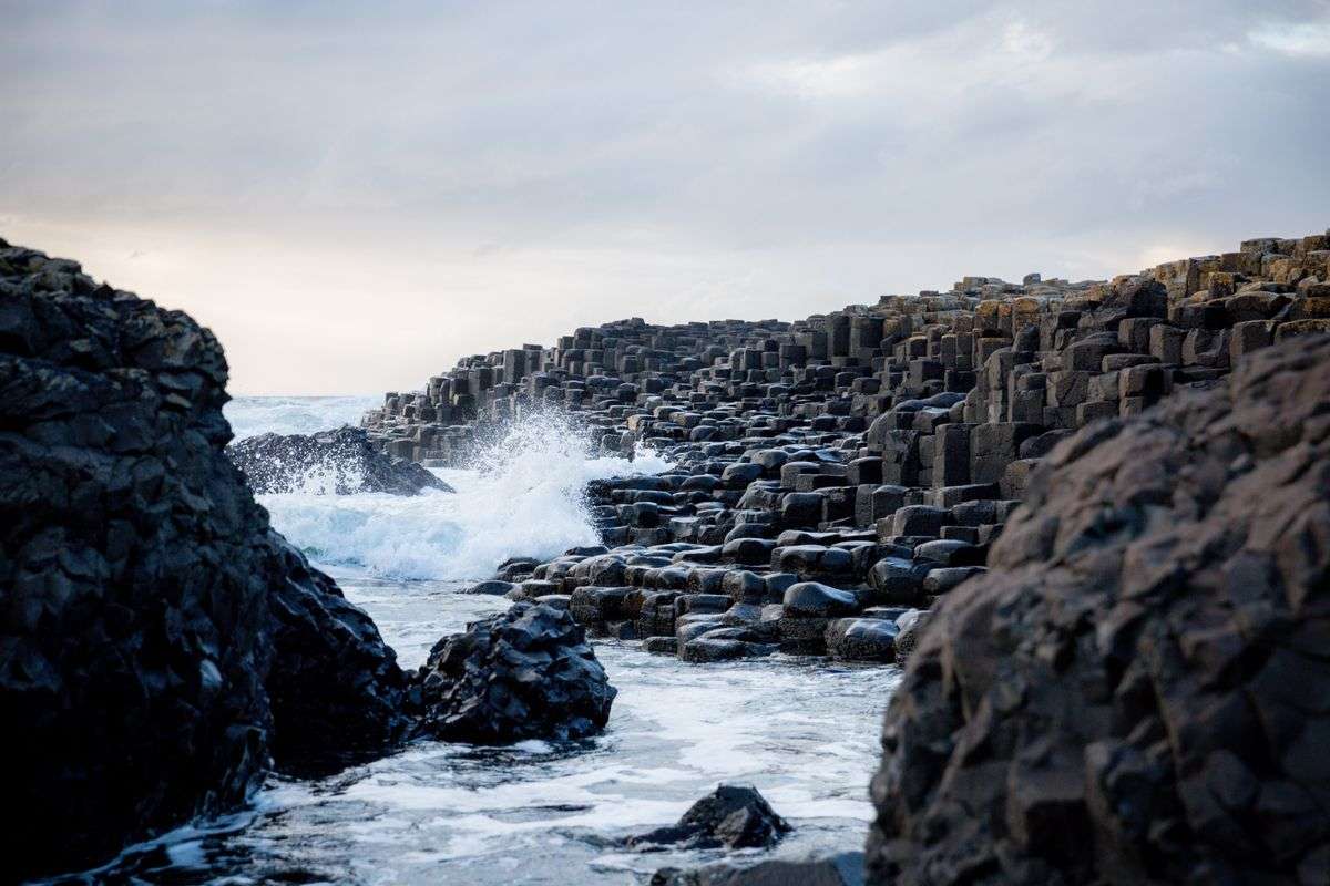
This is the big one up north. The Giant’s Causeway and its hexagonal basalt columns are the headline, with the Antrim Coast Road, the Bushmills distillery, and the Carrick-a-Rede rope bridge all strung along the same drive.
👉 Check out our full guide to the Giant’s Causeway.
County Armagh
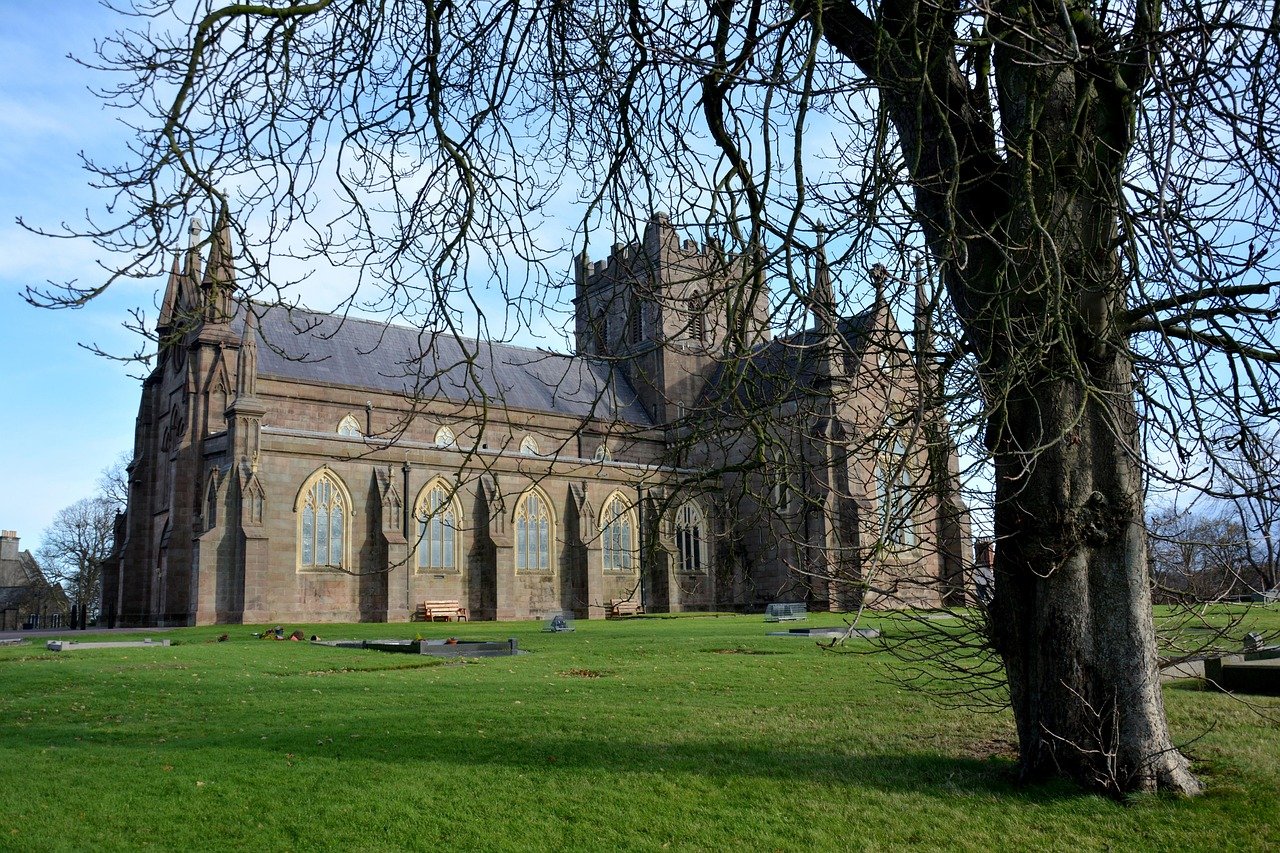
Known as the orchard county for its apple growing, Armagh is also the ecclesiastical capital of Ireland, with two cathedrals both named after St Patrick sitting on facing hills. Navan Fort nearby was an ancient royal site.
County Derry
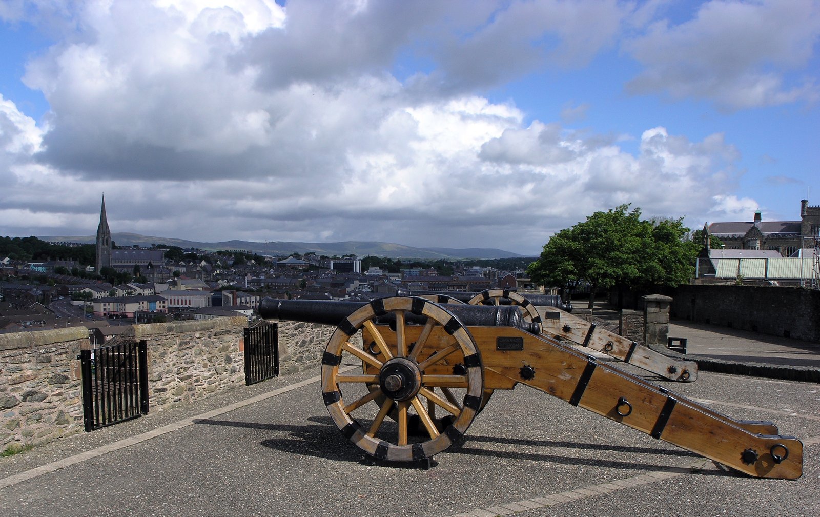
Also called Londonderry, and the naming itself tells you a lot about the history here. Derry city has the only fully intact set of walls in Ireland, and you can walk the complete circuit around the old town.
County Down
The Mourne Mountains sweep down to the sea here, and St Patrick is said to be buried in Downpatrick. Strangford Lough and the coastline around it make Down the easiest wild scenery near Belfast.
County Fermanagh
Lakeland country, built around the two stretches of Lough Erne. Boats run out to Devenish Island and its round tower, and Enniskillen sits on an island between the two loughs.
County Tyrone
The largest county in Northern Ireland, with the Sperrin Mountains running through its heart. The Ulster American Folk Park near Omagh traces the story of Irish emigration to the New World.
Planning a Trip Around the Counties of Ireland
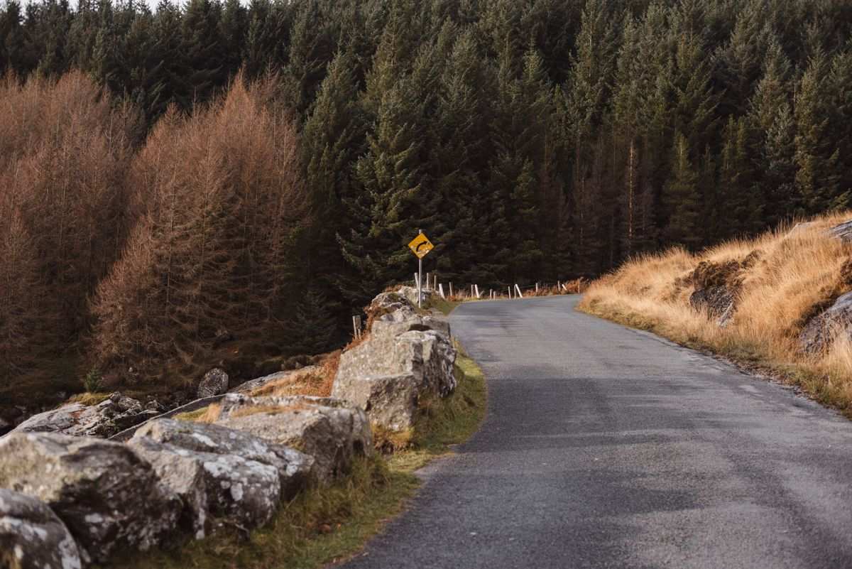
The first rule of planning Ireland is to stop trying to see all 32 counties. It’s a small island, but the roads are slow, the good stuff is spread out, and racing it just means you spend your week in the car and remember none of it.
Pick one region per trip. A week in the southwest, Cork, Kerry, and Clare, gives you the Cliffs of Moher, the Ring of Kerry, and a string of good pubs without a single rushed day. The west around Galway and Mayo is another clean loop. So is the north with Antrim and Donegal.
Rent a car. Public transport connects the cities fine, but the counties you actually want, the coastal drives and the small towns, need your own wheels to reach. We did our last trip in a campervan, and a regular car covers every stop on that route just as well. It’s worth taking a minute to compare car hire deals on Discover Cars before you land.
Two things to know before you drive. Irish roads are narrow, especially the coastal boreens, so budget more time than the map suggests. And book your rental early, because the good rates sell out fast in summer.
One more, if your route crosses into the six northern counties, you switch from euros to pounds and your phone may hop onto a UK network. No border checkpoint, no passport, just a quieter change you’ll notice at the first shop.
Base yourself in a hub and do day trips out. Galway, Killarney, and Kilkenny all work like this, a town with pubs and food to come back to after a day on the coast. That beats hopping to a new bed every night and living out of a suitcase.
Planning Your Trip to Ireland
- What to Know Before Traveling to Ireland: 15 Tips
- The 30 Most Instagrammable Places in Ireland
- Best Time to Visit Dublin: Month-by-Month Guide
In short
- Ireland has 32 counties split across four historic provinces.
- Leinster sits east, Munster southwest, Connacht west, Ulster north.
- 26 counties are in the Republic, six in Northern Ireland.
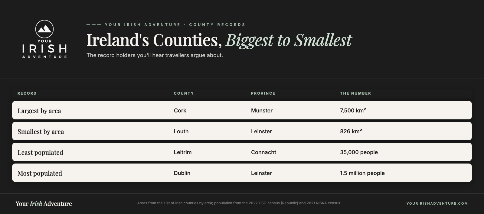
- Cork is the largest county by area, Louth the smallest.
- Plan by region, not by county, one week covers one area well.
Frequently Asked Questions
These are the questions travellers ask most about how Ireland’s counties and provinces fit together, from the north-south split to how much ground you can cover on one trip.
How many counties are there in Ireland?
There are 32 counties across the whole island. Twenty-six are in the Republic of Ireland and six are in Northern Ireland, which is part of the UK. All 32 are grouped into the four historic provinces of Leinster, Munster, Connacht, and Ulster.
What are the four provinces of Ireland?
Leinster in the east, Munster in the southwest, Connacht in the west, and Ulster in the north. They’re not administrative regions anymore, but they’re still how the counties get grouped and how people talk about where a place sits.
Which is the biggest county and which is the smallest?
Cork is the biggest by area, down in the southwest. Louth, up on the Leinster coast near the northern border, is the smallest. Leitrim in Connacht is the least populated.
Why are six counties in Northern Ireland separate?
Antrim, Armagh, Derry, Down, Fermanagh, and Tyrone stayed in the UK when the island was partitioned. They’re still Ulster counties geographically, but they use pounds instead of euros. There’s no border checkpoint, so you cross without noticing until the first shop.
How many counties can you visit in a week?
Don’t count counties, count regions. In a week you can do the southwest properly, Cork, Kerry, and Clare, or the west around Galway and Mayo. On our last trip we ran Dublin to Cork over two weeks and still only saw a handful of counties well.
Final Thoughts
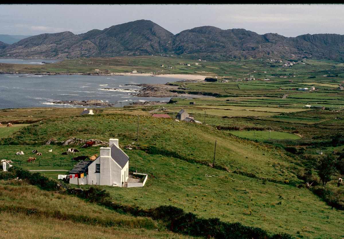
Once you know the four provinces and roughly where each county sits, the whole map stops looking like a wall of names. You can read an itinerary and know instantly whether two stops are neighbors or a full day apart.
That’s the whole point of a guide like this. Use it to pick the one corner you’ll actually see well, get to know it properly, then come back and do another.
We ran Munster and Connacht on our last trip and still left plenty behind. We never made Donegal, we skipped the whole north, and we barely touched Cork. That’s exactly why we’ll be back.
Pick your province, rent a car, and give it a week. Which corner are you starting with?
Like it? Pin it!
Save this guide for later